
Hi, Central Coast!
Temps have started to fall across the region as a small low pressure heads our way. This is going to shift our conditions significantly and even bring a chance for rain tonight into tomorrow morning.
Before I get to all of that there is a small change in our surf conditions. The high surf advisory has been extended slightly. Now it will stay in effect through Thursday morning at 3 a.m. waves 7-12 ft and rip currents are expected for our western beaches.

Now onto the fun stuff. A small low pressure system that has been spinning off of the LA coastline for a few days and it is finally moving onshore. For most communities that means more cloud cover and cooler weather but rain is also a possibility.
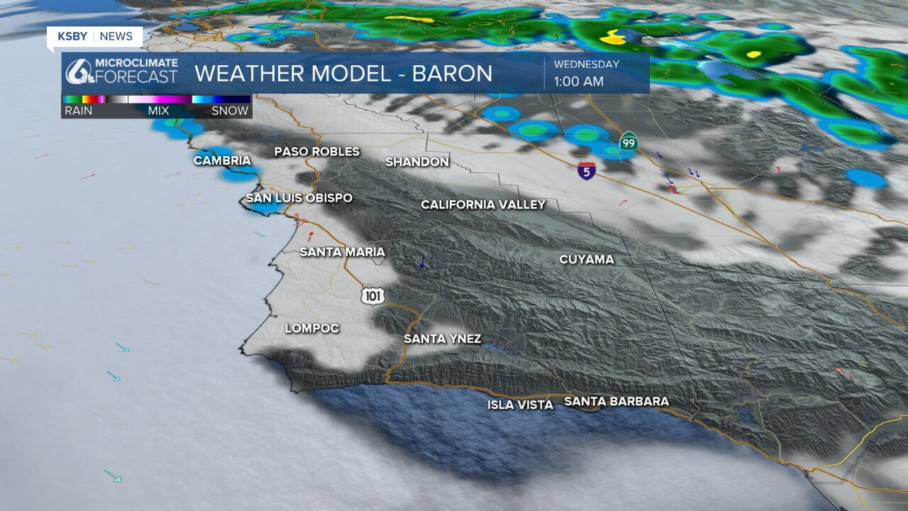
Later tonight the low will pass into the Central Coast and bring an area of showers to the Central Valley but this will also bring some to our interior valleys. Here is what the radar is expected to look like this evening.

Despite the active radar the very dry air in place will limit accumulations as most of the rain droplets will re-evaporate before they hit the ground. There is also the chance for a few small passing thunderstorms within this system. This is much less than last week but still something I am watching.
Into the overnight hours the marine layer will move in more and bring rain to the western beaches. This will once again be very small and mainly just seem like heavier marine fog drizzle.
That drizzle will stick around into the morning commute. Take some extra time and make sure those windshield wipers are working.
As far as accumulations go many won't notice a thing. Just talking hundredths of an inch for most. There is the small chance of higher totals in thunderstorms but that will be limited as well.

With this system the marine layer will extend to 3000 ft (way more than normal) that means morning fog and cooler weather even into the interior valleys tomorrow. 70s for the warmest spots. Most will be in the 60s and upper 50s by the beaches.

Into the weekend we will warm back up to pre-storm temps. 80s for the interiors and upper 70s elsewhere. It will be a great weekend across the region.


Have a wonderful evening, Central Coast!
-Vivian
