

Happy Tuesday, Central Coast!
We have been taking about a big pattern shift for over a week and now that storm is knocking on our door. Here is a look at what we can expect.

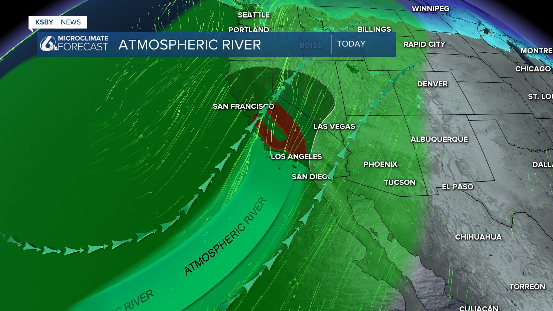
A strong atmospheric river is being driven onshore later today into the overnight hours. The good news is with that timing there is still time to prepare and do any last minute holiday shopping.
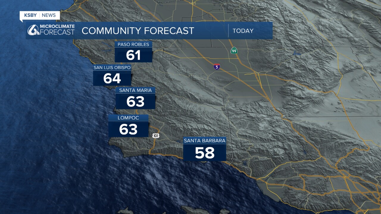
Here is a look at the temps expected today before the rain begins.
By this afternoon, the first few scattered showers will arrive. They will start off mild with light rain. By midnight, though, heavy rain and 50 mph winds will have begun. Fast-accumulating rainfall is expected, especially along the east-west ridges and south coast peaks.
The worst of the storm is expected overnight Tuesday into Wednesday. That time frame will also bring the strongest winds.
Into Wednesday morning, we will see some relief, but showers will still stick around through Wednesday into Thursday morning.
More rain is expected on Friday and into Saturday. Some of these bands will include heavy rain, strong winds, and even some isolated thunderstorms.

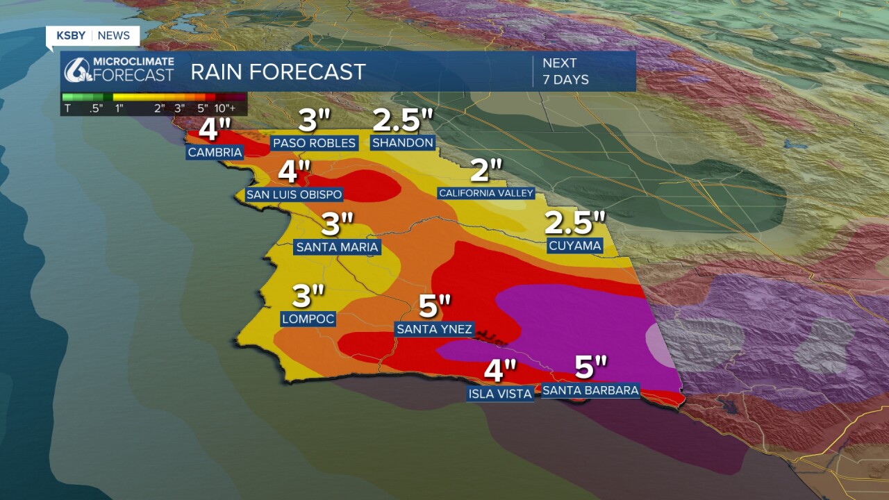
All of those days of heavy rain will combine to massive rain totals. Here is a look at what we can expect over the next 7 days.
The Storm Prediction Center has issued a marginal risk for thunderstorms into Wednesday morning.

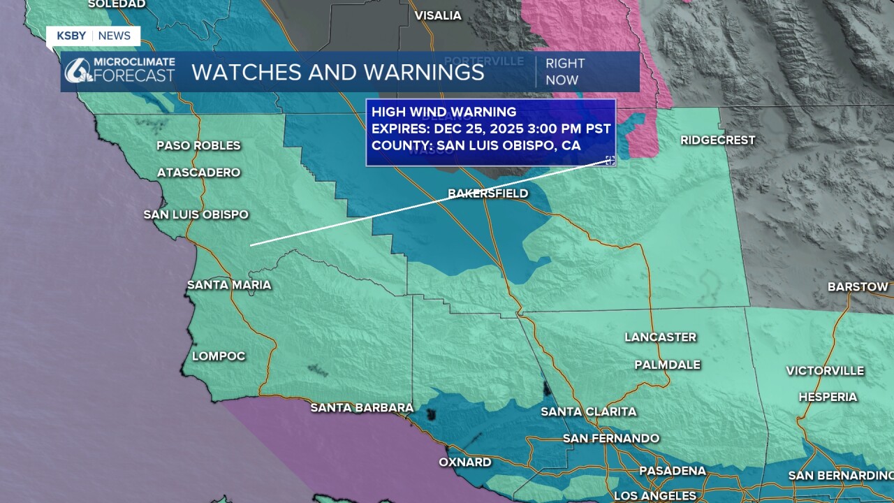
That amount of rain is expected to cause flooding across the region. There is a flood watch in place through 10 p.m. Wednesday for the whole region.

There is also a high level (5/5 on the scale) risk for excessive rainfall for much of the region Wednesday into Thursday. This indicates the chance for dangerous flooding across the region.

One additional concern with the storm this week are strong winds. Most of the region will see strong southerly winds beginning Tuesday afternoon. The combination of strong winds and heavy rain is expected to cause issues with power outages and downed trees.
Those winds will be widespread and have prompted a high wind warning for the whole region. 50 mph winds are expected with strong, sustained winds as well.
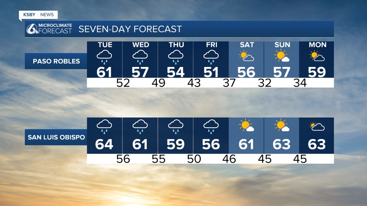
Here is what all of that looks like on your 7-day forecast!

We will continue to keep you updated as the storm gets closer. Stay tuned on air, online, and on social media for the latest through the week.
Have a wonderful day, Central Coast!
-Vivian
