

———11:30 p.m. update from Meteorologist Vivian Rennie———
New rain totals are coming in. The storm is looking to move through a little faster, which will allow our totals to fall a little, that being said these are still significant. Upwards of an inch possible at ridges.

——— Original Article———
Happy Friday, Central Coast!
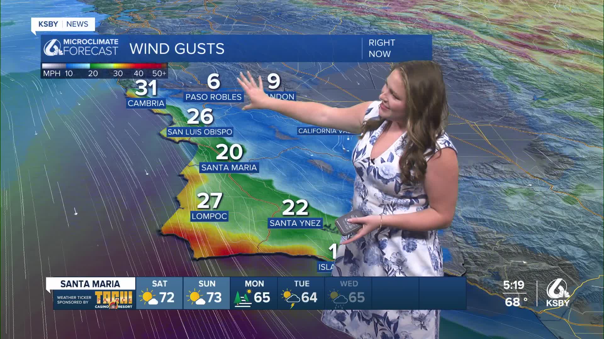
It has been another beautiful, albeit windy day across the Central Coast. High temps climbed into the mid 70s once again, but as we head into the evening, the winds are more of a concern. Here is a look at the winds as of 6 p.m. Friday evening.

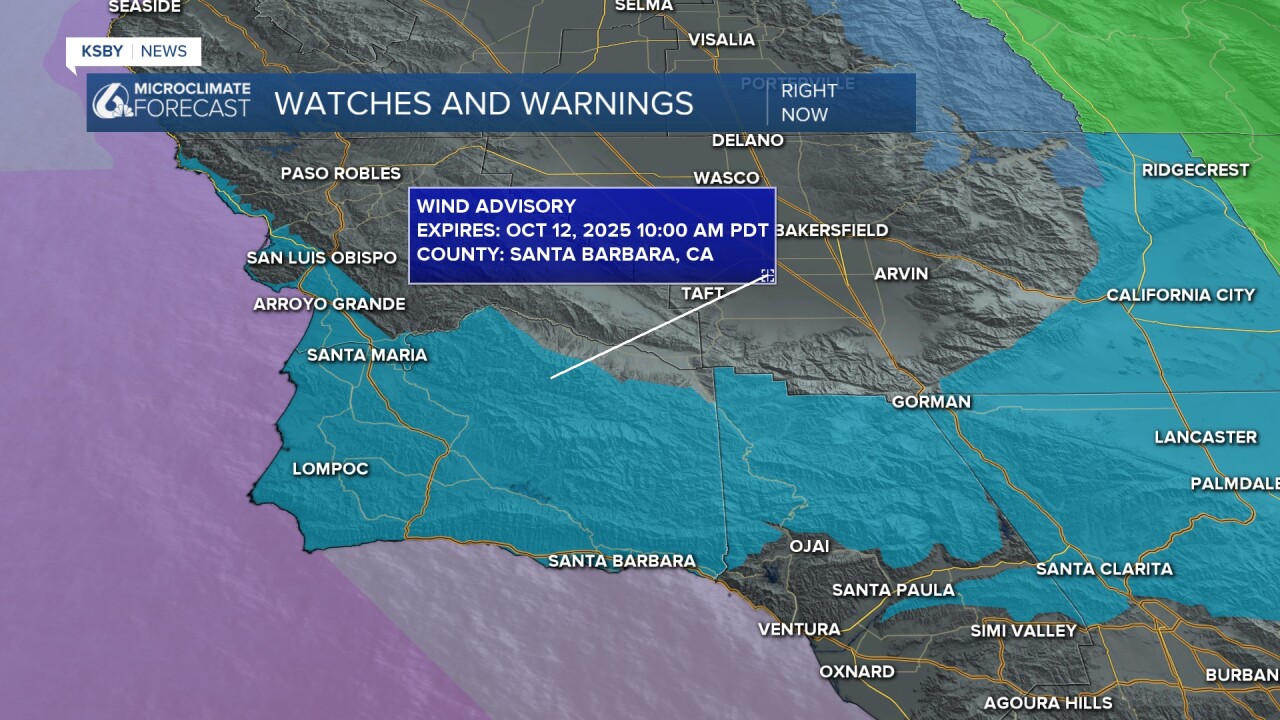
As we head into the weekend, the winds will kick up even more as a cold front presses south. This doesn't have the energy or moisture needed to bring anything but a passing high altitude shower. What it will do, though, is bring northerly winds sustained 20-30 mph with isolated gusts up to 60 mph. Unsurprisingly, this is enough for a wind advisory for most communities. That is in place from Noon Saturday through 10 a.m. Sunday.
Temps over the weekend will be mild, mostly in the 70s.

Monday will be a transition day between the (relatively) warm temps this weekend to the cold early-season storm we expect next week.
Before I get into the details of that storm, here is a look at the 7-day forecast.


Okay, now that is all out of the way, here is what I am looking at for next week's storm.
A yet-to-form low-pressure system will push out of the Gulf of Alaska and make its way south. On the way to us, it will encounter a plume of tropical moisture. Those will combine into a strong storm that will bring us significant rain next week.
The cold front will arrive Monday night and into Tuesday morning will get going.
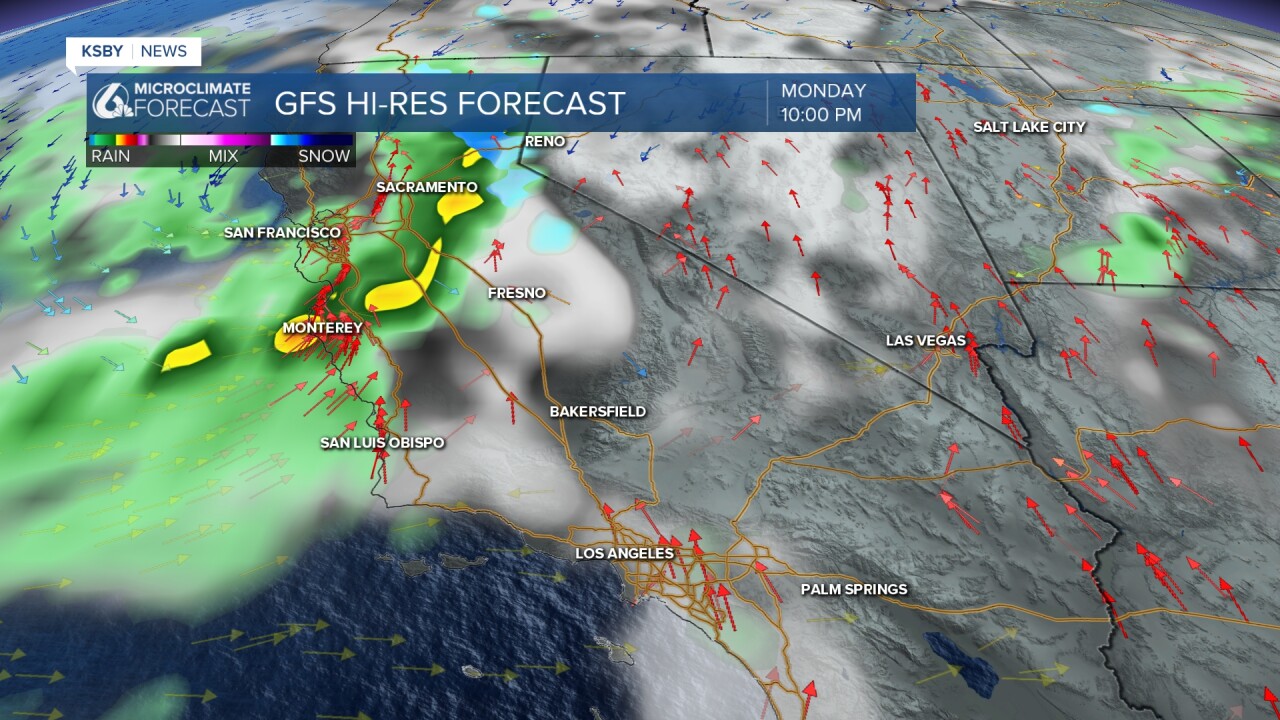
The heaviest rain looks to be from early Tuesday morning through Tuesday evening, but there are showers possible through Wednesday night.

Patches of heavy rain are expected alongside strong winds and cooler temps. By Wednesday night the main storm will have passed and will leave the cooler temps into the following weekend.
In terms of rainfall accumulations, models are still far from agreement so I don't have a forecast that I particularly like. That being said here is the best I can do. This storm will bring 1-2 inches of rain to most communities with higher elevations and peaks potentially picking up even more. Here is a model that I like the overall pattern but I still think it may be a little bullish overall.

Because we are still a ways out from the systems arrival there is a lot of time for things to change. I will be updating the forecast on-air, online, and and on social media. Until then, enjoy the sunshine and mild temps.
Have a wonderful holiday weekend, Central Coast!
