

Happy Wednesday evening, Central Coast!
Today brought sunshine and beautiful weather across the Central Coast, and the last of the rain showers from the low-pressure system that has been lingering off our coast for the last few days.
Into the extended forecast, we will see a large ridge of high pressure settle in. That means warmer weather and sunny skies are on the way soon. For now, though, we are making the turbulent transition between the two systems. That transition is the reason behind all of the wrinkles in our forecast over the next few days.
Starting off with the overall pattern. A branch of the jet stream has plunged south, kicking the last low-pressure system east and bringing gusty winds across the whole west coast.

Already this evening winds are ticking up, by the overnight hours winds upwards of 60 mph are expected at the peaks of the Los Padres National Forrest.

Those strong winds have prompted a high wind warning for the eastern interior valleys of Santa Barbara County through 8 p.m. Thursday evening and a wind advisory for the rest of Santa Barbara County through 9 p.m. Thursday evening.

Even if you aren't included in the alert area, winds will be gusty through late Thursday.
Those strong northerly winds will bring in cooler air from the north and will drop a few degrees off our daytime highs for Thursday. Here is what we can expect across the region.
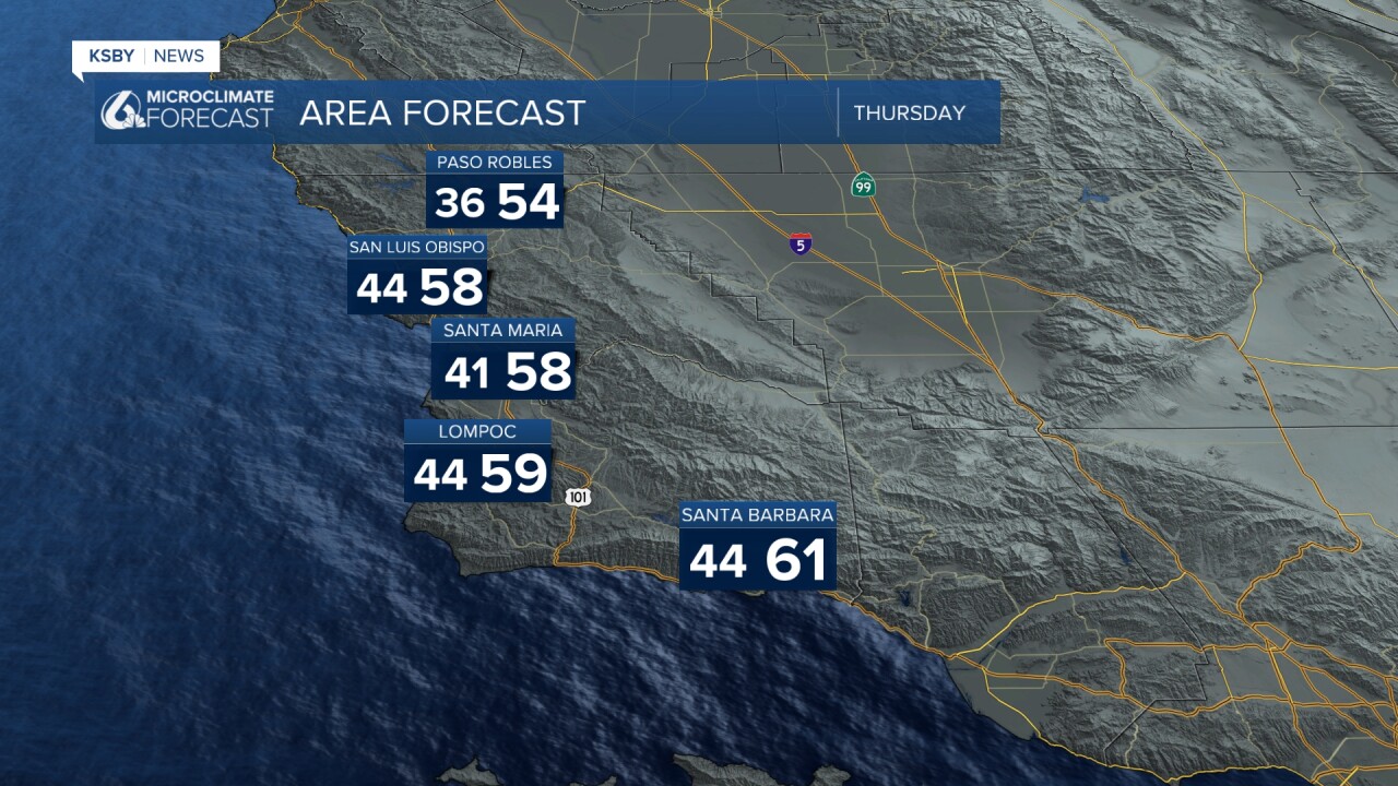
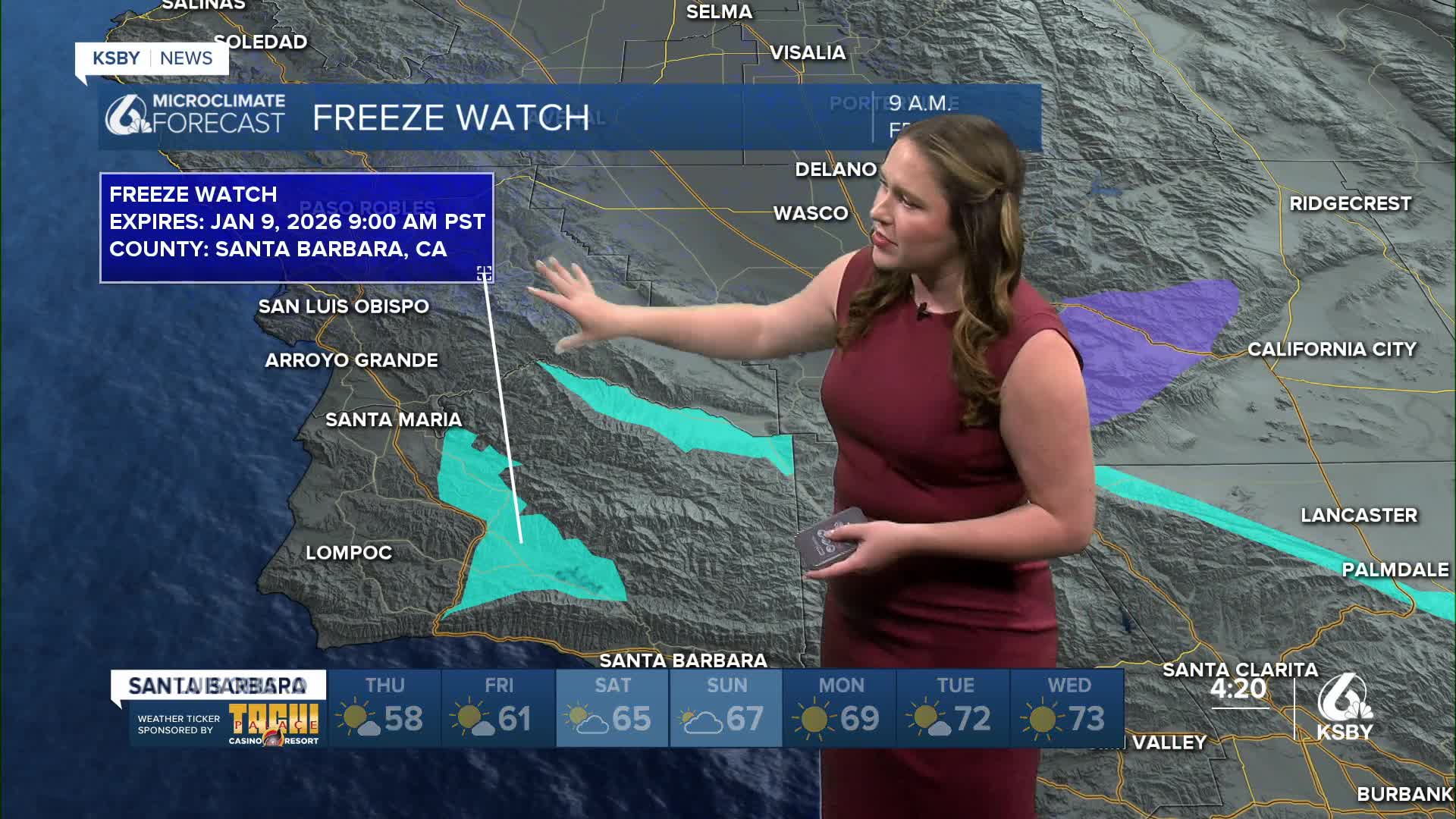
Tomorrow night into Friday morning, temps across many communities will fall below freezing. Due to those temps there is a freeze watch in effect through 9 a.m. Friday for several valleys in Santa Barbara County. Similar temps in the upper 30s are expected for all of our interior valleys, but because that is a bit more commonplace, the watch doesn't extend to those communities this time.

Outside of the temperatures, there is concern along all of our western beaches for strong waves. From 4 a.m. Thursday morning to 9 p.m. Friday evening, there is a High Surf Advisory for all western beaches.

Large breaking waves 10 - 15 ft are expected along with dangerous rip currents.
Friday will be a bit of a transitional day as well, but by Saturday, the high pressure will be arriving, and sunshine and calmer winds can be expected. That trend will continue day after day into next week, where high temps will climb into the 70s for many communities.


Even into the second half of January, we can expect warmer-than-normal conditions and dry weather.

Have a wonderful evening and rest of the week, Central Coast!
-Vivian
