

Happy Wednesday evening, Central Coast!
Today started off with some dense fog and cloud cover, but that wasn't to last. By midday, sunshine and climbing temps moved in. Highs climbed into the 60s low 70s across the board.

While that isn't much of a departure from previous days. What was more interesting today was the winds.
Thanks to a cold front that is passing up to our north gusty winds are very strongly in place. Highest peaks in the Los Padres National Forrest have winds upwards of 50 mph while most communities are breezy at least. Here are the winds as of 4:30 p.m.
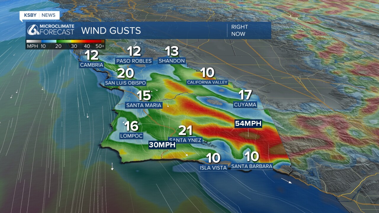
Those strong winds prompted a wind advisory for much of Santa Barbara county through 4 a.m. Thursday morning.

Tomorrow temps will be right around what we saw today with continued early morning fog and afternoon gusty winds.

The rest of this week won't produce much of any change into the weekend, though things get really interesting and potentially tricky as we reach the holidays next week.
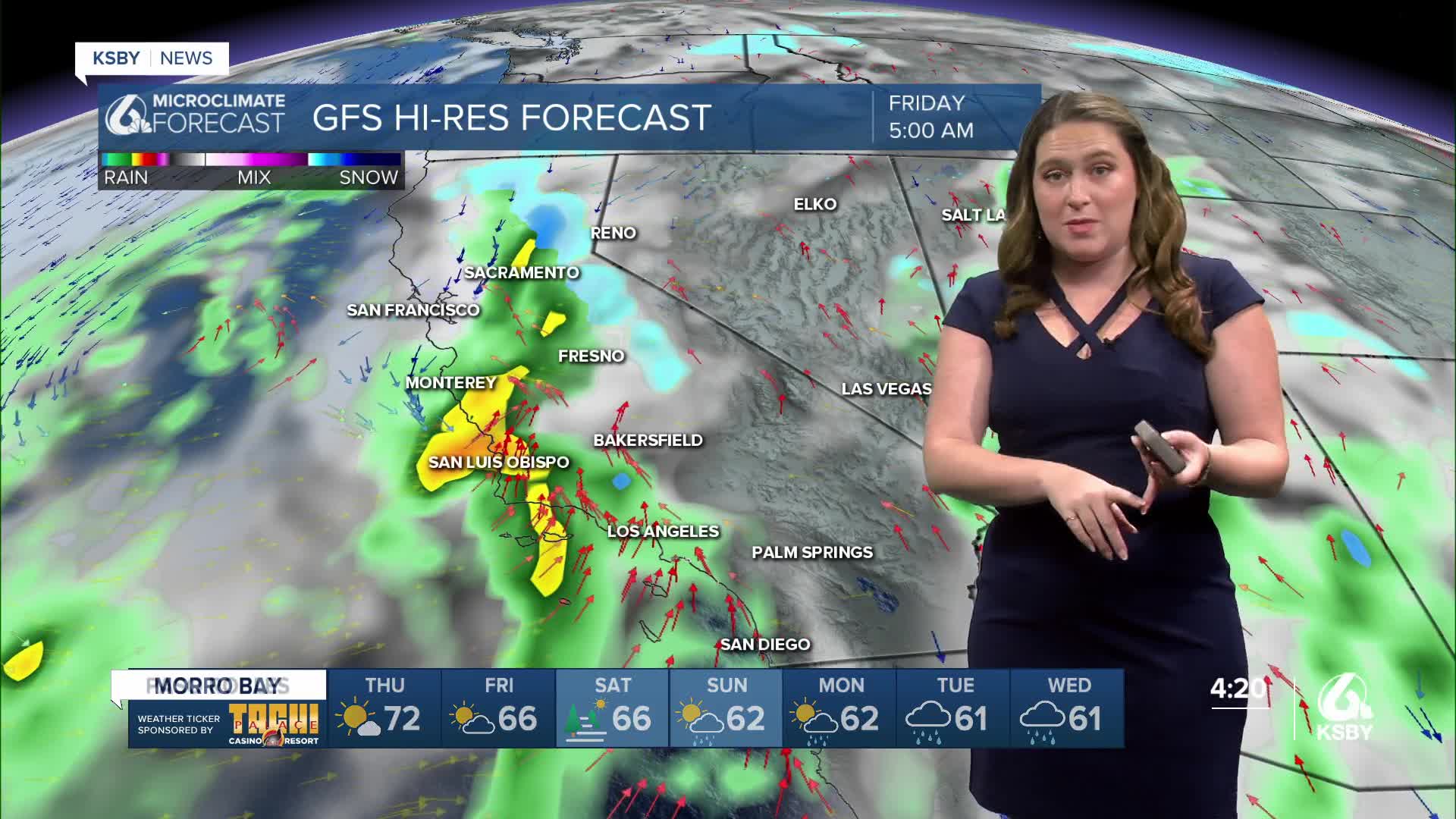
A quick disclaimer before we really dive in, this set of storms is still quite a long way out and will shift around a bit through this week. I am diving into the details a little earlier than I normally would due to the increased travel and activities that will be taking place next week. I recommend preparing for significant rain and travel woes, kind of a prepare for the worst, hope for the best forecast.
The forecast shift starts with the cold front that I have been chatting about for the past few days. It has strengthened slightly and will now arrive on Sunday morning. With its arrival, some light showers are possible for San Luis Obispo County. These won't amount to much but mark the beginning of a soggy pattern.
Following the first cold front, the door will be wide open for several large storms to reach the region.
The first band of heavy rain is expected to reach us sometime Christmas Eve.

More rain is expected on Christmas Day, although that will be a bit more patchy.

Another band of heavy rain is expected for the day after Christmas.

All three of those sections of the storm will add up to inches of rain for the region. Highest elevations will see substantially more, but the whole of the Central Coast is in for a soggy week.
I have added the rain icons to the 7-day forecast. Here is what that looks like, put together with the high and low temperatures.


Here is an infographic showing the timing and intensity for some of our communities.

Even once we reach the end of next week the more active pattern will stay in place. I wouldn't be surprised if another storm sneaks in before the new year.

Here is all of that whittled down into your forecast at a glance.

Have a wonderful evening and a good rest of the week!
-Vivian
