

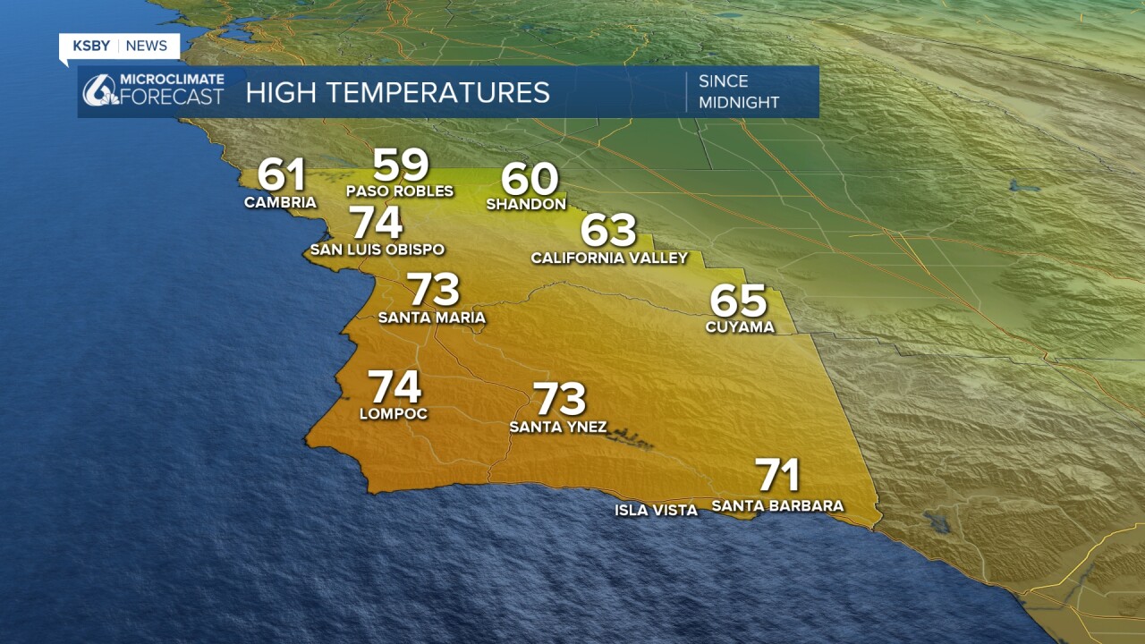
Tuesday brought the Central Coast another day of gusty winds, warmth, and sunshine for the region.
Highs in the coastal valleys climbed into the 70s while interiors stayed near 60. Here is a look at the temps we saw today.
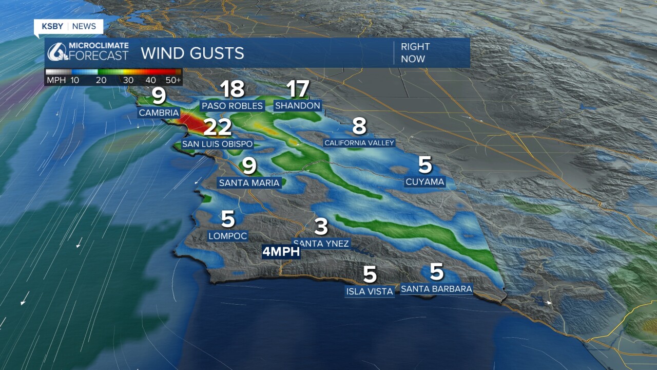
Today was also another windy day as well as offshore winds pushed through. As those winds move from east to west, they are forced to rise over the Santa Lucia mountains before sinking back to sea level. This warms up the temps and dries out the air for San Luis Obispo and many of our San Luis Obispo County coastal locations.
Overnight into early Wednesday morning, I expect another round of cold temps for the interior valleys. While there isn't a frost advisory in place just yet, I wouldn't be surprised if another one was issued.
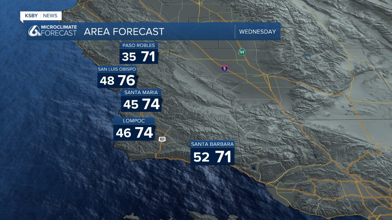
The high pressure will bring another day of warm temperatures for the midpoint of our week. Here is a look at the expected highs into Wednesday.
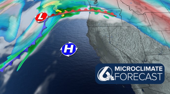
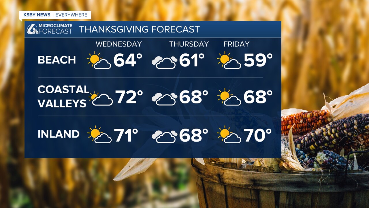
Thanksgiving will bring a very slight cooldown as a decaying cold front seeps across the region. This will bring some additional cloud cover as well but still, wonderful conditions are expected.
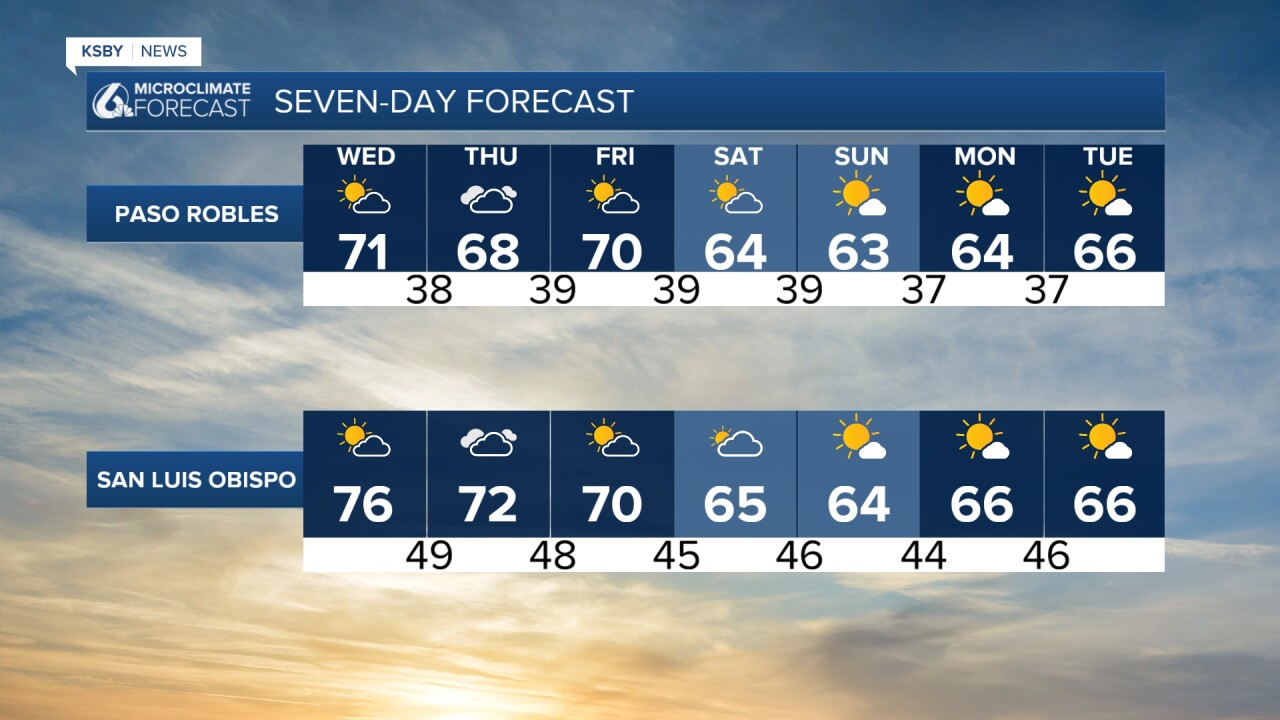
Following Thanksgiving and into the weekend, a weak system will move onto the west coast from the north Pacific. This will bring us a very slight chance of rain into the weekend. It is a small chance, so I haven't changed the icon on the 7-day. The bigger change you will notice as this system moves through is a drop in temperatures and much gustier winds. Highs will fall back into the low 60s and upper 50s. There will also be a little bit more cloud cover across the region.
Here is what all of that looks like on the 7-day forecast.

Have a wonderful week and holiday, Central Coast!
-Vivian
