
Good morning, Central Coast!
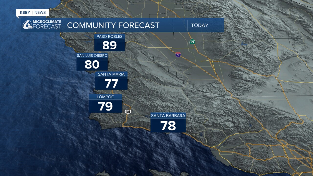
Today and Wednesday will bring some warmer weather to the region as offshore winds continue to fight the marine layer at the beaches. For us this means temps will be slightly warmer across all of our communities as compared to Monday. Plus, beaches will see a bit more sunshine as the winds mitigate some of the fog. Here is a look at the temps we can expect across the region.
Santa Ana winds are slowing slightly today, but are still supporting some large fires across the region. 40 mph wind gusts in the mountains and 30 mph wind gusts in the valley areas around the LA/Ventura County line. Here is a look at some of the regional fires and their acreage as of 4:30 a.m. Tuesday morning.

Our South Coast communities may see a little smoke from the fires over the midday hours. It won't be too significant, but it may be hazardous for particularly sensitive groups. One silver lining, it will make for a beautiful sunset on the south coast.

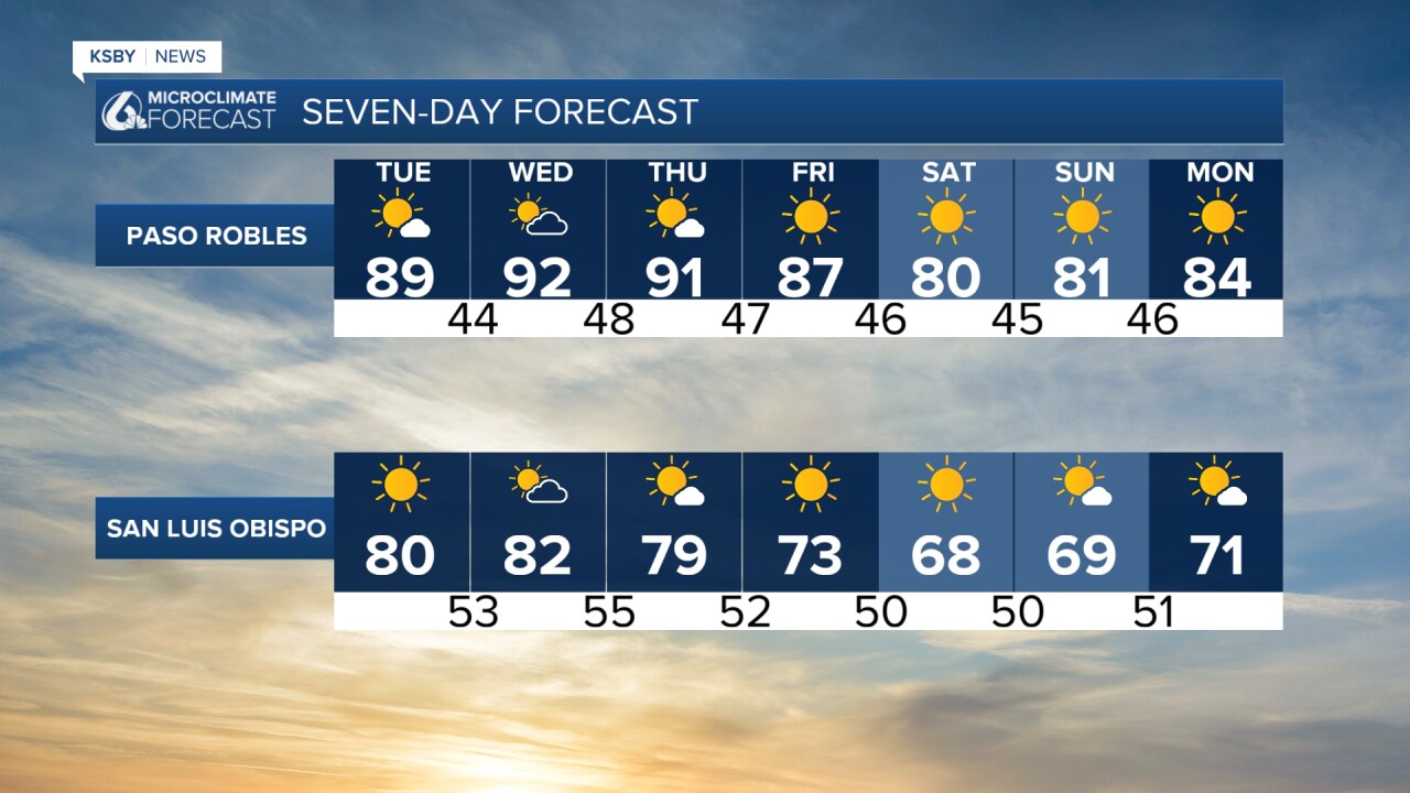
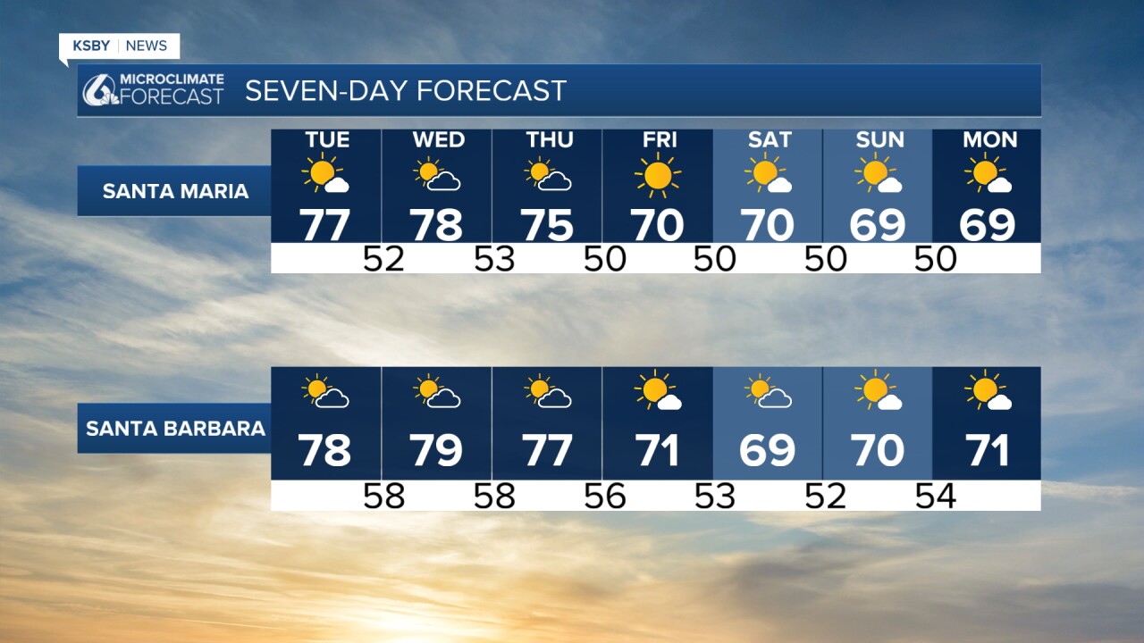
Wednesday will also bring some warming, but offshore winds will start to calm. This will slowly allow the marine layer back onto our beaches, and by late week, May Gray will be back for many beaches.
The cooldown will be felt for all of our communities, but honestly won't be too much of an issue; highs will stay around normal for this time of year.
Here is a look at all of that on your 7-day forecast.
Have a wonderful day, Central Coast! If you are up early Wednesday morning and along the north coast, I (Meteorologist Vivian Rennie) will be at Carlock's Bakery in Los Osos through the Daybreak show until 8 a.m. Stop by and say hi!
-Vivian
