

Good morning, Central Coast!
The last few days of rain and windy weather have cleared out, and now we can enjoy sunshine and mild weather, for a little while at least!
Before I get into the forecast, here is a look at some of the rain totals across the region from our last storm. One thing to notice is how widespread the totals are; the thunderstorm-based nature of the system really impacted localized rain totals. If you have a rain gauge total that you would like to share, I would love to see it. Email me at vivian.rennie@ksby.com to send me the totals!


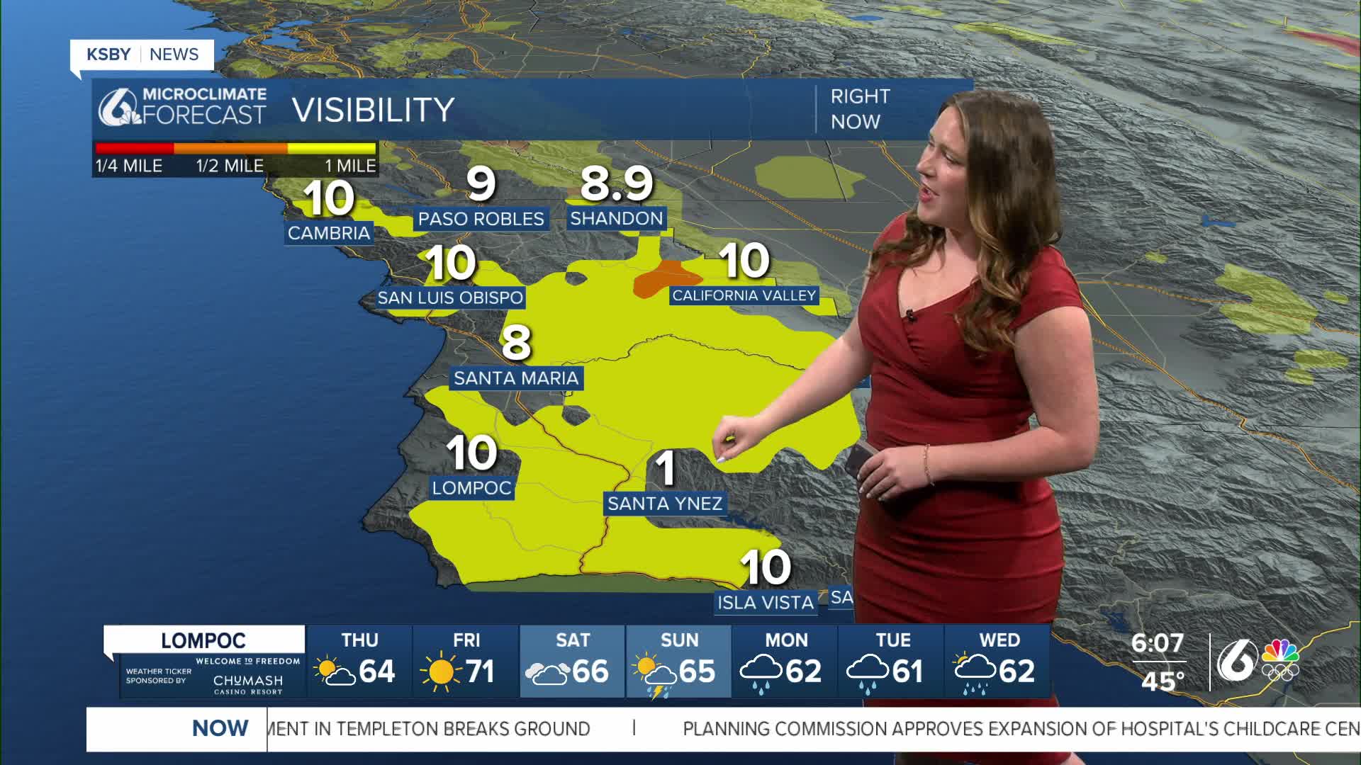
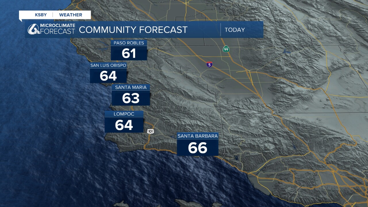
Some morning fog will give way to sunshine this afternoon. Highs will be in the 60s across the board.
Okay, back to the forecast! Friday will be nearly identical with beautiful conditions on the way. Even for Valentine's Day, sunshine will be the story to start off. By the evening clouds will build in ahead of our next system.
There is a high surf advisory for the western beaches that will go into effect Friday morning at 9 a.m. lasting to 2 a.m. Saturday morning.
On Sunday morning, the pattern will change. Thunderstorms and widespread rain will kick off Sunday afternoon and bring substantial rainfall to the region through Wednesday.
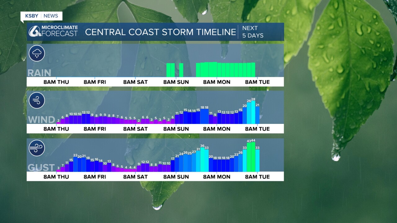
Here is a look at that on the 7 day forecast!


Even into the extended forecast, we are looking at a more active pattern for the west coast with several more rain chances before the start of March.
Have a wonderful day, Central Coast!
-Vivian
