



Good morning, Central Coast!
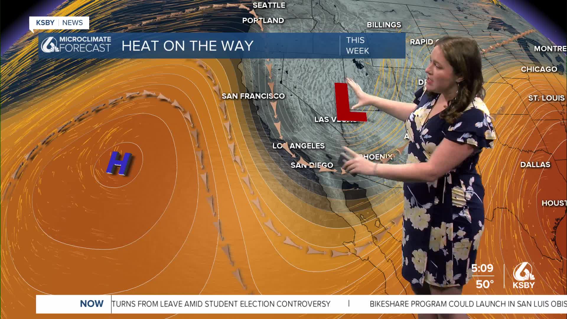
As we kick off our Wednesday morning, sunshine is the story with, some light offshore winds keeping skies clear for the morning. Good news for our commuters: no fog or cloud cover to kick off the day.
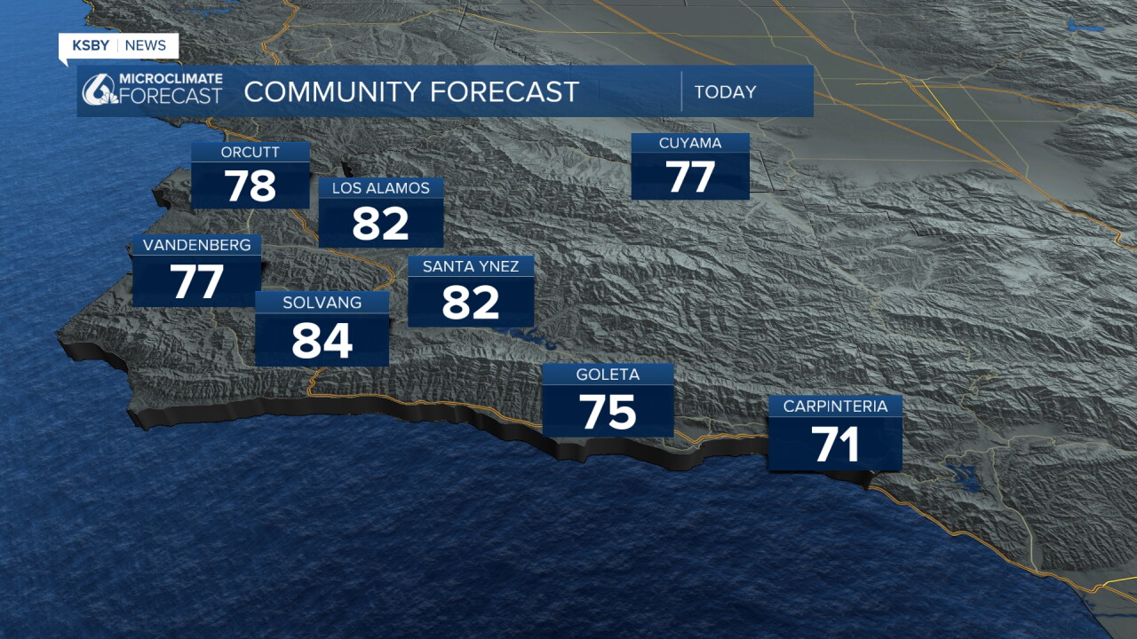
As we head into the afternoon, the light offshore winds will increase to a bit of a breezy afternoon. Temperatures will increase by a few degrees, bringing highs into the low 80s for some spots.
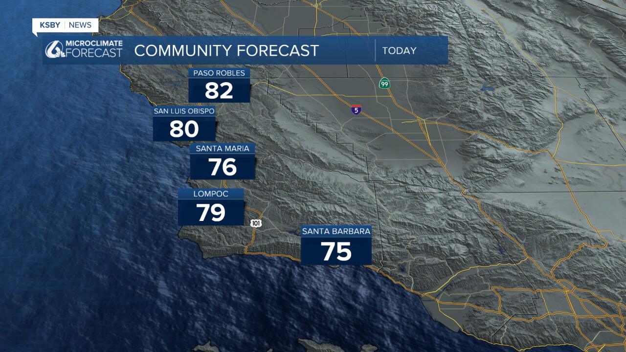
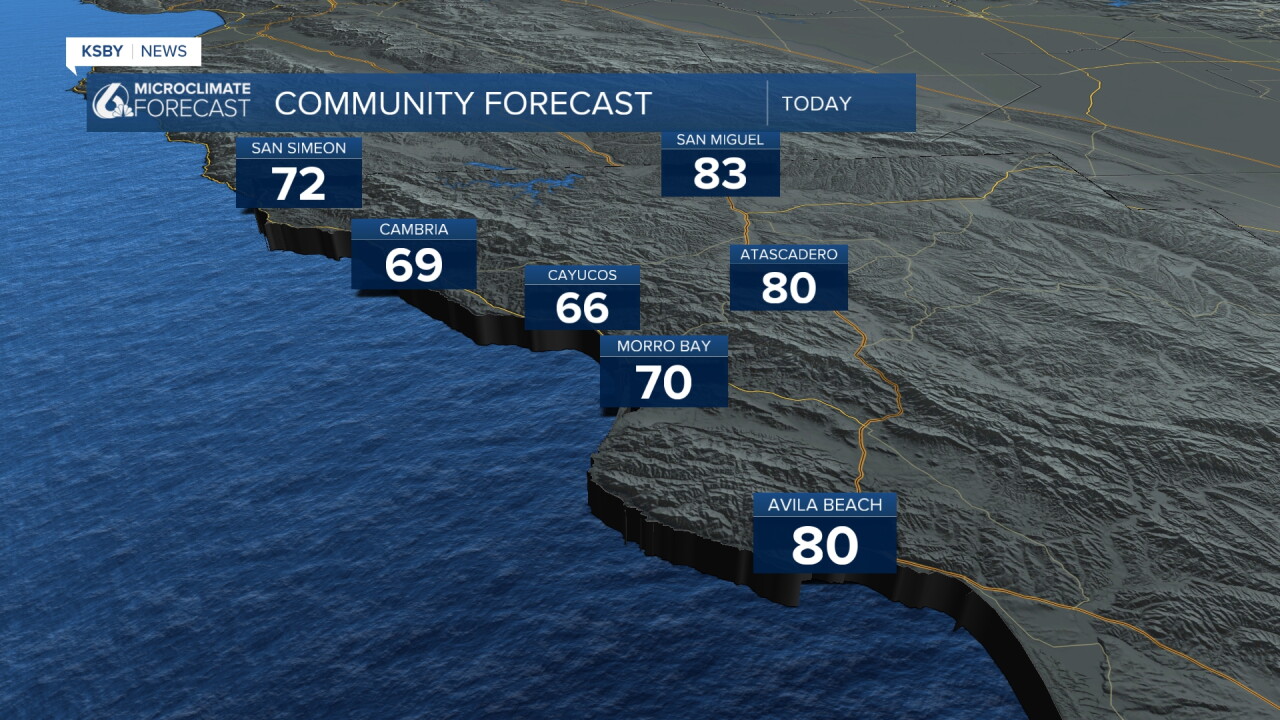
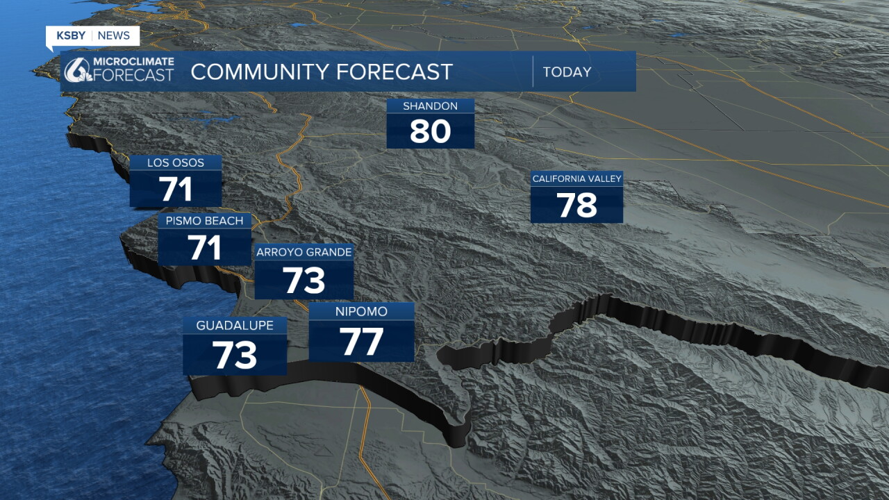
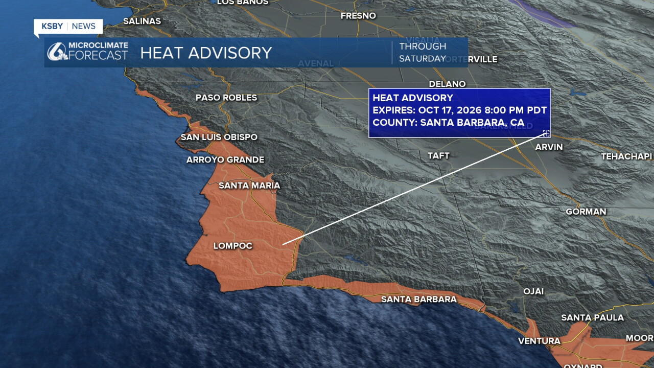
Those temps are going to climb a few more degrees each day into the weekend. High heat by the beaches (and interiors, although it won't be as far above normal) have prompted heat advisories for our beaches and coastal valleys through 8 p.m. Saturday.
There is also a fire weather watch in place for the Los Padres National Forrest as well as the Garcia Wilderness through 6 p.m. Friday night.
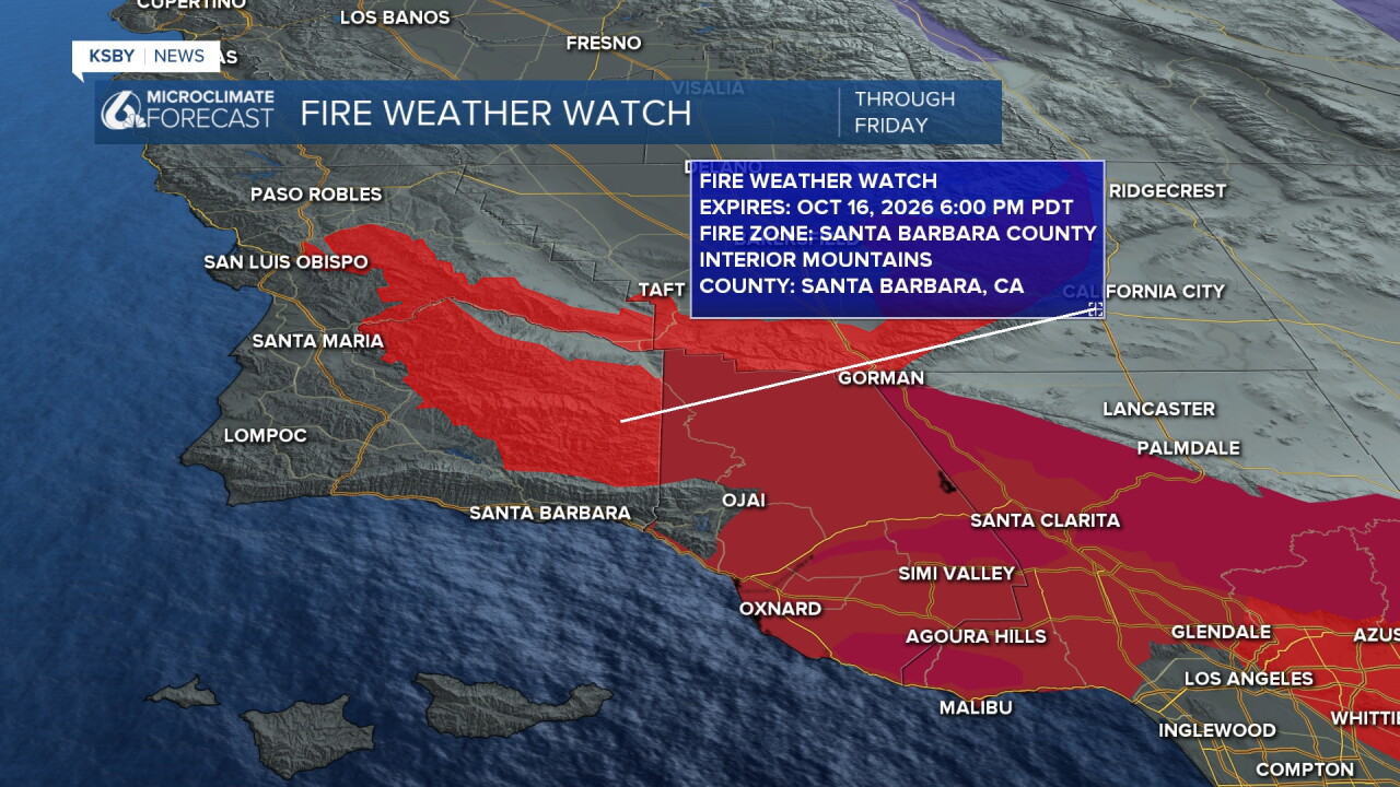
The fire weather watch is in place thanks to the combination of heat and strong offshore winds. A strong Santa Ana wind event to our south has a fire weather warning in place through Friday night.
The temps will peak Friday before cooling a few degrees into the weekend. Next week will be cooler and by Wednesday a small system moving south brings us a tiny chance for rain. I will keep an eye on it as those chances get closer.
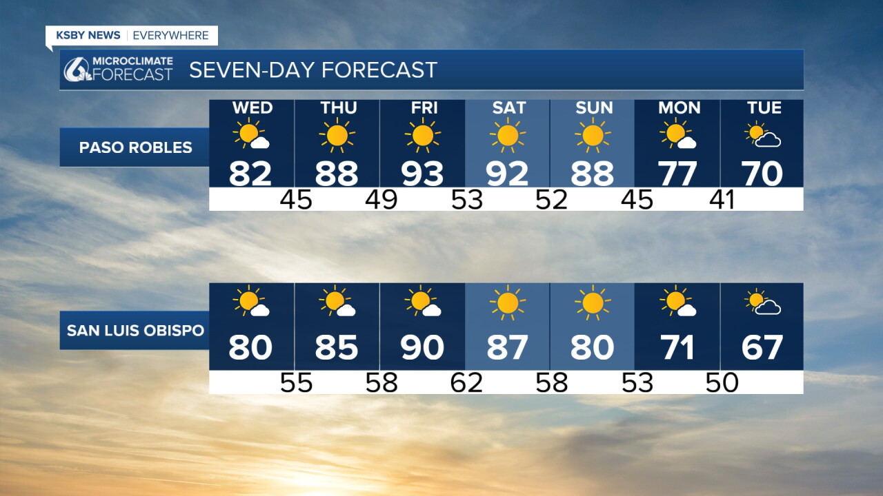
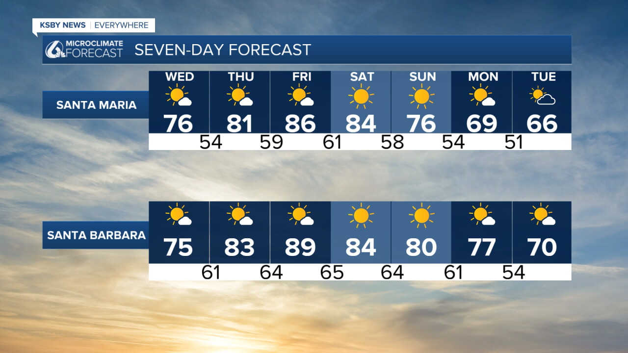
Here is what all of that looks like on your 7-day forecast!
Have a wonderful day, Central Coast!
-Vivian
