

Happy Monday, Central Coast!
As we get back in the groove after Thanksgiving, we can expect a mild and windy week ahead. Let's get into the details!
Today brought a warmer day with some highs climbing towards 70. There have been significant winds to our south from the Santa Anas but on the whole we have been okay.
The biggest change we are seeing is the high pressure that we have been enjoying moving east and allowing for a cooler pattern to set up.

That change starts tonight with cold weather expected in the interior valleys. The far eastern side of San Luis Obispo County will have temps falling into the low 30s tonight. This has prompted a Freeze Warning through 8 a.m. Tuesday morning.

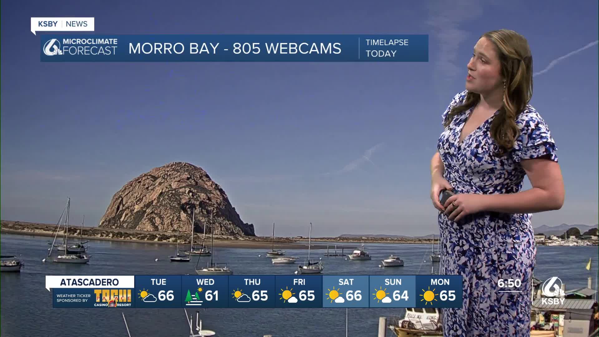
Into our Tuesday, we are looking at another mild day, winds will move onshore slightly, but on the whole, it will be another great day. Here is a look at the forecasted high temperatures.

There is a lot of action along our coasts over the next week. Starting off with waves. From 3 a.m. Tuesday through 3 a.m. Thursday, a long-period swell will bring large breaking waves 8 to 12 feet with a dangerous rip current to our western beaches. This has prompted a high surf advisory through early Thursday.
Additionally, all beaches are under a Beach Hazard Statement though 11 a.m. Saturday, thanks to another round of King tides associated with the full moon. Small-scale tidal inundation is possible from the 4th to the 6th due to the tides.

On Wednesday and Thursday, strong winds will move in from the north and drop temps a few degrees. This will also bring some low clouds into the interior valleys, although they should clear by midday. The cooldown will only be a few degrees, and it will be short lived. Warmer temps and abundant sunshine are the story by Friday and will last through the weekend.
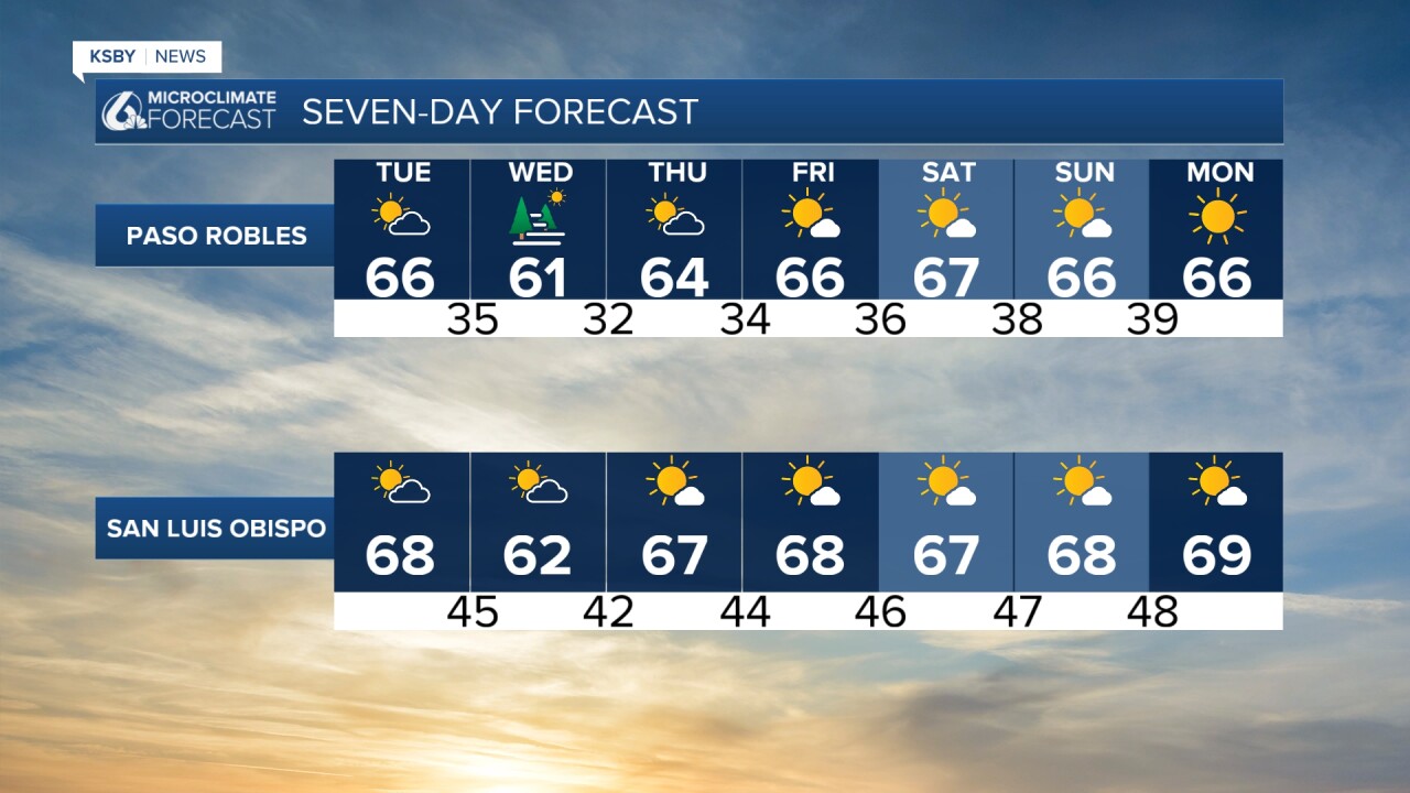
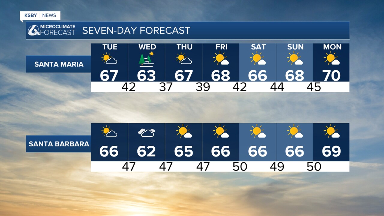
Here is a look at all of that on the 7-day forecast!
Have a wonderful week, Central Coast!
-Vivian
