


Good morning, Central Coast!
The last week has been all about the sunshine and high heat (7-15 degrees above normal for this time of the year). Now that the high-pressure system that fueled the warm weather has been pushed south, several systems will move into the region.
The first changes have already taken shape with onshore winds and much more cloud cover than we have seen recently.
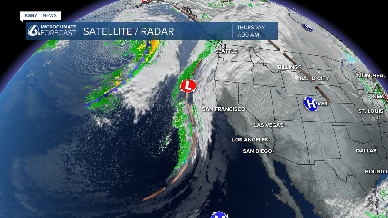
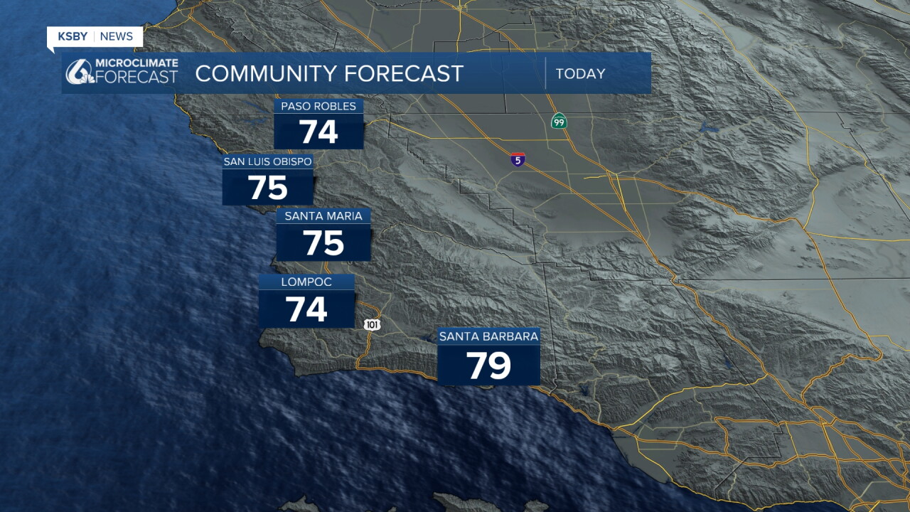
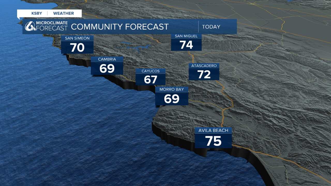
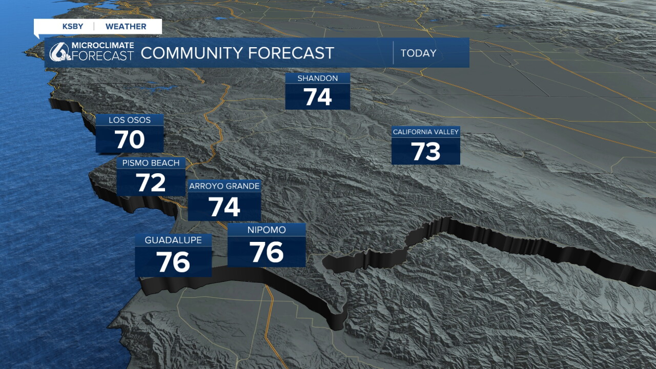
The transition between the heat and the rain will be slow but persistent. Today, high temperatures will be about 10 degrees below Wednesday's highs, although still slightly above normal for this time of the year.
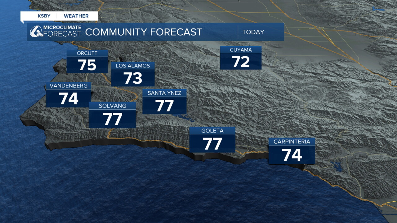
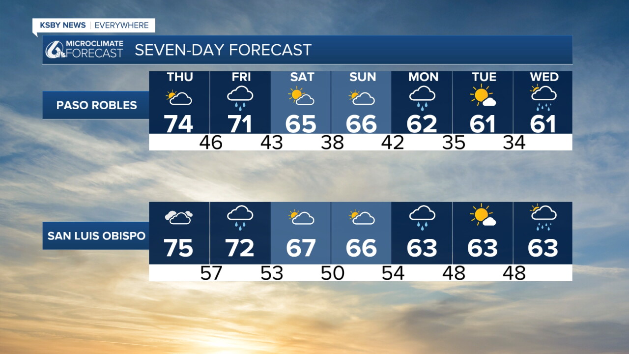
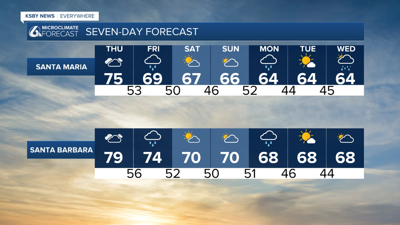
Late tonight into early Friday, the clouds will start including some small pockets of light rain. These will become widespread by the Friday morning commute. Through the day, even more showers are expected, although for the most part they will be light.
Friday night, the core cold front will pass overhead and bring a band of heavier rain. No thunderstorms are expected, but the rain may be heavy enough at points to cause a few issues.
Saturday and Sunday will be cooler, with highs in the low 60s and partly cloudy skies. This will be a break between systems. More is on the way next week.
Monday and Wednesday will feature bands of rain (at some points, it may be intense).
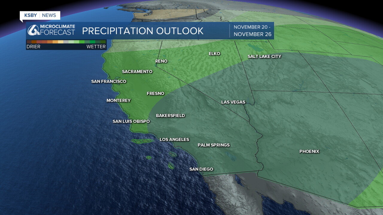
Even into the 8 to 14-day outlook, we will continue to see a more active pattern across the region. With the Thanksgiving travel period still a little too far out to forecast, we are relying on the longer-range modeling that indicates an active setup that could potentially impact Thanksgiving.
Have a wonderful day, Central Coast!
-Vivian
