



Good morning, Central Coast, and happy Monday!
It was a warm weekend with highs in the 80s across the region. Much of that is caused by a big high-pressure system paired with offshore winds.
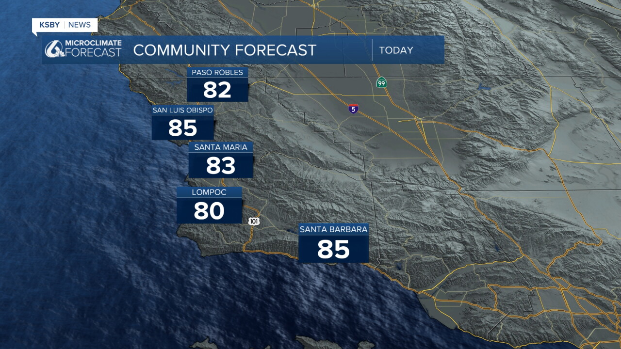
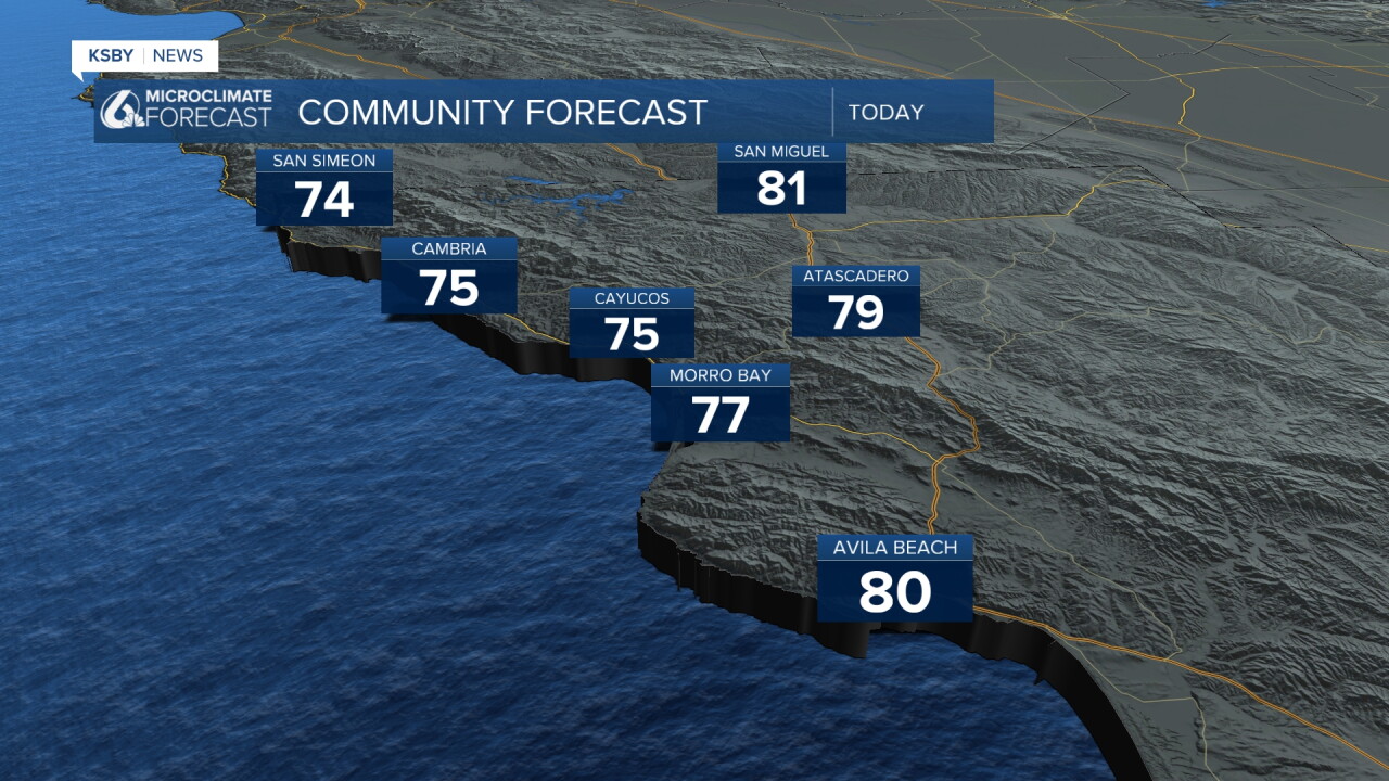
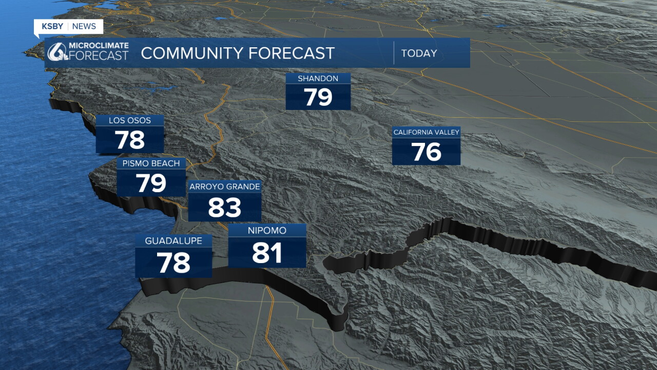
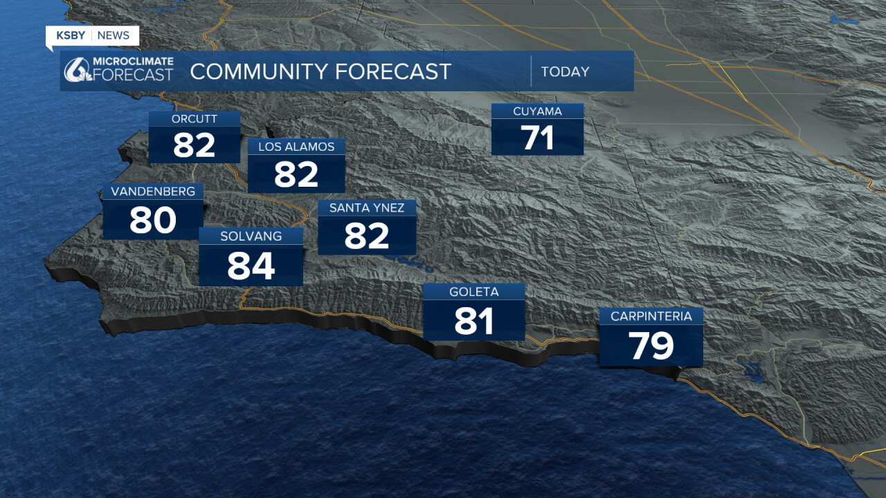
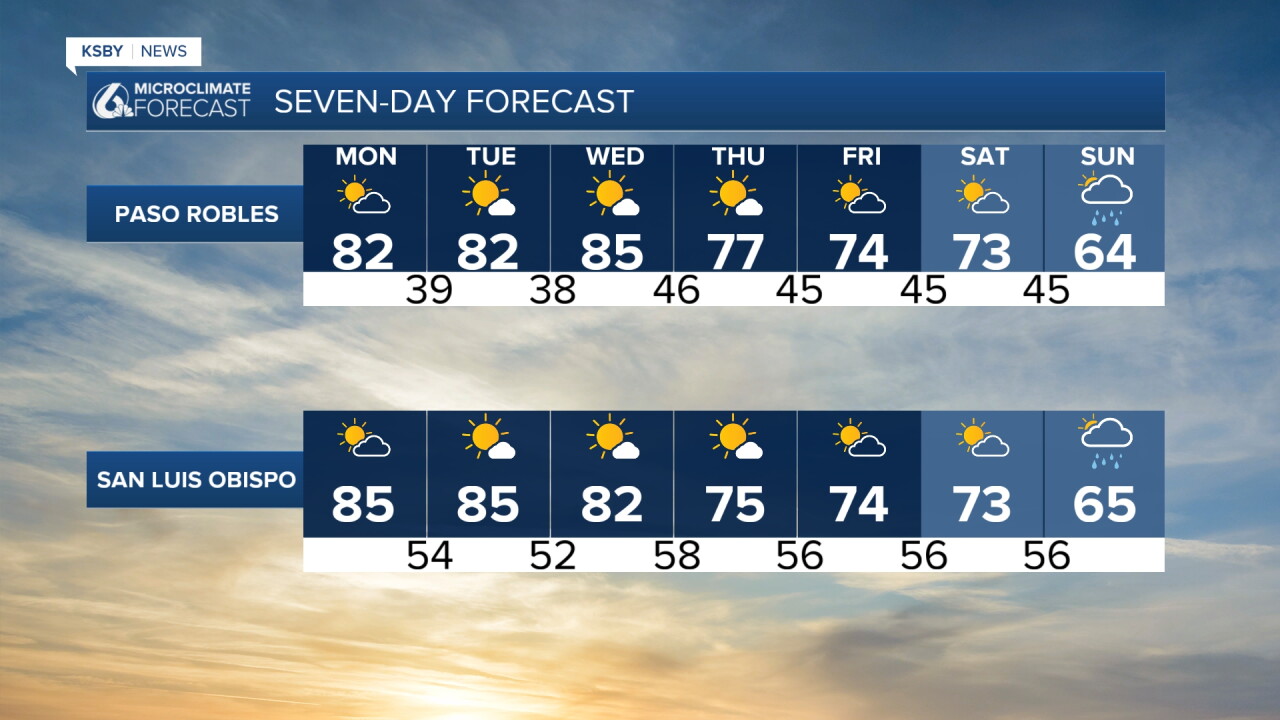
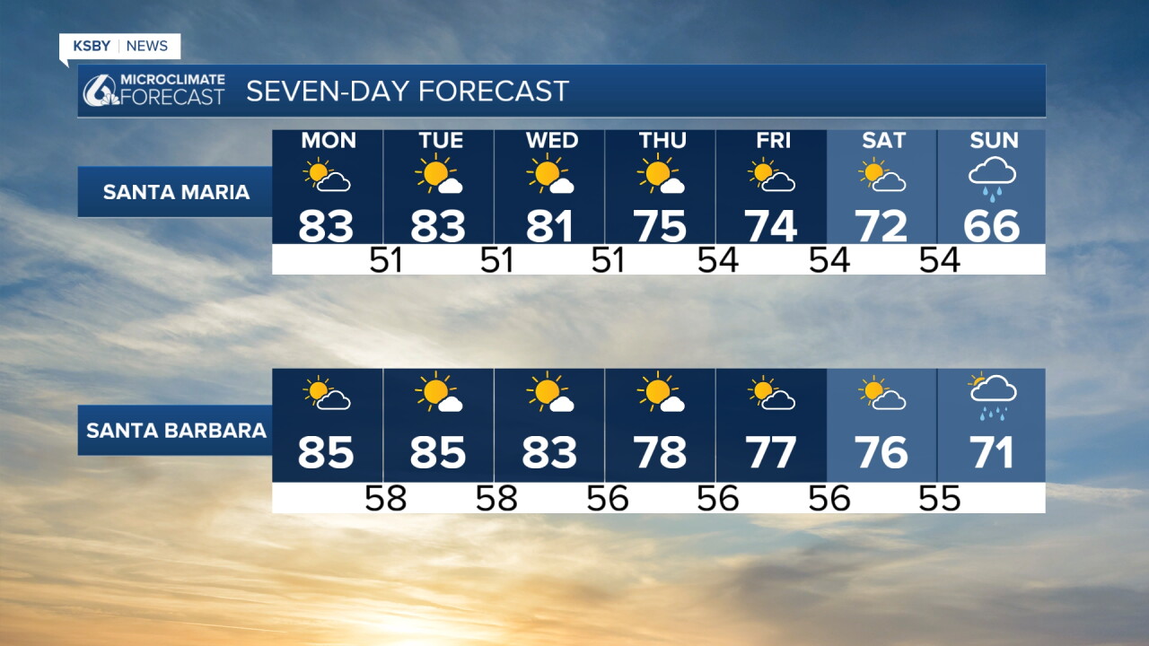
Today, similar conditions are in place. Here is a look at the temps we can expect today.
By our coasts, there are several concerns.
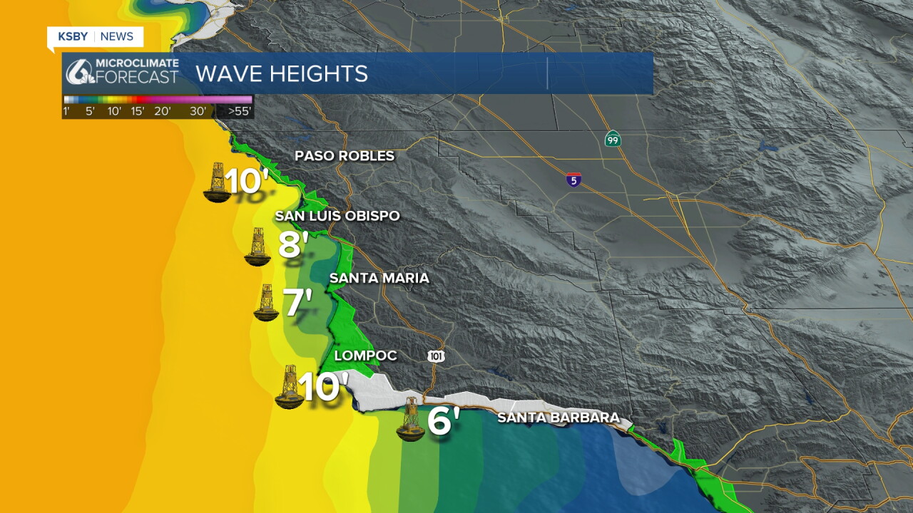
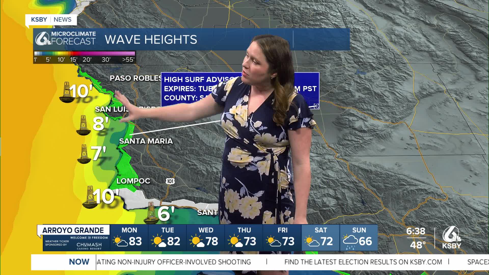
High Surf Advisory: For our Western Beaches, in place for waves 8-10 ft, with localized sets to 16ft. Through Noon on Tuesday.
Beach Hazard Statement: Rip Current Risk for the South Coast through Noon on Tuesday.
Coastal Flood Advisory: High tides up to 7 ft through Noon on Tuesday.
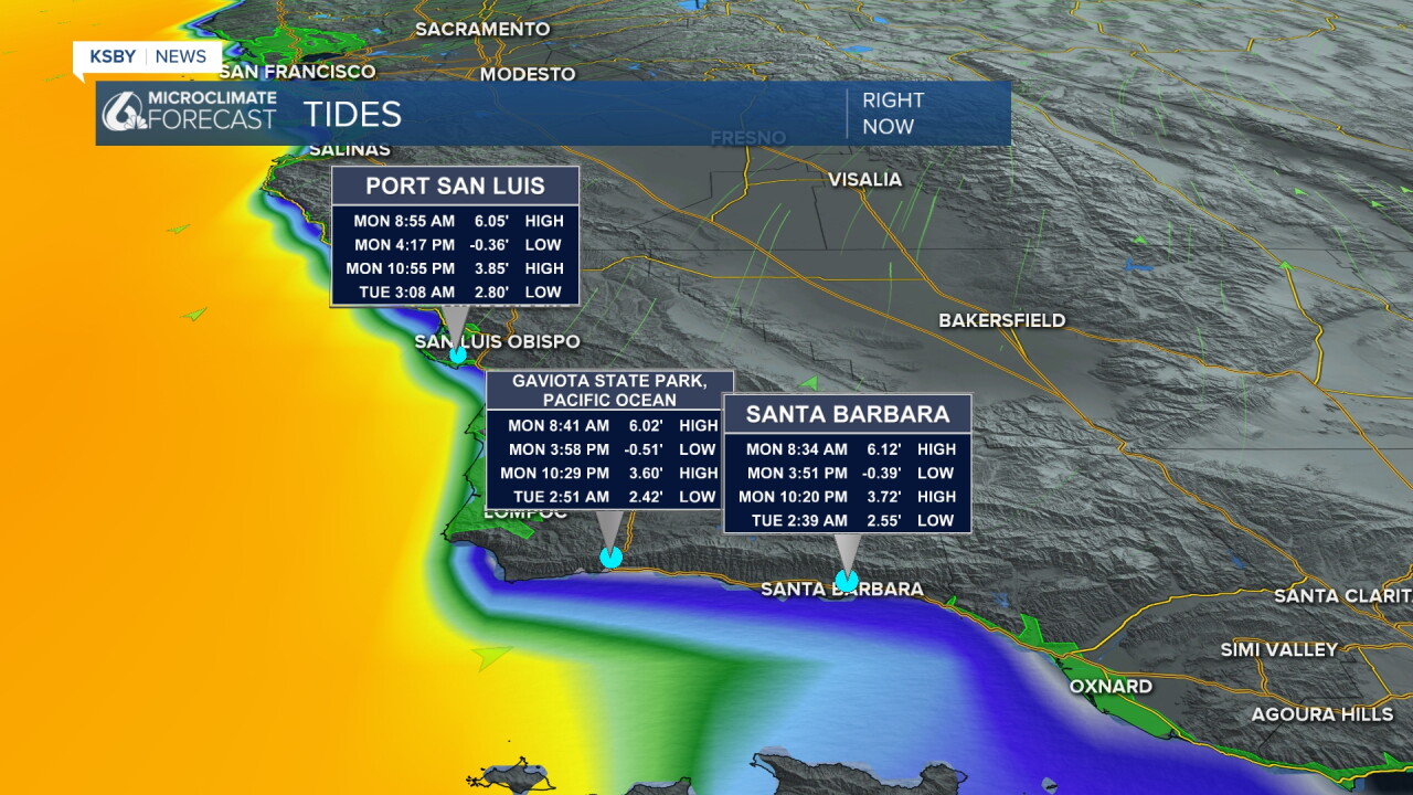
For Tuesday and Wednesday more warmth is expected but as we near the weekend winds will calm and allow cooler air into the region. low 70s expected by Satyrd
Now let's talk about the rain chances. Full disclosure: this is a long way out, and I anticipate changes to the timing and totals as the storm gets closer this week.
The storm I am monitoring is a low-pressure system moving south from the Aleutian Islands in Alaska. It will reach us with a descending cold front this weekend. Most of the rainfall is expected Sunday, but a few showers may arrive early and reach us by Saturday night.
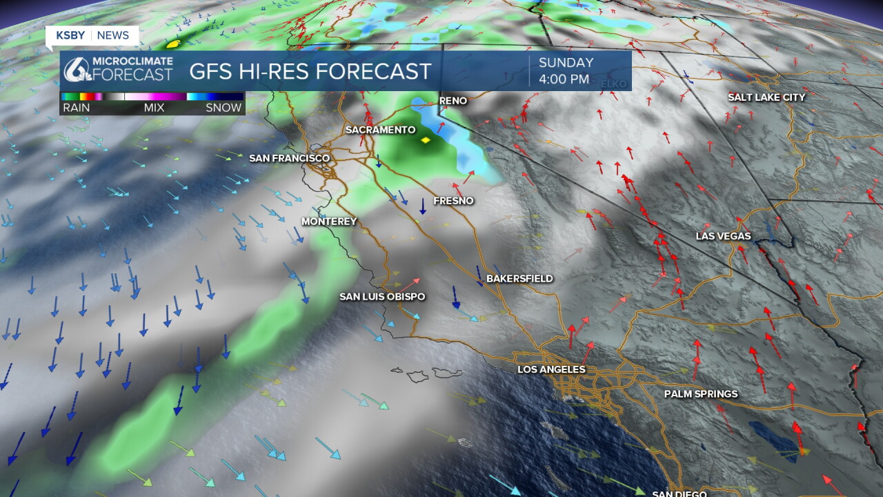
At this point, though, accumulations will be low. Less than a tenth of an inch for most.
Here is what all of that looks like on the 7 day forecast!
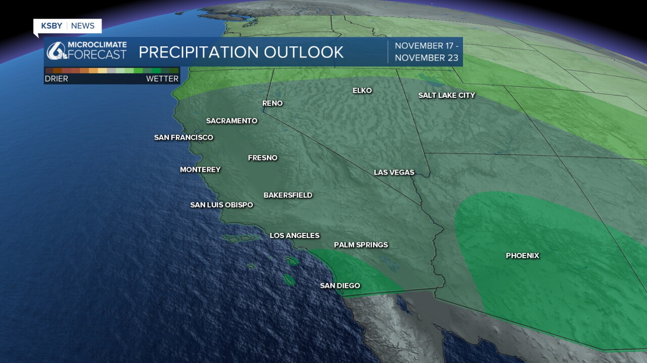
Into the second half of November, we are expecting an active pattern with above-normal precipitation expected across the West Coast.
Have a wonderful day and a great week ahead, Central Coast!
-Vivian
