



Good morning, Central Coast and happy Friday!
It was a hot one in Paso Robles on Thursday with high temps reaching 102 in the afternoon hours. That marks the first official triple-digit temps at the Paso Robles Airport in 2026. By the end of this heat wave that will be joined by many more days with temps soaring.
The reason behind this heat up is a massive heat dome over the West. That will bring us sunshine, offshore winds and for the interiors, limited marine influence. AKA the heat is here to stay.

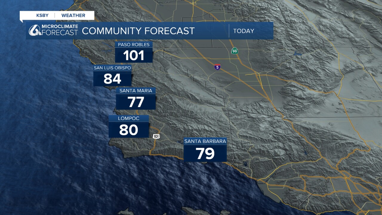
For coastal valleys and beaches, the morning is marked by lots of cloud cover and fog. That will clear out quickly and all temps will tick up. Here is what we can expect for today!
The weekend will feature more of the same hot weather, with temps taking a tiny tick down on Sunday with the addition of more cloud cover. That won't be too much of an issue, but still something I am watching.
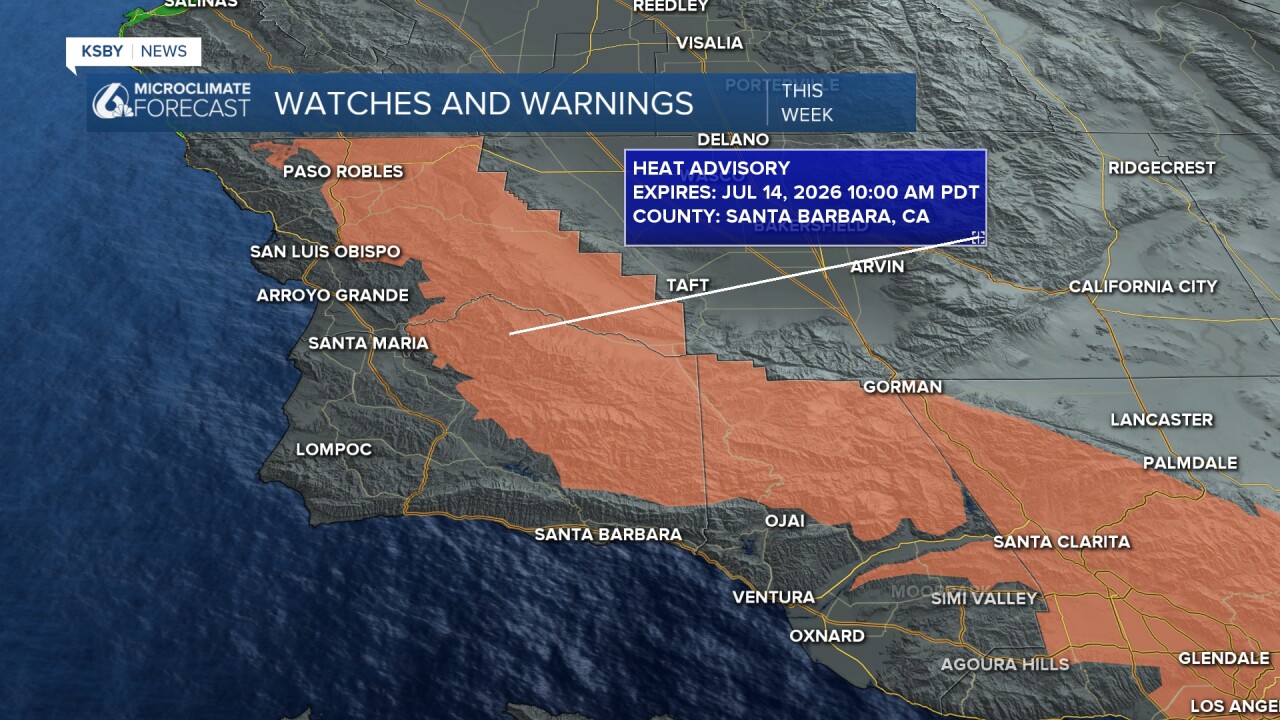
A Heat Advisory is already in place and continues through Tuesday of next week. Interior valley temps will reach up to 103°
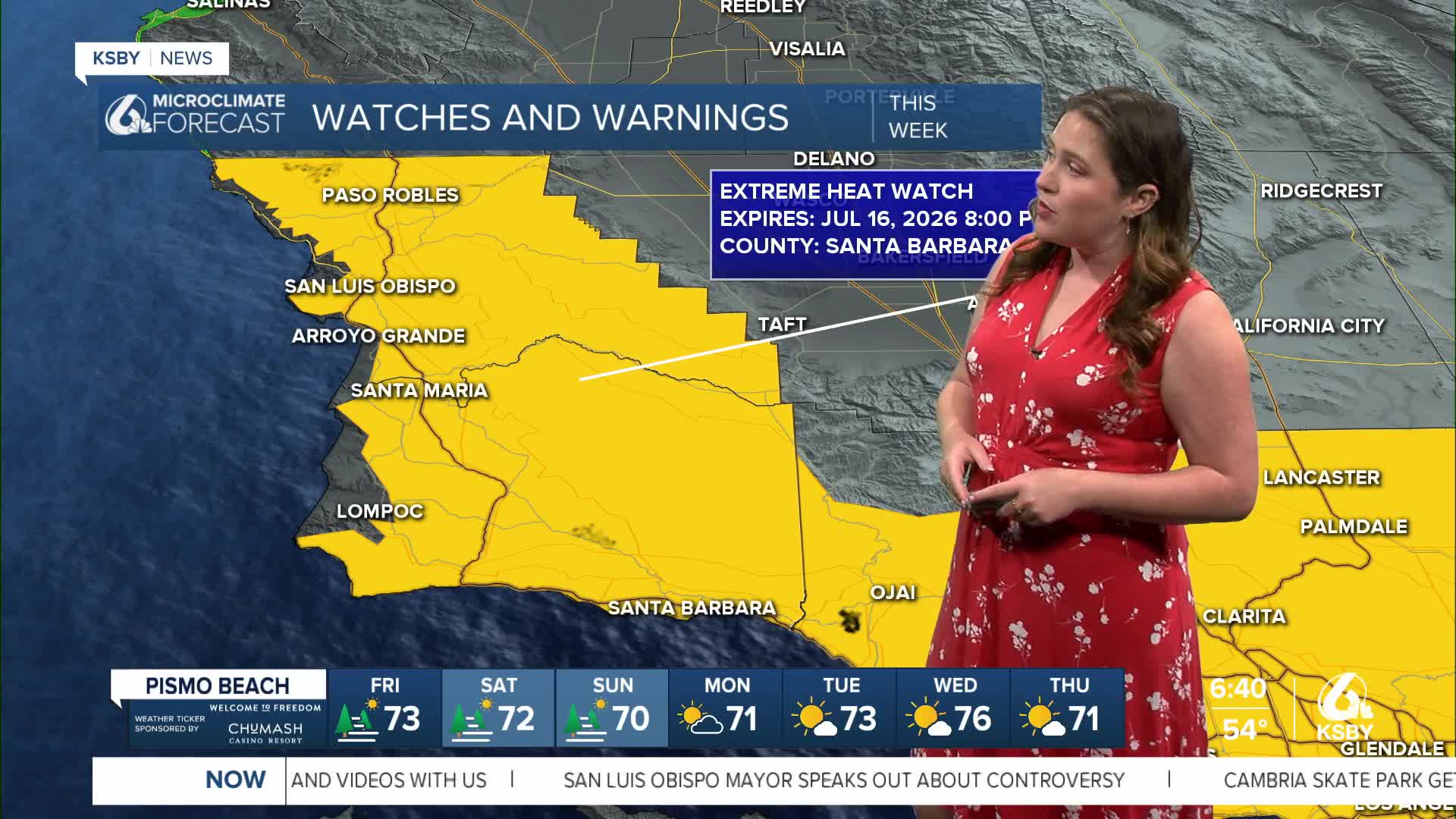
There is an Extreme Heat Watch that will replace the heat advisory and last through Thursday. This has a larger extent and widespread triple digits are expected.

Here is all of that on the extended forecast. Long story short, stay hydrated and aware of heat concerns.


As we head into this extended period of hot weather, please remember to stay hydrated, limit outdoor activities during the hottest parts of the day, and never leave children or pets in vehicles. Check on elderly neighbors and relatives, and ensure your air conditioning systems are working properly.
Along with the heat next week, there is a very small (but still there) chance for the monsoon moisture from the desert Southwest to make its way to the Central Coast. No large rain chances, but there is the risk for dry lightning. On top of all this heat and strong winds, fire weather danger will be extreme next week.
Have a wonderful weekend, Central Coast!
-Vivian
