

Happy Thursday evening, Central Coast!
Today started off with some dense fog and cloud cover, but that wasn't to last. By midday, sunshine and climbing temps moved in. Highs climbed into the 60s and low 70s across most communities. The South Coast was a different story, strong winds compressed air and heated up temps quickly. The state street thermometer reached well into the 80s today. Once that temperature is confirmed later today it will officially be a record, surpassing the previous record set in 2024 when the temp reached 80.

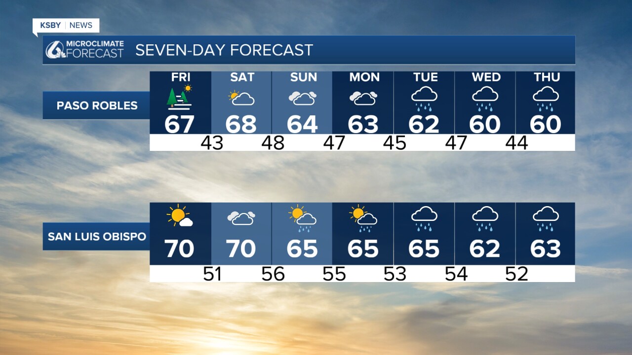
Tomorrow, most temperatures will be right around today's highs with the exception of Santa Barbara. Without the strong offshore winds, highs will not climb as much.

Saturday will be much of the same with morning fog and some gusty winds. The bigger changes are going to arrive on Sunday afternoon.
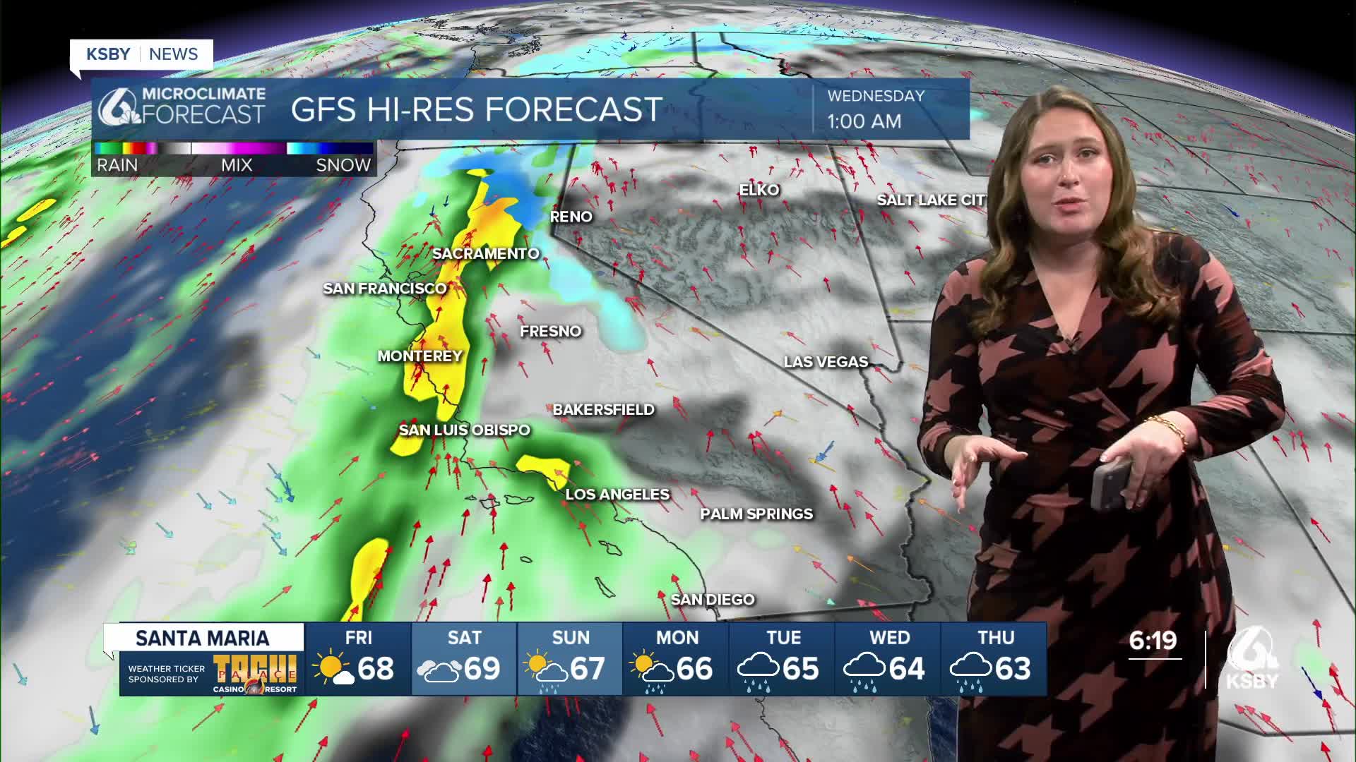
A quick disclaimer before we really dive in, the main bands of rain are still quite a few days out and will shift around with timing and amounts. I recommend preparing for significant rain and travel woes, kind of a prepare for the worst, hope for the best forecast.
The forecast shift starts with the cold front that I have been chatting about for the past few days. Sunday morning it will begin to bring some light rain for NW San Luis Obispo County. These showers will be limited at best, but what they will do is open the door for the atmospheric river that will bring inches of rain to the region next week.
The conditions will stay on the cloudy and unsettled side on Monday and for much of Tuesday. I have kept some rain icons on the 7-day, those are simply to signify the few showers expected. On the whole, it will be a cloudy but mild set of days.
Tuesday night into Wednesday morning (early Christmas Eve), the first band of rain will arrive. This will bring in strong winds and heavy rain. Several inches of rain are possible with the highest totals along the east-west ridges and at the highest peaks, although valley communities will still see significant rain.
Rain will continue with a few heavy bands embedded through Thursday and Friday (Christmas and Boxing Day) and even for Saturday morning.
All three of those sections of the storm will add up to inches of rain for the region. Highest elevations will see substantially more, but the whole of the Central Coast is in for a soggy week.

Even once we reach the end of next week the more active pattern will stay in place. I wouldn't be surprised if another storm sneaks in before the new year.
Have a wonderful evening and a good rest of the week!
-Vivian
