


Good morning, Central Coast!
As we kick off the week (and the month of November) high pressure is building into the region and bringing a set of beautiful days.
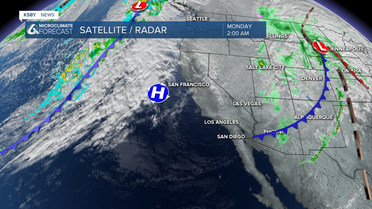
Today will bring temperatures in the mid-70s to the upper 60s for our beaches. Here is what you can expect.

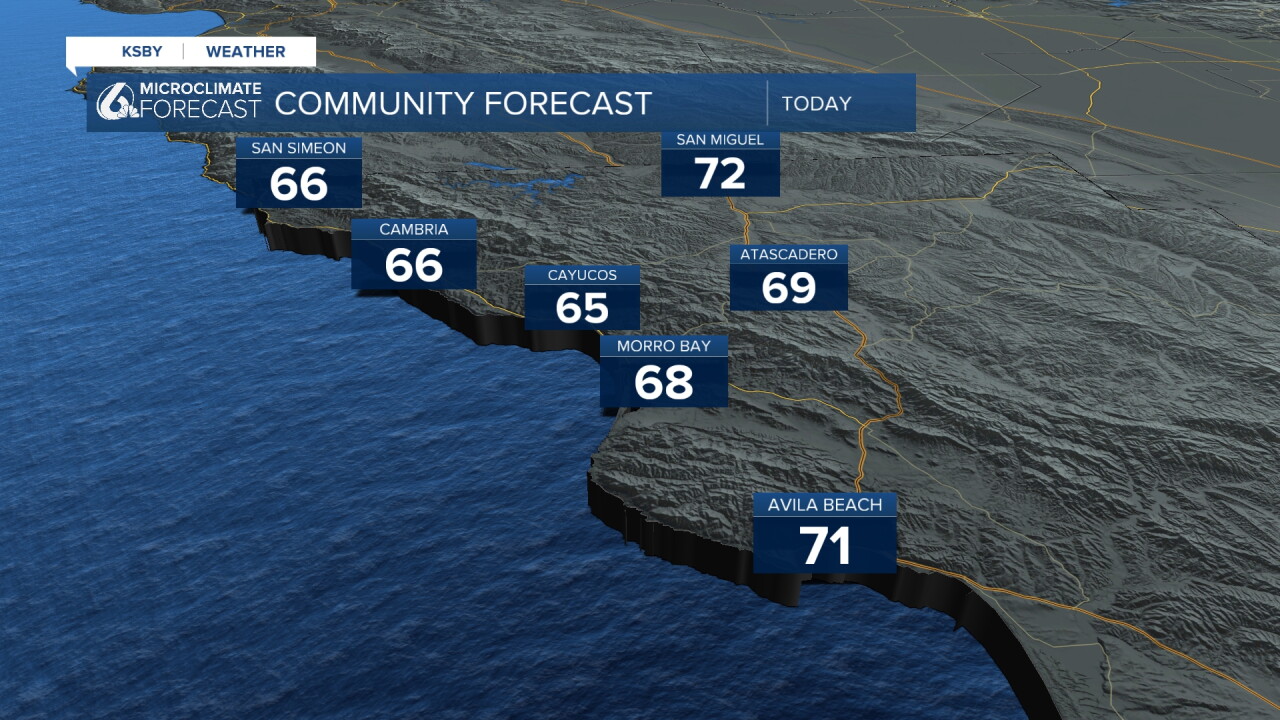
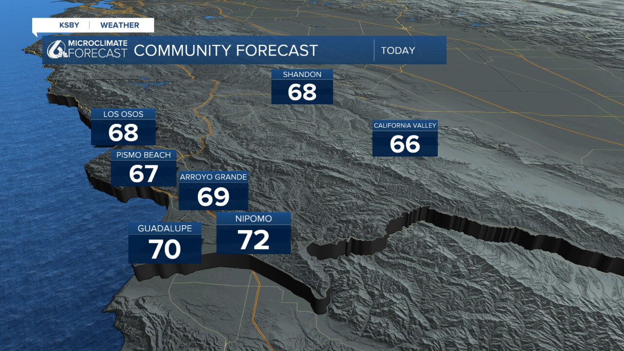
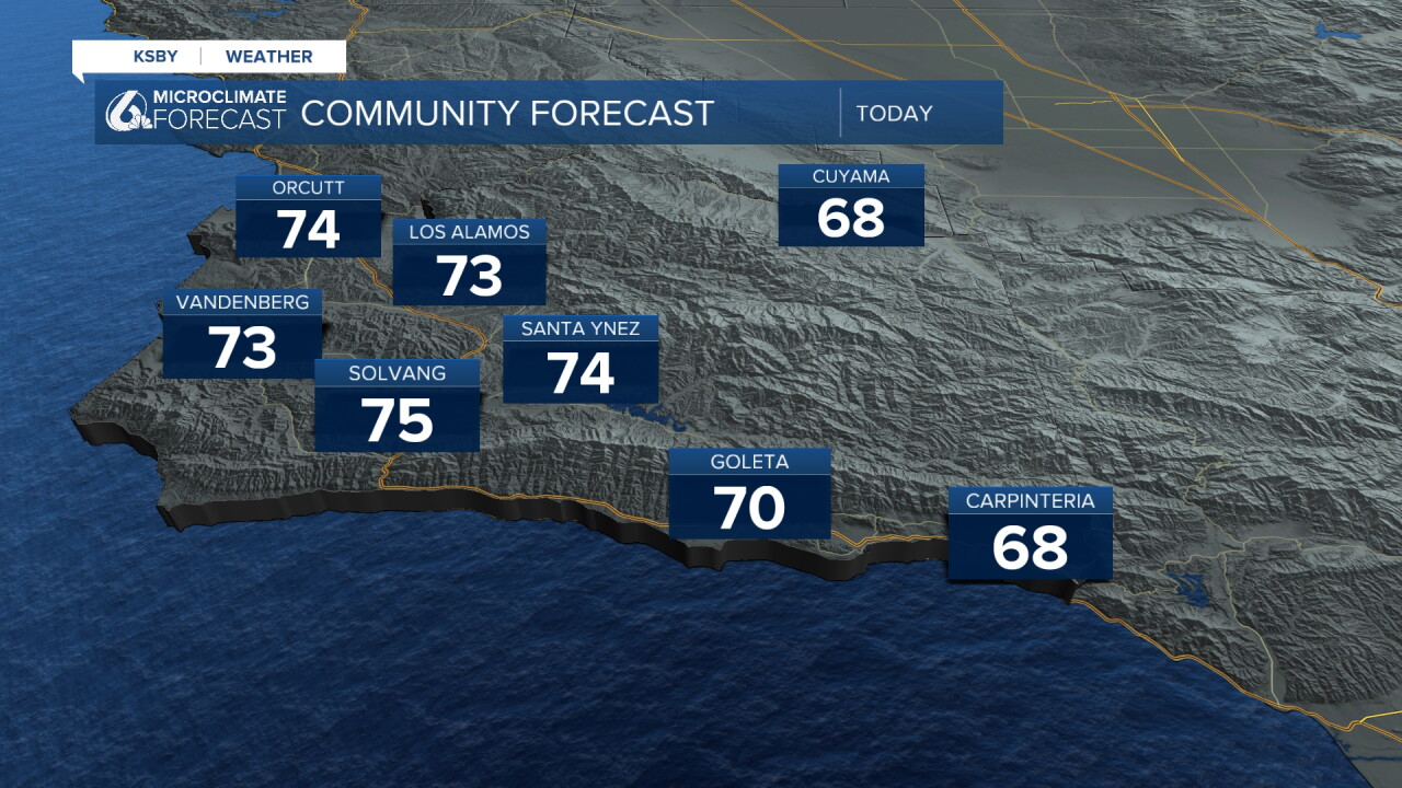
Into Monday evening, clouds will move in and bring a cooler pattern and chance for rain. The rain chance will be very minimal, especially compared to our last few storms. We are looking at just a few hundredths of an inch of rain, mainly for our most northwestern communities.
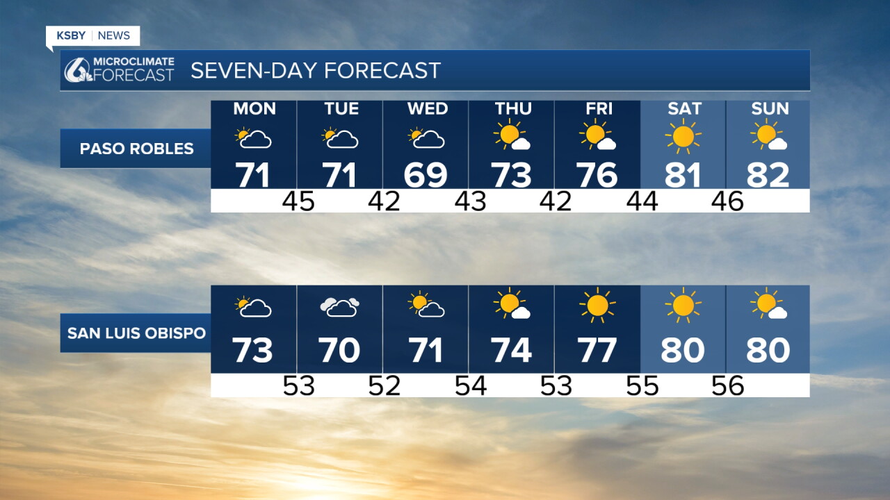
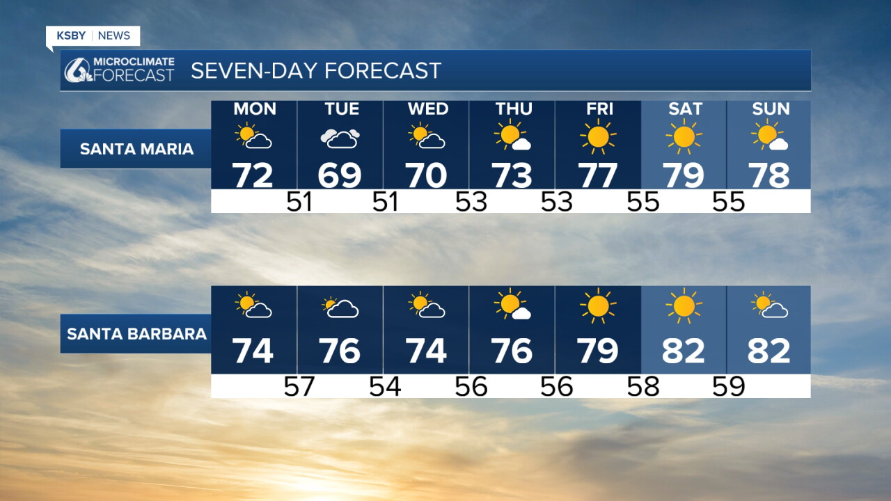
Once that small rain chance moves out, some offshore winds will establish themselves (some Santa Anas will move into the LA Basin), and temperatures will warm up. Late this week, highs in the upper 70s will be widespread; into the weekend, low 80s will arrive.
Here is what all of that looks like on the 7-day forecast.
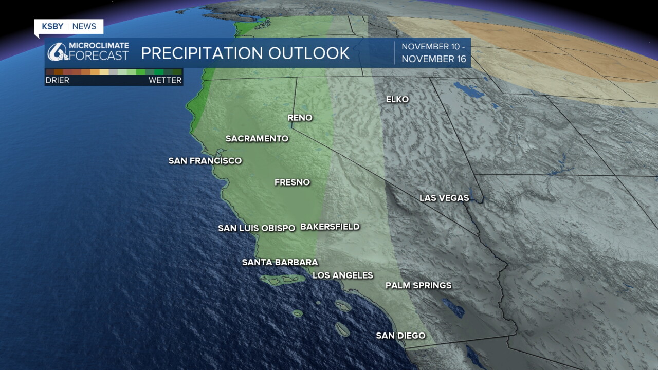
Into the mid-portion of November, the forecast favors a more active and wetter pattern. No massive storms on the radar right now, but still something I am keeping a close eye on.
Have a great week ahead, Central Coast!
-Vivian
