

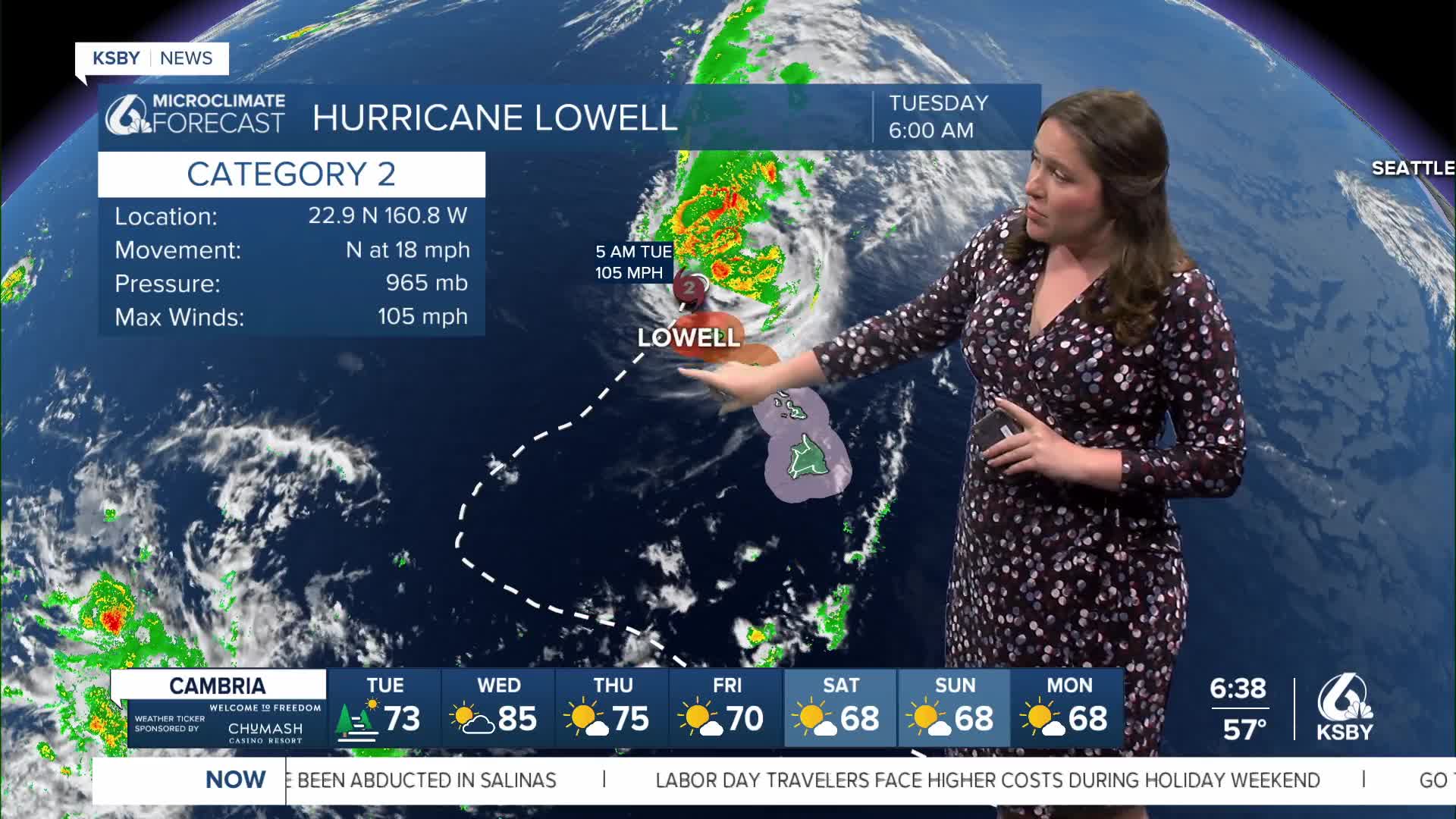


———Update 11 a.m. Tuesday from Meteorologist Vivian Rennie ———
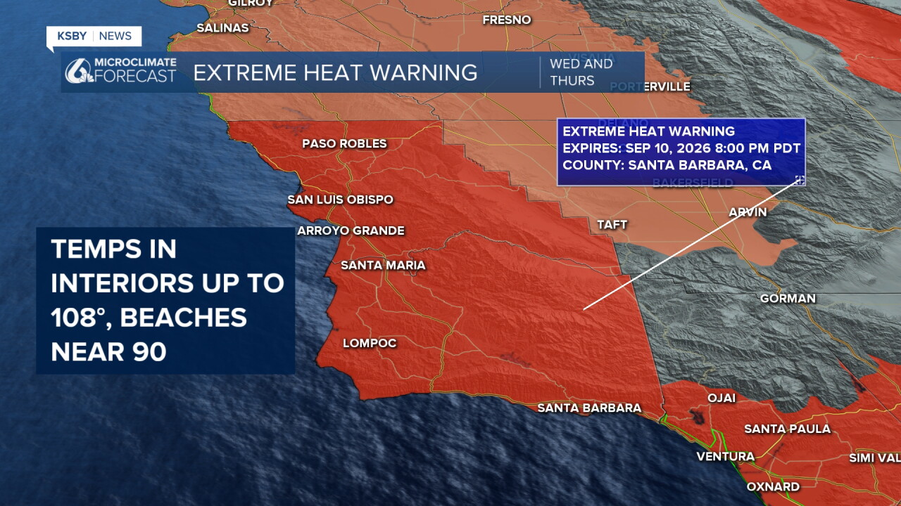
In advance of the soaring temps Wednesday, an Extreme Heat Warning has been issued for all of San Luis Obispo and Santa Barbara Counties. This is a substantial upgrade from the heat advisory that is in place until Wednesday morning. With the combination of this heat and humidity, it will be very uncomfortable outside. Heat illness is possible and can set in quickly.
——— Original Article ———
Good morning, Central Coast!
As many people kick off the shortened work week, skies are clear, and temps are very comfortable!
The story over the past few days has been the tropical influence across the region; today, that influence will start waning. That being said, some upper-level clouds will mix with our hot, more humid air and bring us some very small rain chances. These will be mainly for the farthest interiors and tall peaks where air is forced to rise in the atmosphere. A stray storm can't be ruled out, but the chances are small.
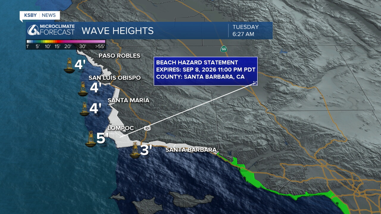
The other impact is in our waters. There is a beach hazard statement in effect through 11 p.m. Tuesday for all beaches thanks to heightened wave energy, rip currents, and high tides.
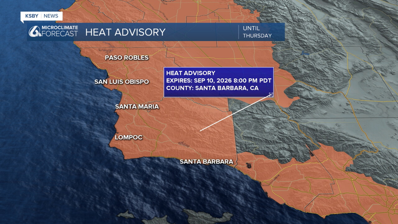
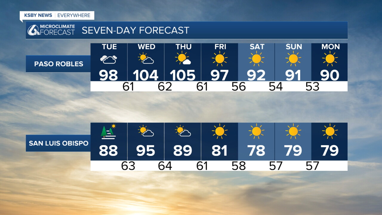
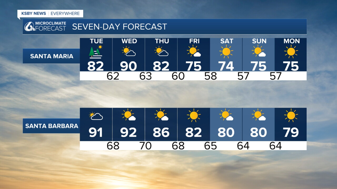
There is also a heat advisory in place for ALL of our communities through 8 p.m. Thursday. Dangerous heat with additional humidity will be the main impact of our forecast this week. Heat will peak Wednesday evening and will linger into Friday.
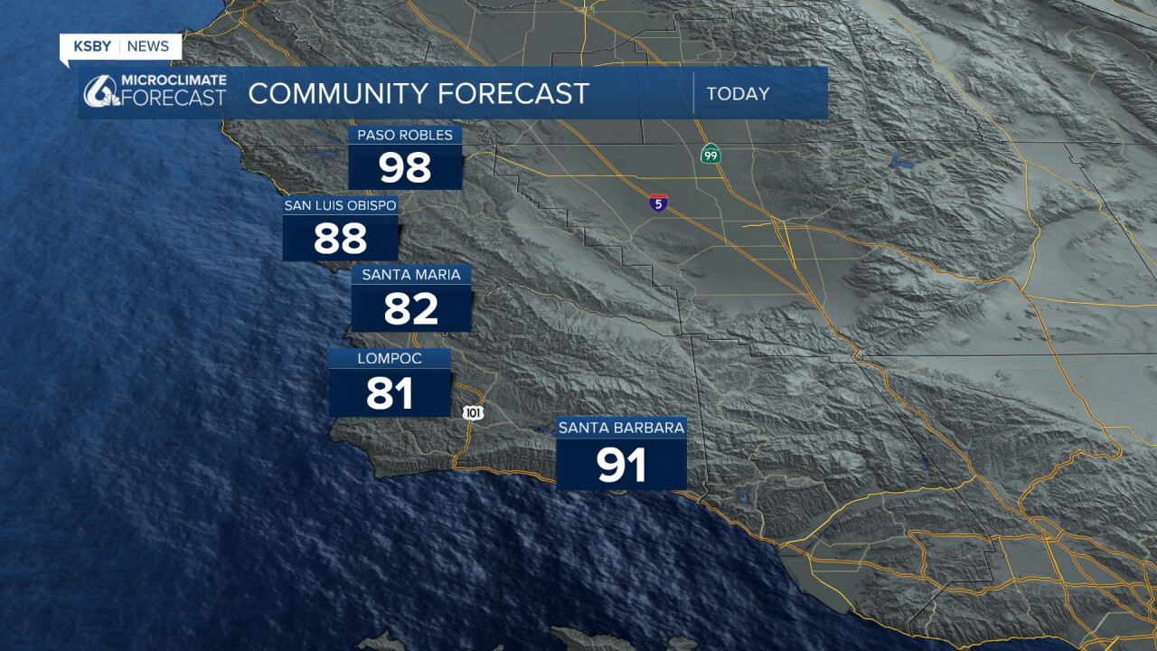
Today's highs are just starting to warm up. Upper 90s for the interiors, 80s for most coastal valleys.
Wednesday will be the peak for most spots, but high heat will stay in place through the week, with highs falling towards seasonal normals by the weekend.
Have a wonderful day, Central Coast!
-Vivian
