


Happy Tuesday evening, Central Coast!
Today was a warm (bordering on hot) day across the region. Temps soared into the 80s for many coastal communities.
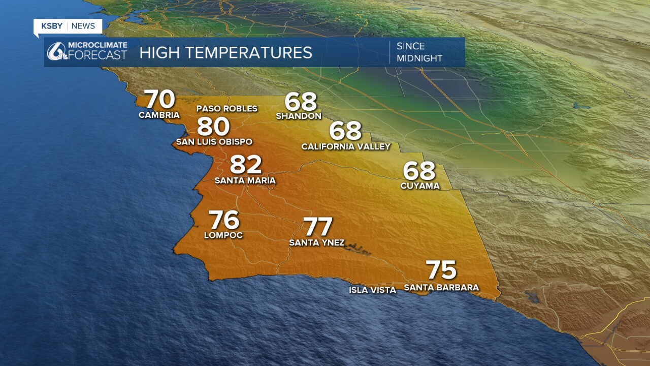
For a little context the typical daytime high temperatures for December 9th are in the mid 60s across the region.
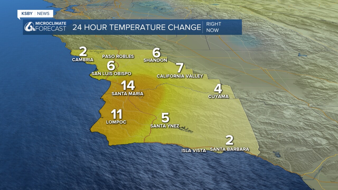
These warm temperatures marked a large increase just from the past few days as well. Here is the 24 hour temperature change as of 5 p.m.
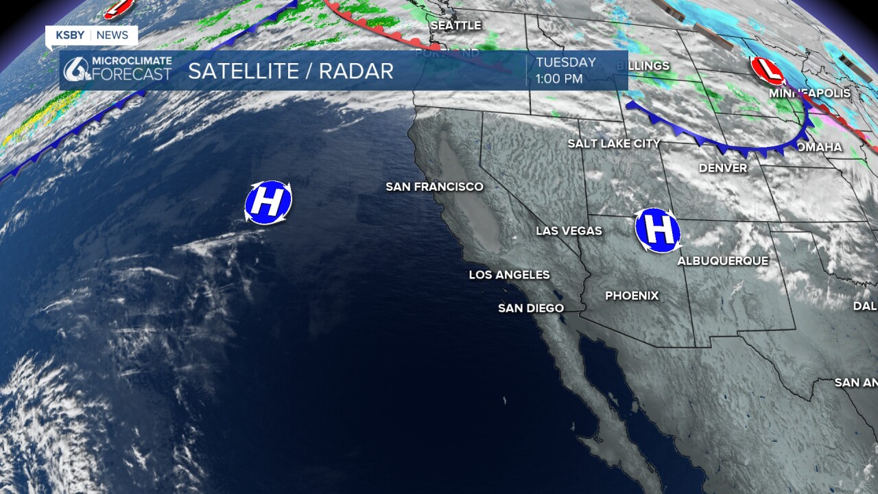
The warm temps are a combination of a few factors (offshore winds, limited marine influence, and abundant sunshine), but all those come back to the same cause... a massive high-pressure system sitting just offshore.
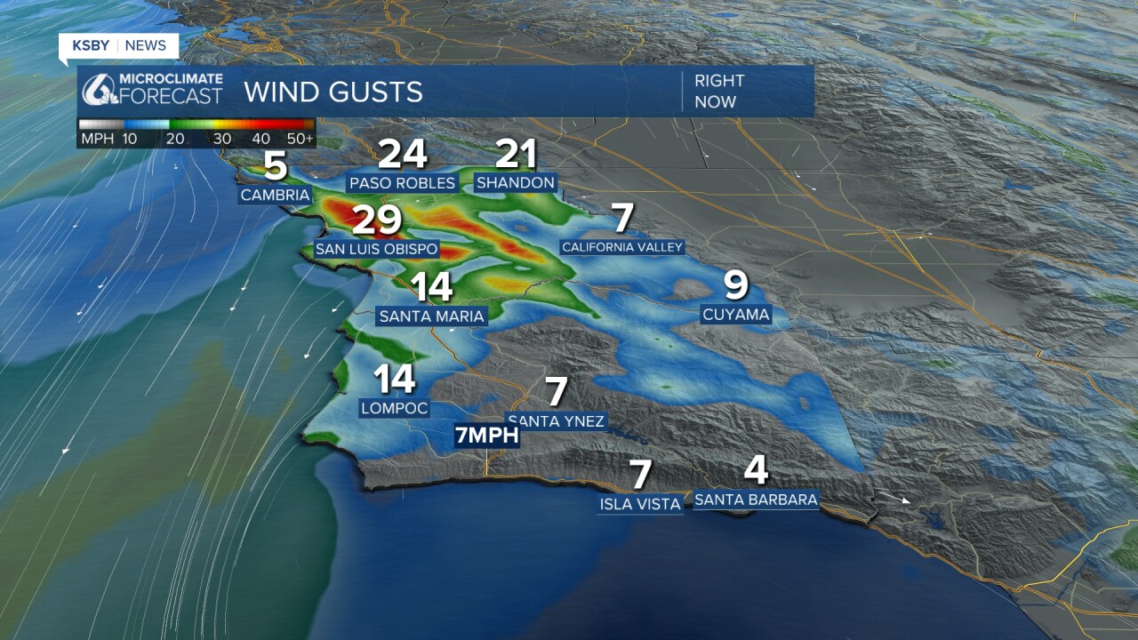
That will stick around and continue to bring us the warm weather for the next few days. Winds will also continue to be a concern, although they are expected to stay below advisory level, but a gust up to 45 mph can not be ruled out. Here are the winds as of 5:30 p.m.
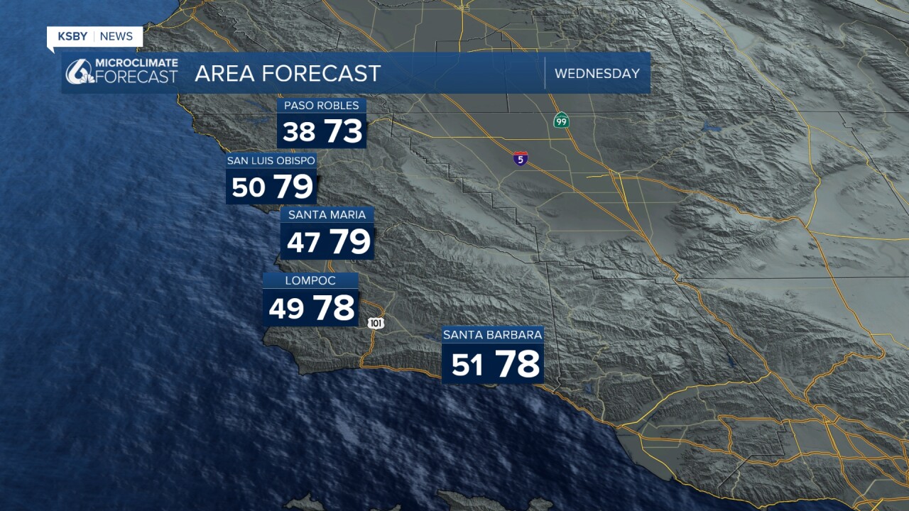
Wednesday will be more of the same with highs in the upper 70s and low 80s for most spots with continued offshore winds.
Thursday, the winds will ease and with that will come a slight cooling trend (because of the lack of compressional heating that the winds were bringing us). Conditions will still be warm and wonderful though with sunny skies and mild temps through the weekend. Next week, we will see a slight cooling trend once again that will bring us closer to average for next week.
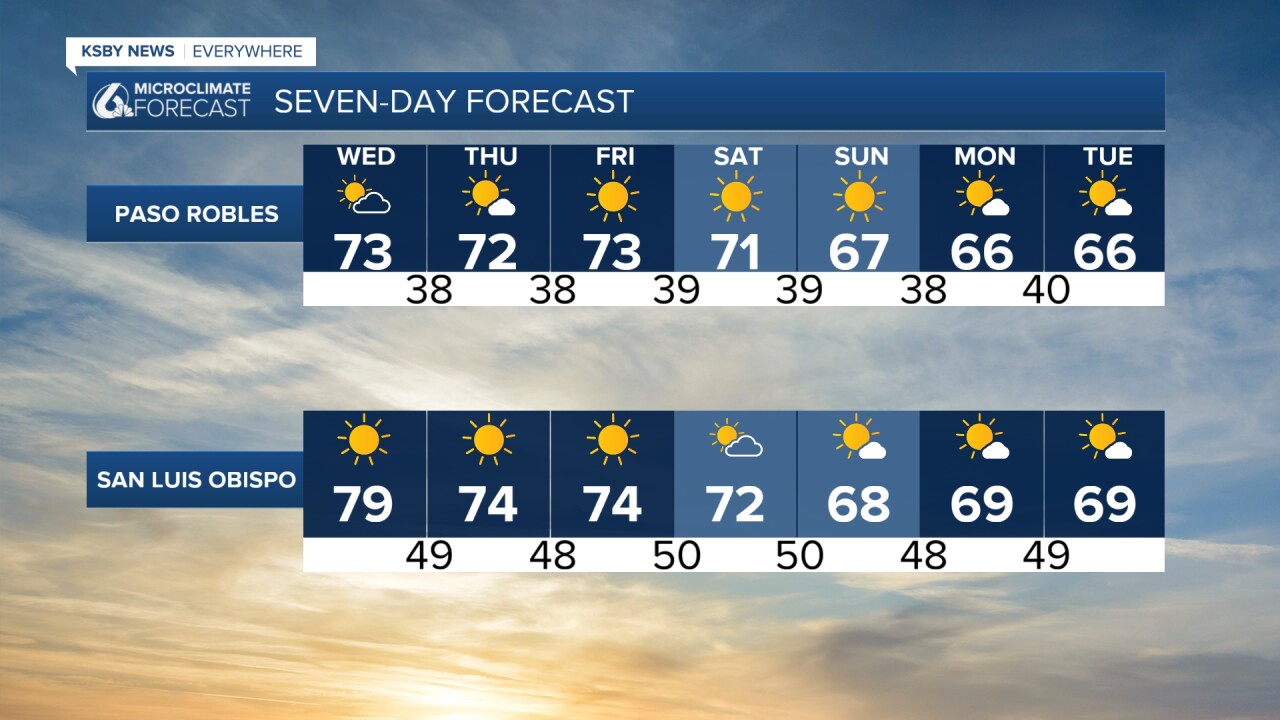
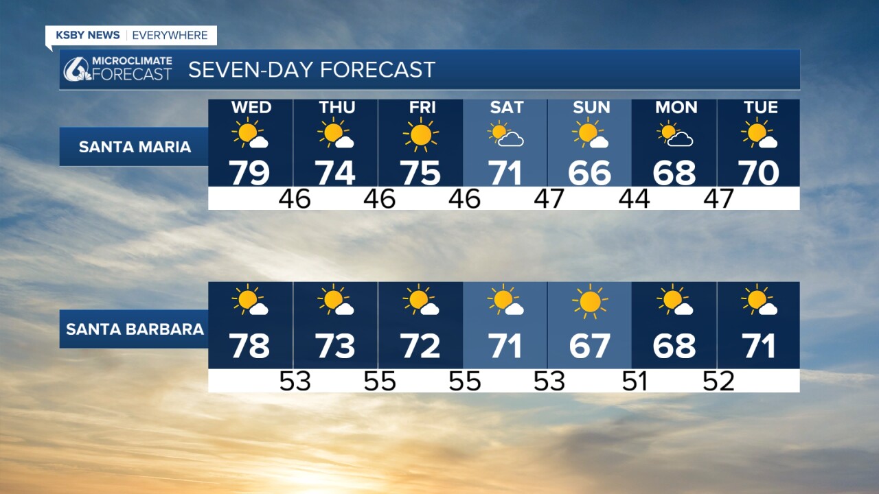
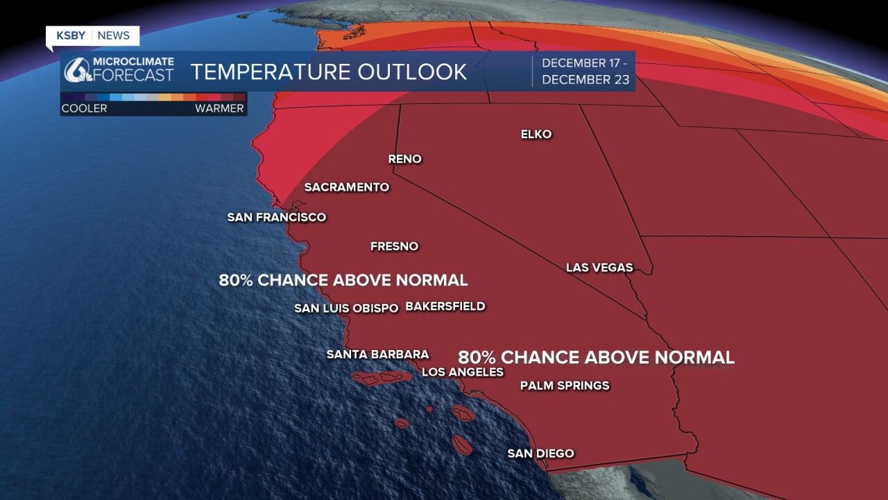
Looking further into the extended forecast temps are expected to stay well above normal into the latter half of December. Unfortunately there are no major chances for rain in the forecast.
Have a wonderful evening, Central Coast!
-Vivian
