
Good morning, Central Coast!
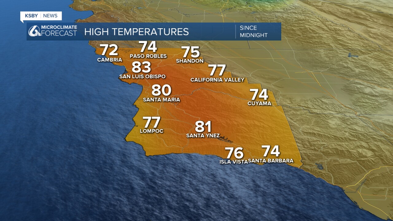
Yesterday was a beautiful and hot one across the region with highs soaring into the 80s for many communities. Here are the highs from Tuesday.
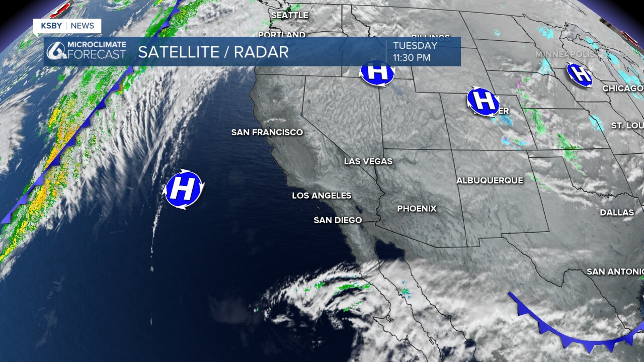
This heat is being caused by a strong high-pressure system sitting across the west coast.
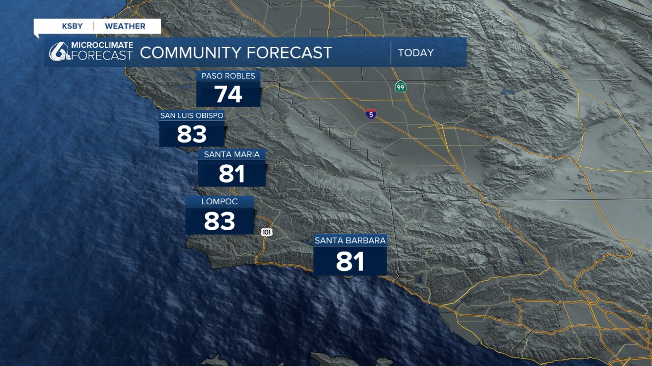
Today will once again be mainly controlled by that ridge of high pressure. Highs will be in the 80s once again with some potential record highs possible in the LA Basin. Here are the highs expected for Wednesday.
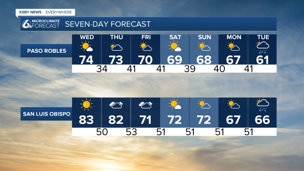
Thursday will be similar temperature-wise. Some cloud cover will move in by mid-afternoon and start a shift in the forecast. As the high pressure breaks down, it will open a door for cooler weather to move in from the north.
Because of this 'open-door', temps will take a tumble into the weekend, although highs will still be in the low 70s.
This weekend, we are also expecting a swell along our beaches with localized sets up to 12 ft expected. I wouldn't be surprised if a high surf advisory is issued.
I am watching a change in the pattern for early next week as a cold front races down the coast, bringing rain chances Monday night into Tuesday morning. This looks to be a pretty mild system, but it will break our dry streak that has lasted for over a month.
Here is a look at all of that on your 7-day forecast.

Have a great day, Central Coast!
-Vivian
