

Happy Wednesday evening, Central Coast!
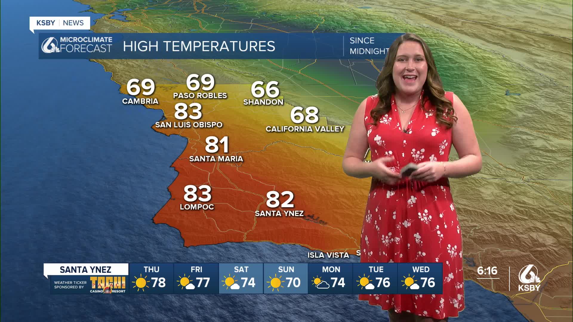
It was a warm, bordering on hot, day across the Central Coast with high temperatures climbing into the 80s for much of the coast.

This was mainly caused by a massive ridge of high pressure centered over the West Coast. That has brought us lots of sunshine, limited marine influence, and offshore winds. This is the perfect recipe for heat, even in December.

Tomorrow will be similar with temps climbing quickly. The highs will be a few degrees shy of today but still hot overall.

Into the weekend, the high-pressure pattern will weaken slightly and allow a few degrees of cooling, although we will still stay above normal into the beginning of next week.


Even into the further extended forecast, we can expect warmer-than-normal temps across much of the country until Christmas Eve.

Have a wonderful evening and a great rest of your week!
-Vivian
