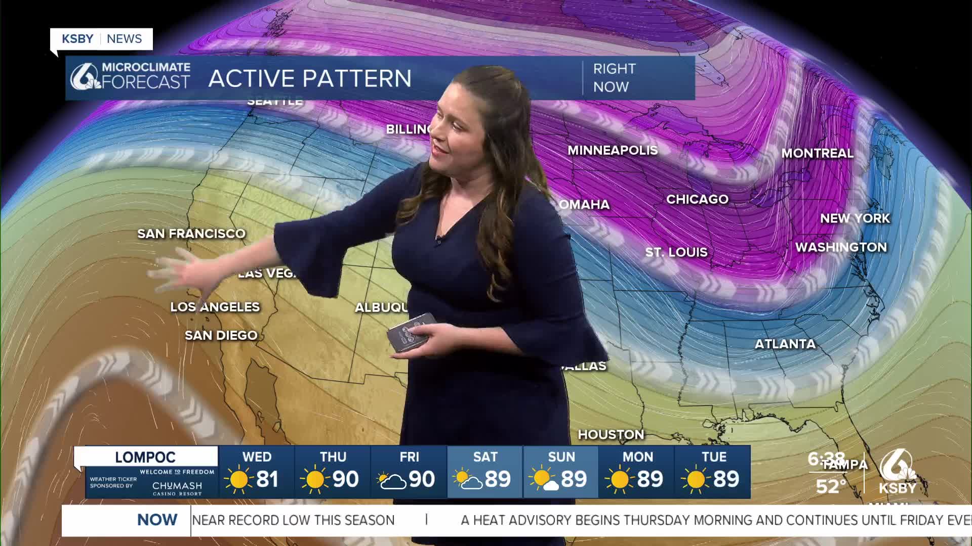


Good morning, Central Coast!
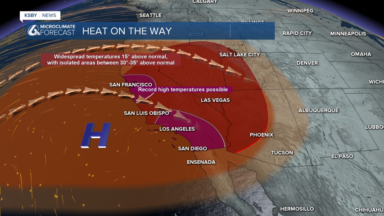
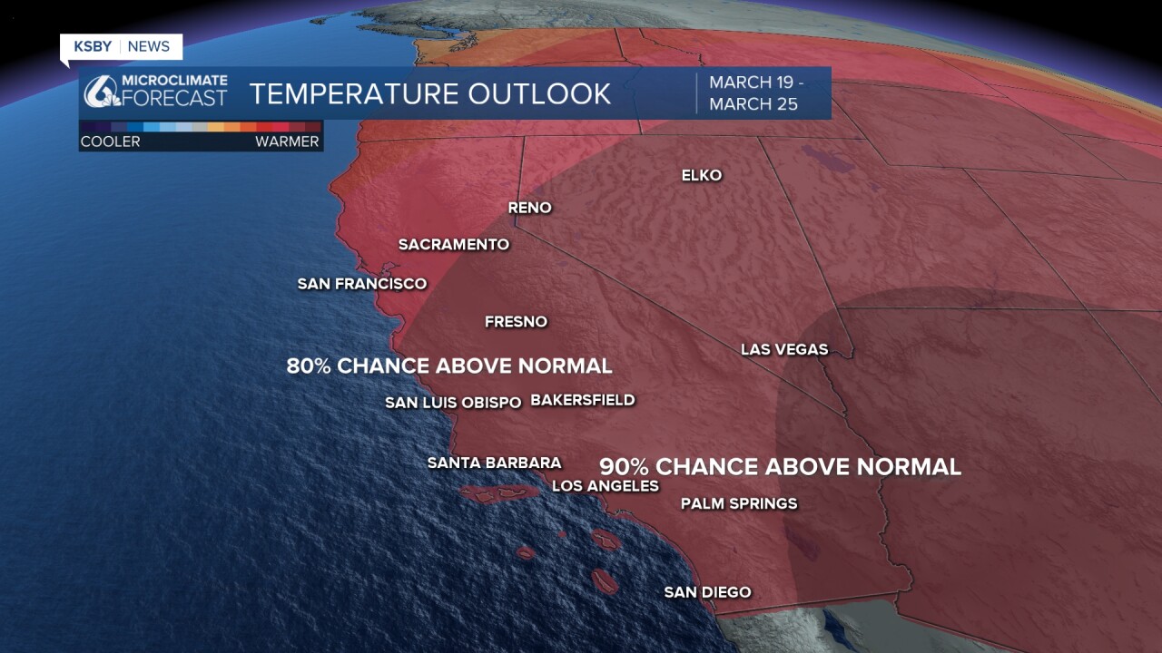
It is about to get HOT. The next 10 days will go down in record books with near guaranteed daily high temperature records as well as monthly records set to fall. The 90s will be widespread as we see temperatures 30 degrees above normal across the region.
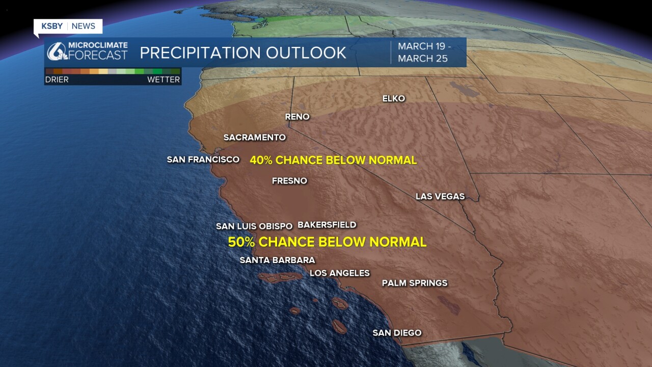
This is all thanks to a large high-pressure system sitting to our west that will bring us abundant sunshine, offshore winds, and limited marine influence.
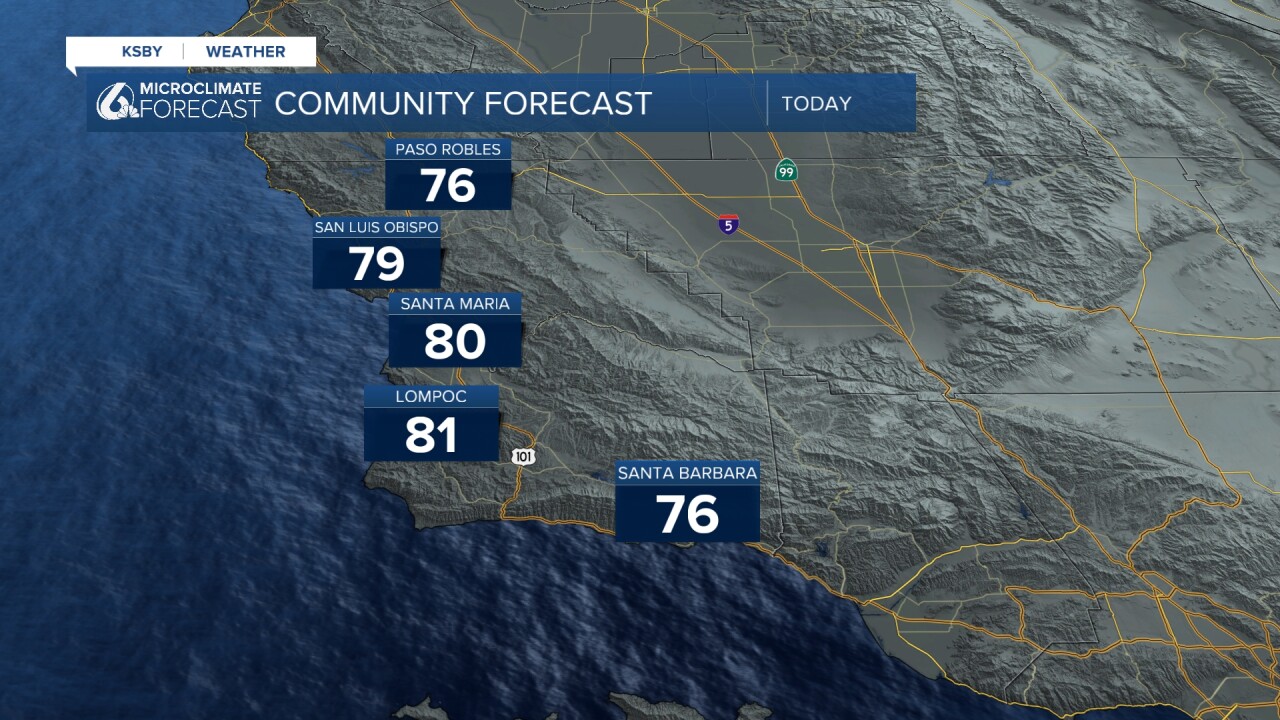
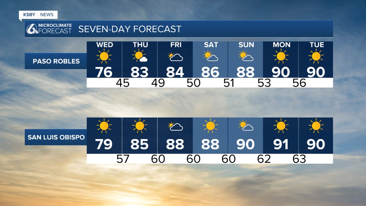
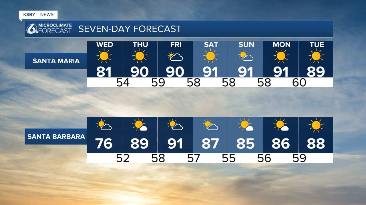
The high pressure is still moving towards us so Wednesday will be more of a transitional day with highs reaching into the 80s and some early morning cloud cover.
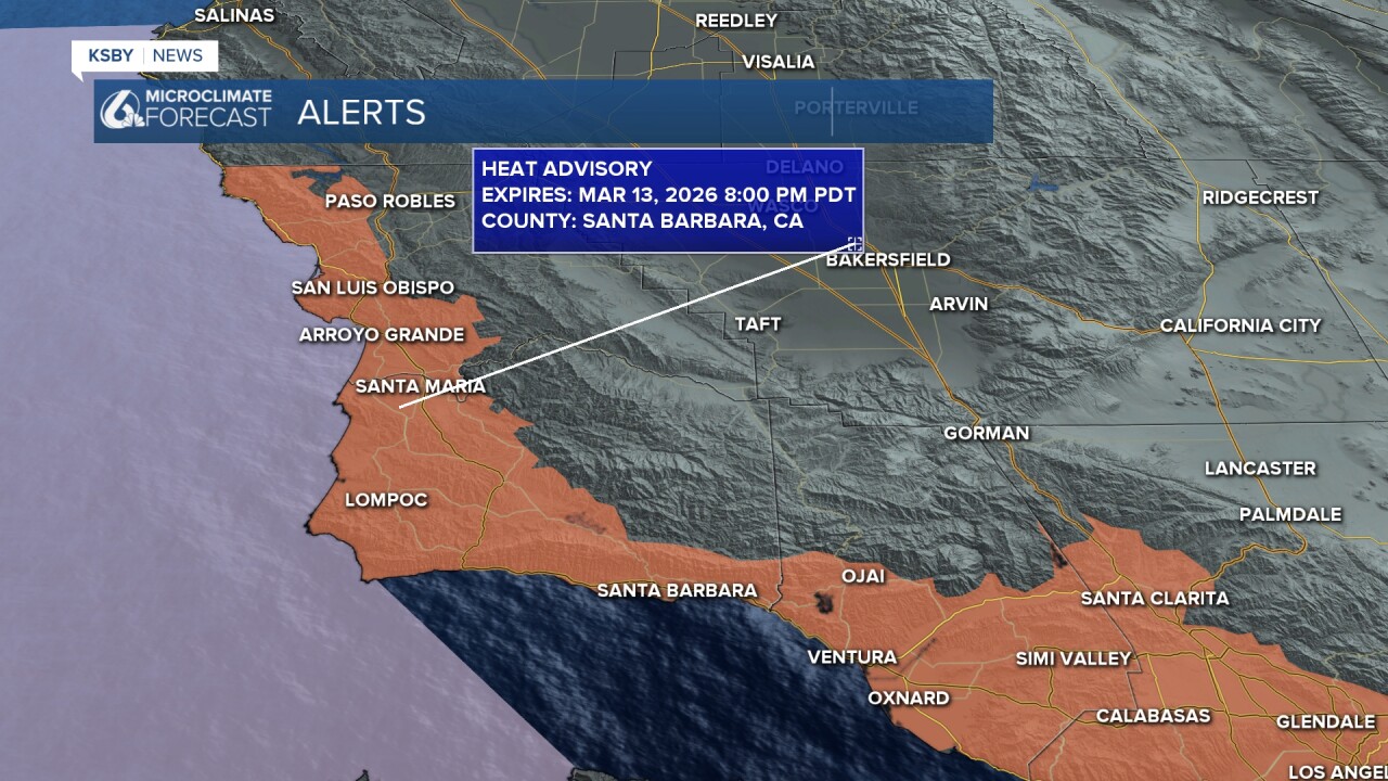
The heat will increase once again for Thursday when we have our first chance of 90-degree temps. In advance of this, there is a heat advisory in place for much of the region through Friday night (I expect that to be extended significantly). Please remember to stay hydrated and limit exertion at the hottest times of the day, and as always, NEVER leave people or pets in cars.
With highs 30 degrees above normal for this time of the year, we will see the first 90-degree temps (some portions of the farther SW could reach 100) nearly two months earlier than normal for our region.
Here is what that looks like on the 7 day forecast.
This pattern is not looking to break anytime soon. Even into the 8-14 day forecast, we are looking at continued heat and very dry weather.
I will be keeping a very close eye on this heat wave as it continues and will bring updates as they become available.
Have a great rest of your day, Central Coast!
-Vivian
