
Happy Wednesday evening, Central Coast!
It was another warm and wonderful day across the region with highs climbing alongside sunshine and some breezy winds. Into the evening more mild weather is in store and the marine layer may even make an appearance.
Early Thursday morning a few coastal communities will contend with fog but that will clear out very fast and skies will become clear once again by mid morning. At that point temps will start to rise.

Interior valleys will reach into the mid 90s, that is a slight decrease from the past few days but not too substantially. Valleys will climb to the upper 70s with beaches in the low 70s. The only exception to that is the Santa Ynez Valley where some spots will reach the upper 80s.

Friday is when the real changes will take shape. The high pressure that has dominated the forecast will press past us and more "normal" conditions will set up.
I don't love the word normal in weather but in this case I am taking about daily temperature averages for this time of the year ties with the typical West-East wind flow.
Along with the cooler weather some more marine layer is expected and some mid day clouds as well.
These very typical September conditions will be in place through the weekend.
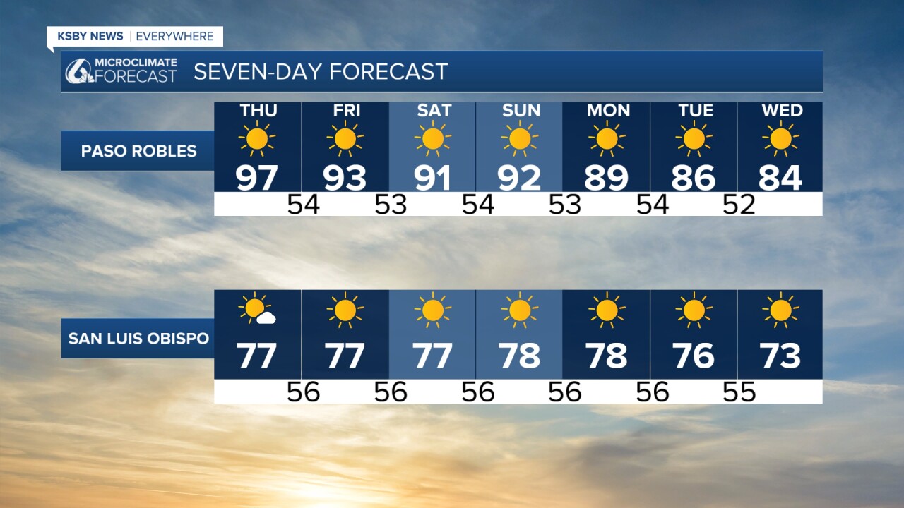

Early next week remnants of Hurricane Lorena will reach SoCal. Most will see just a bit more cloud cover and maybe a band of rain in the Palm Desert but for us a more mild pattern is on the way. Interiors will cool down into the 80s with some clouds. Beaches will be in the 60s with coastal valleys in the 70s through next week.

Have a wonderful evening a great rest of the week!
-Vivian
