



Good morning, Central Coast!
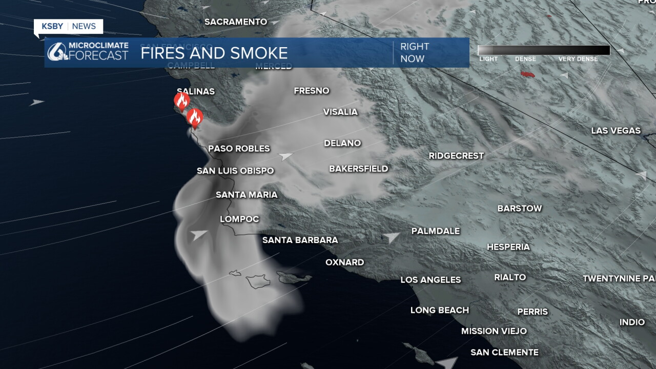
As we kick off our Wednesday morning, there is some smoke lingering in our communities from the Timber and Plaskett Fires. This isn't as thick as previous mornings but may be noticeable to sensitive individuals.
The good news is that the smoke will be pushed inland over the afternoon hours. Rinse and repeat that tomorrow with morning smoke.
Other than the smoke, there is some morning fog that will clear out quickly.
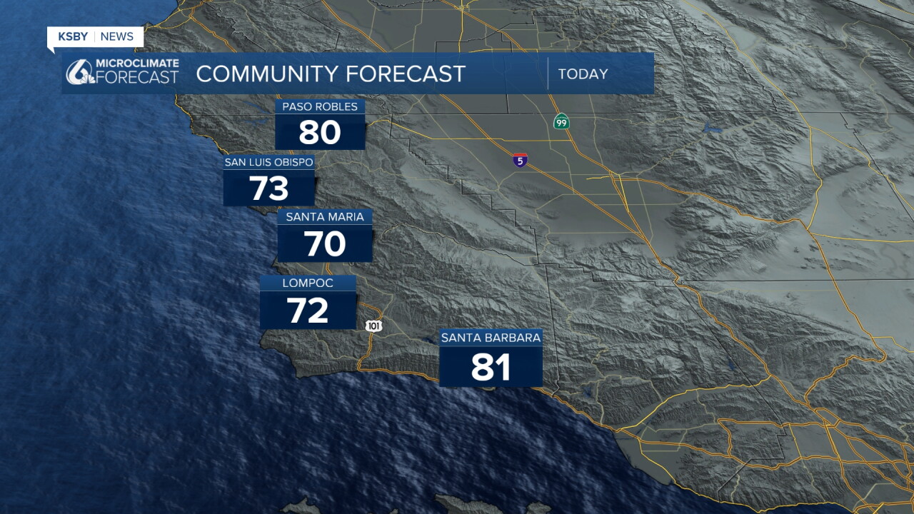
High temps will stay well below normal for this time of the year with most spots in the 70s.
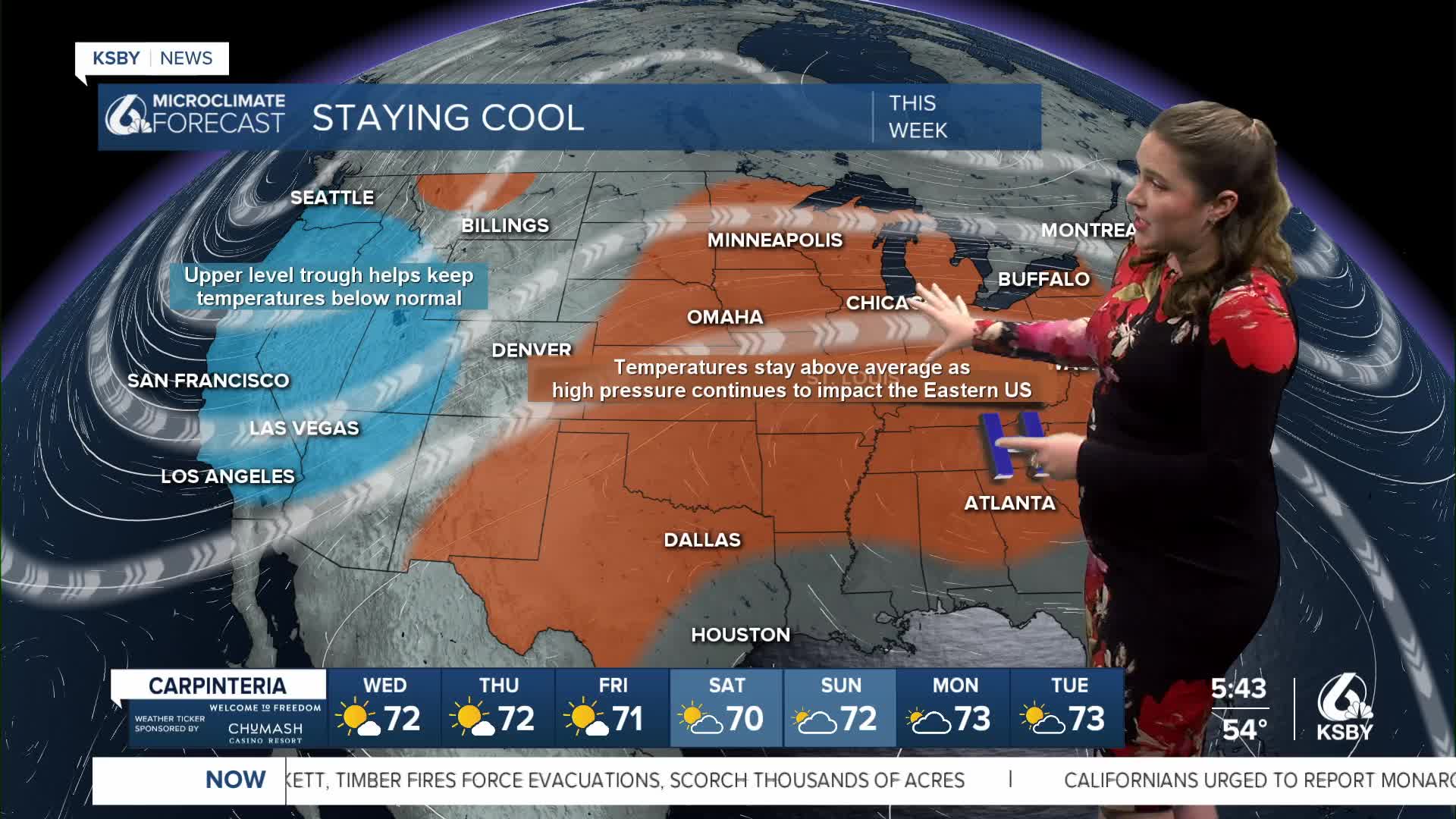
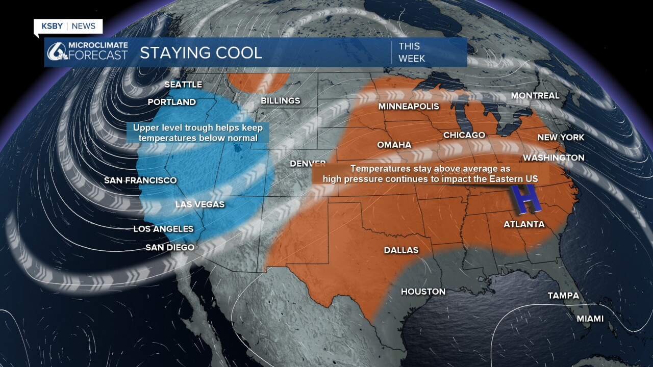
Those well-below-normal temperatures are thanks to a large trough of low pressure sitting across the West Coast, drawing in marine air from the North Pacific to our communities. That will stay in place through the rest of the week with comfortable, although unseasonal, afternoon temperatures.
Staying with the overall pattern, we have very active conditions in the Pacific. Three named storms are currently spinning in the Eastern Pacific Basin. Lowell (Cat. 4), Karina (Cat. 4), and Marie are creating large-scale swells in the region. For Labor Day weekend, we will begin to see impacts of those waves.
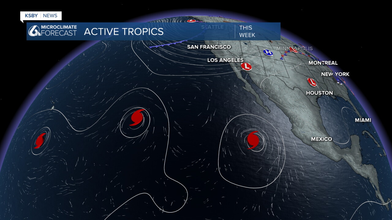
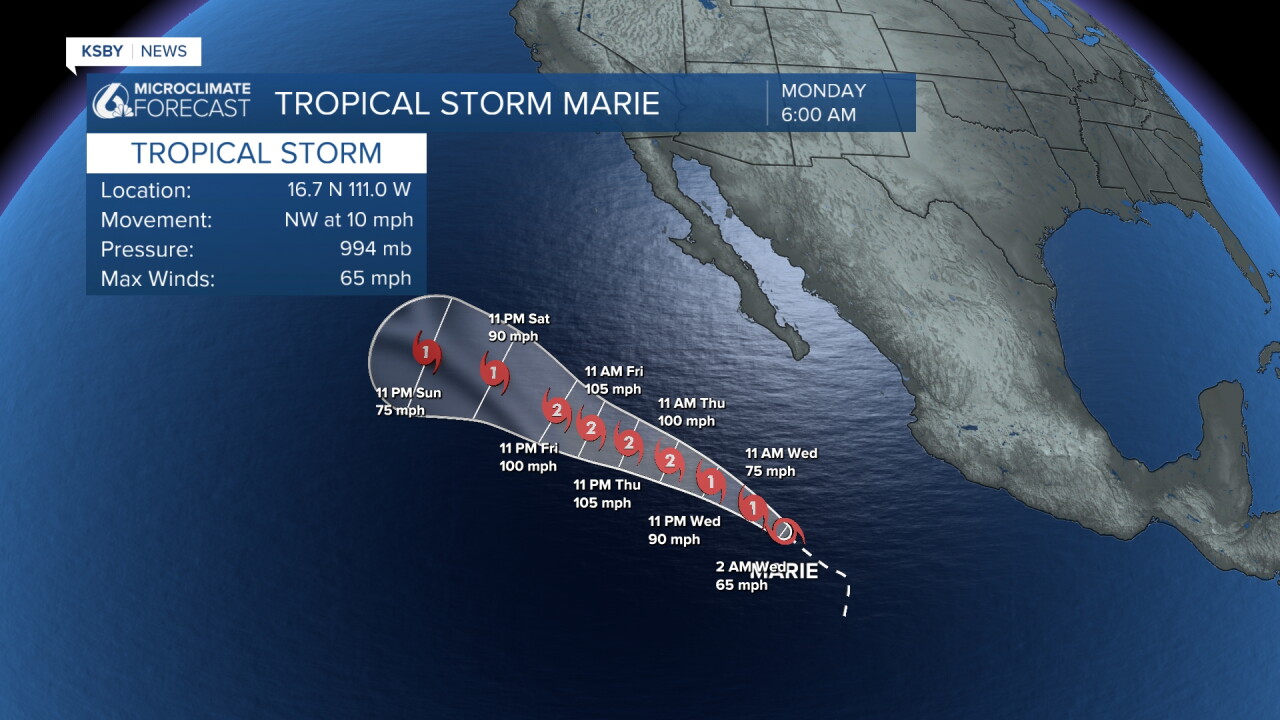
Marie is the storm making the most headlines here on the West Coast. The path is staying a long way offshore, but there is the chance for some showers associated with the system. Those are unlikely but are for Sunday night when far outer bands of the system sweep across the region. I will keep a close eye on that chance through the next few days.
After the trough moves east, we will see a small warming trend into next week.
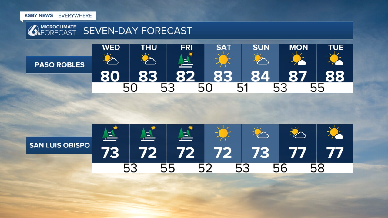
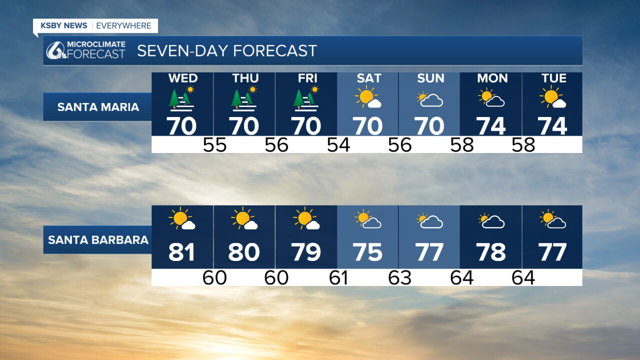
Here is what all of that looks like on your 7-day forecast!
Have a great day, Central Coast!
-Vivian
