

Happy Wednesday, Central Coast!
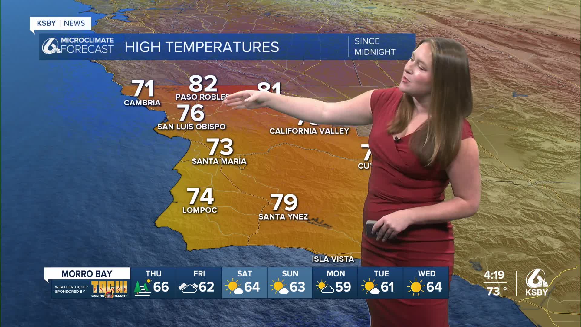
Tuesday shaped up to be a beautiful one, sunny skies, mild temps, and some gusty winds continued today across the region. Temps climbed a couple of degrees above yesterday's highs but nothing too spectacular. Here is a look at our high temps for Wednesday.

Tonight temps will cool, and for the most part, winds will calm. The only exception is the Gaviota Coastline, where another below advisory level sundowner wind event is on the way.
Thursday will look almost identical to Wednesday's conditions. Highs will be comfortable, albeit slightly below normal for this time of the year. Winds are still expected to be a bit breezy with the sunshine sticking around.

Friday will bring a little change into the region. We have seen a series of weak troughs pushing through the region, keeping us on the cooler side with the night/morning low clouds. On Friday, a slightly stronger front will push through and bring more onshore winds, cooler temps, and a very small chance for a passing shower in northern SLO County. This is a classic non-zero chance where I am not going to change the icon in the forecast (because this is not the prevailing weather for Friday), but still want to make sure you are aware.
Saturday, the tides will change again as the winds will flip around and push offshore. That will mean clear skies and warmer weather. The shift will also mean it will be the breeziest day of the forecast.
Here is what all of that looks like on our 7-day forecast.


Have a wonderful evening, Central Coast!
-Vivian
