

Happy Wednesday, Central Coast!
The first half of the week was a bit of a mixed bag with a temperature roller coaster, some light rain, and all of that fog. As we push towards the weekend, the overall setup is evening out. Better weather is on the way.
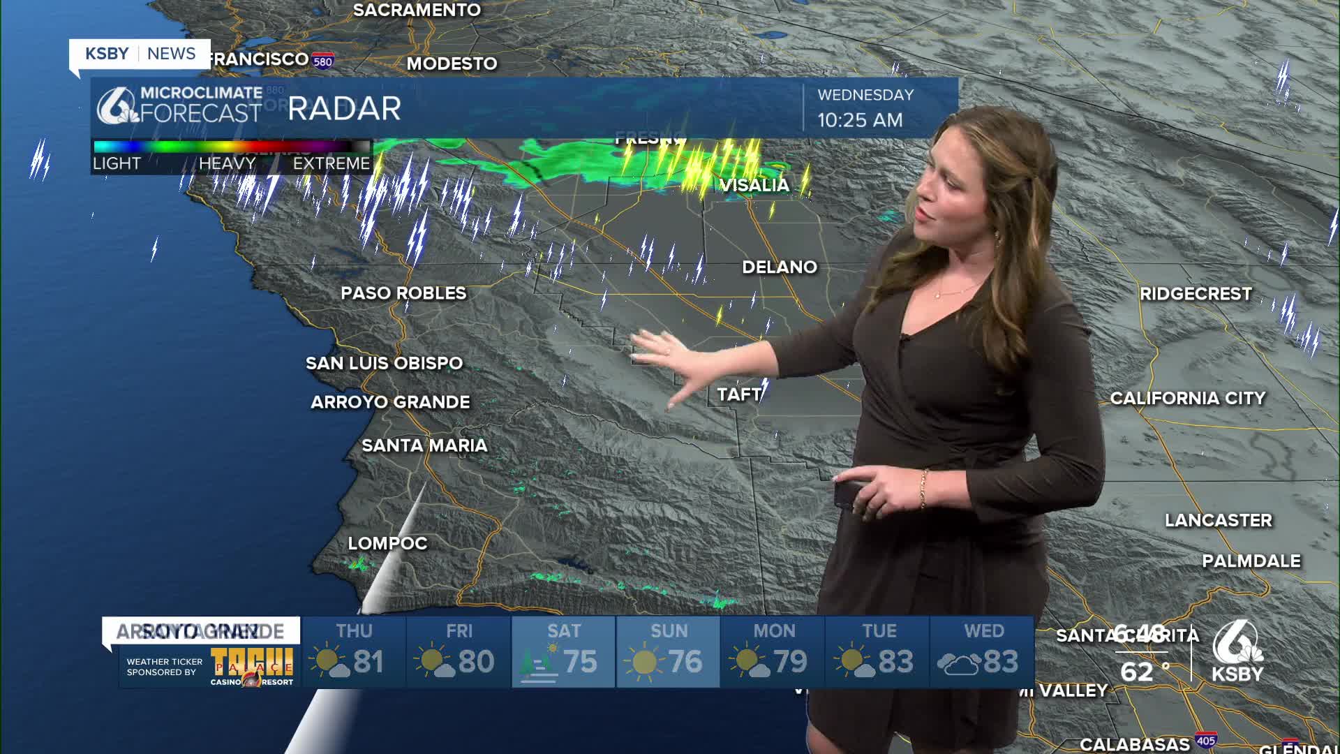
A weak upper low pushed through the region yesterday into today, which has brought slightly cooler conditions to the region. Most of that difference came in the form of fog in the interior valleys this morning. The drop in temperatures for the interiors also indicates the lingering instability in the upper atmosphere. For us, that means a lingering chance for an isolated thunderstorm for the Los Padres National Forrest and into northern Ventura County. If anything, this will be quick and will not impact us much.
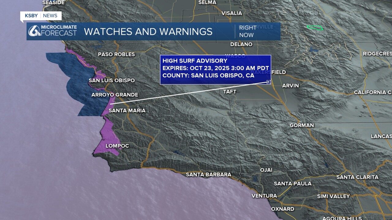
There is a lingering high surf advisory in place for the western beaches into early Thursday morning. Localized sets up to 10 ft are still possible with rip currents reported as well.
This evening, a ridge of high pressure will move in and bring a return to more stable weather. Thursday and Friday will bring warmer temps and more seasonal weather along the beaches. Here is a look at the high temperatures for Thursday.

Saturday, a slight cooldown is expected. No worries with this, though, morning fog by the beaches and afternoon sunshine with temps just a few degrees below normal are expected.
That slight cooldown is driven by a quick-moving low that will bring gusty northerly winds to the region Sunday into Monday.
With those gusts, we will usher in another slight warm-up that will last through much of next week.

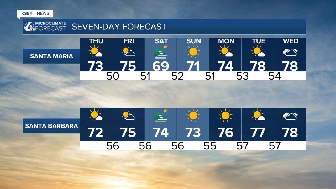
This oscillation between cool and warm temps is likely to continue into November.
Have a wonderful Thursday, Central Coast!
-Vivian
