



Good morning, Central Coast!
Memorial day brought beautiful sunny skies and warm weather as the region commemorated Memorial Day. Now as we kick off a shortened work week a big change is the conditions is queued up.
A cold front has moved south through the region and will cool us down and add winds, waves, and rain.
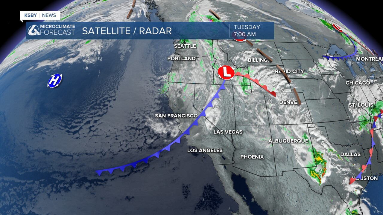
The first thing you may notice is cloud cover. Embed int hose clouds is a few small chances for rain. These will be very minimal, but I would not be surprised to need windshield wipers over the next few days.
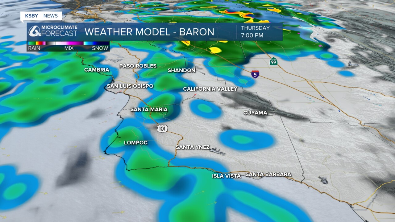
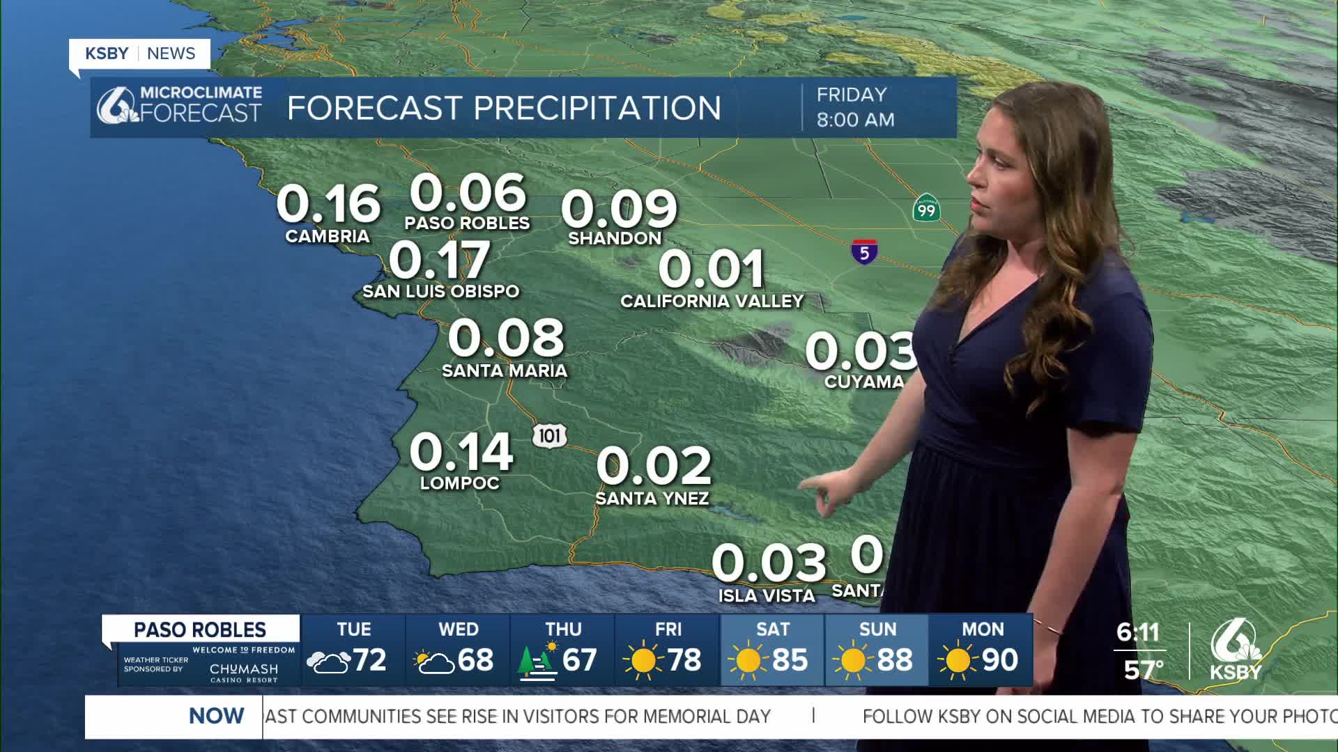
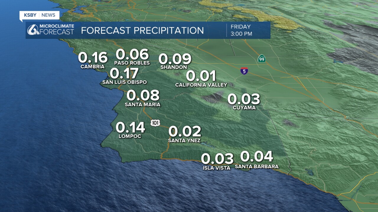
All the showers will be very light and will not amount to much. From Tuesday through Thursday, totals will stay below two-tenths of an inch.
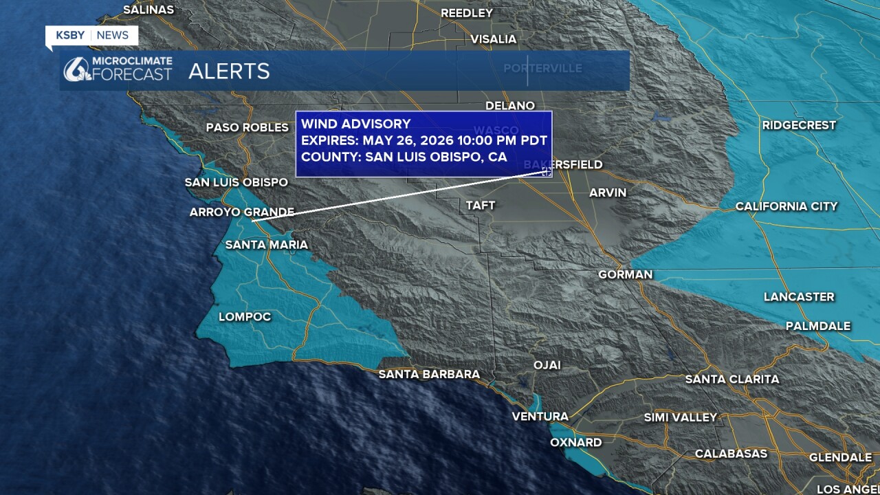
With the clouds and showers will come gusty winds. Up to 45 mph wind gusts are possible, this has prompted a high wind advisory through this evening.
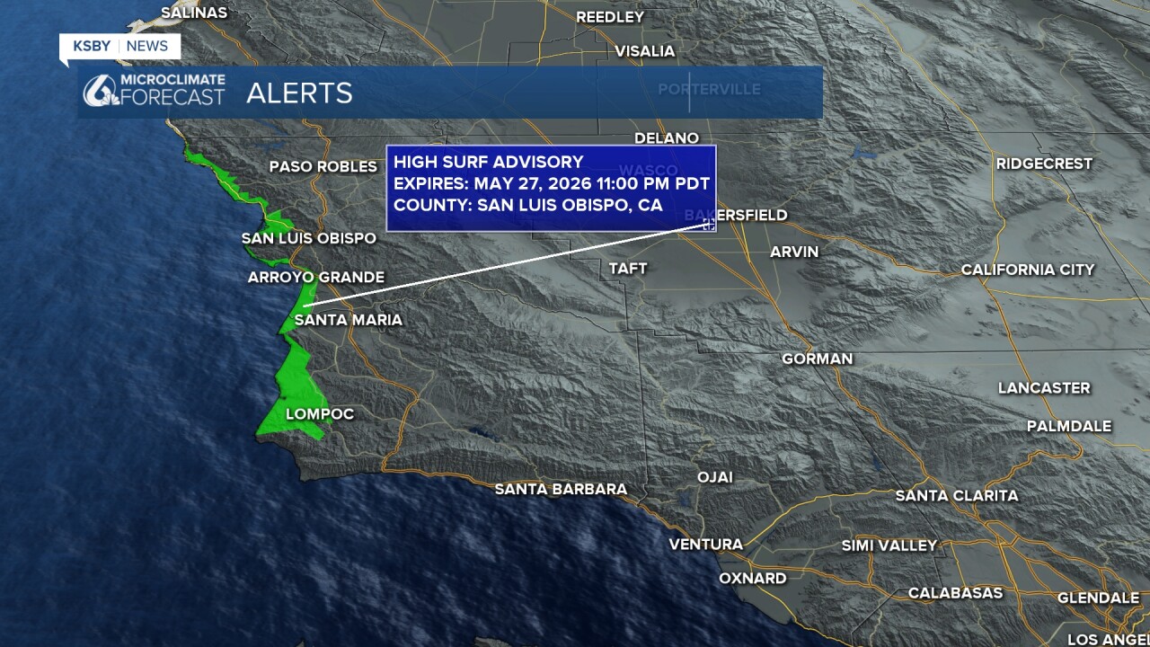
Where there is winds, there are typically waves. Localized sets 8-12 ft are expected for our western beaches with rip current risk as well. There is a high surf advisory because of this in place through Wednesday night.
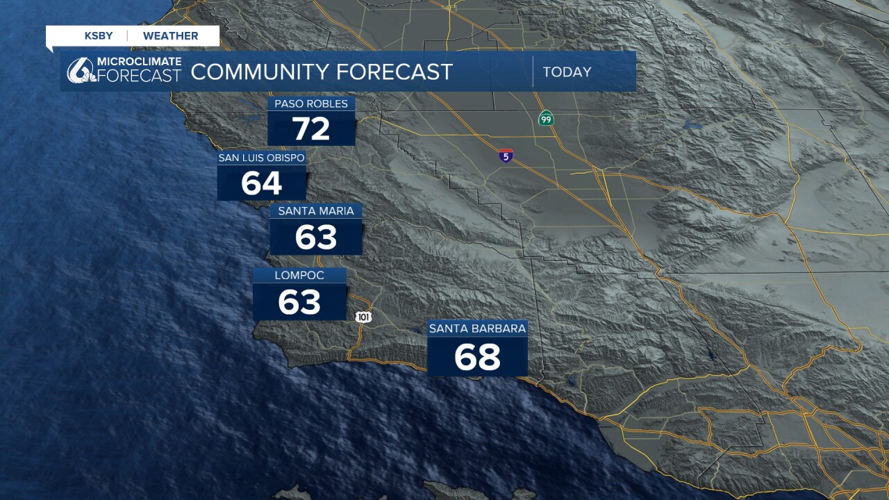
Thanks to the cold front (as the name suggests) temps have taken a tumble. Highs in the low 60s for most spots today with some lingering 70s are expected.
The cool, cloudy, and unsettled weather will start to shift on Friday as a high-pressure system moves in. That will quickly return temps to seasonal normals and add in more sunshine. By early next week we will see temperatures above normal once again.
Here is what that all looks like on the 7-day forecast!

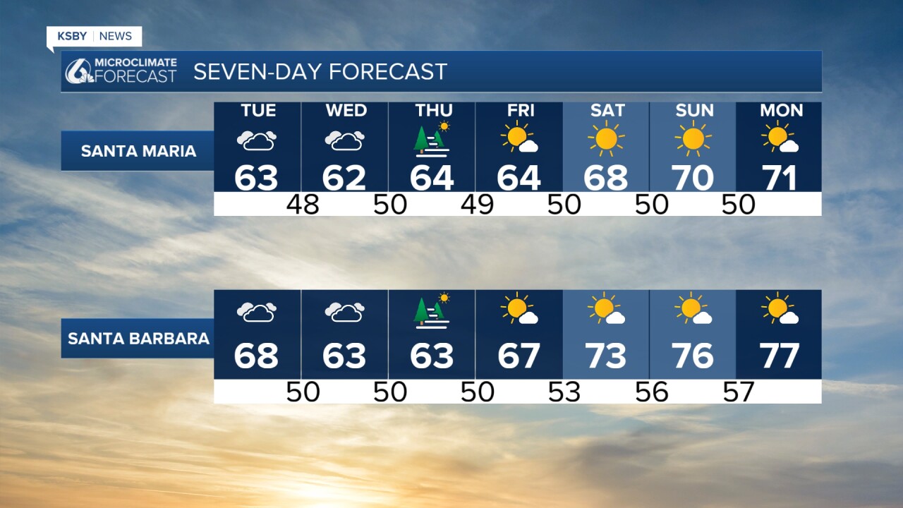
Into early June temps will stay hot for the Central Coast, it will really feel like summer!
Have a wonderful day, Central Coast!
-Vivian
