

Thursday brought us the hottest temps of the week, paired with winds and low humidity, which have led to rapid growth of the Gifford Fire. Plus, hot, windy, and dry weather has been the story all around. Before I dive into all of that, here are a few links to keep on hand.
The Gifford Fire CalFire Incident Page
Air Quality Information San Luis Obispo County
Air Quality Information Santa Barbara County
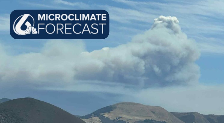
Plumes of smoke could be seen far and wide across the region emanating from the Gifford Fire. These are pyrocumulus clouds and are fueled by the hot air within fires, pushing up to cloud level. That rising air creates strong local winds at fire sites and erratic fire behavior. Here is an image I captured of the smoke plumes.

Here is a look at the current map of the Gifford Fire as of 5:50 p.m. At that hour it stood at 98,396 acres and 15% containment.

As far as the fire weather is concerned, relative humidities in the teens are once again expected Friday. Overnight, cooler, dense marine air will increase humidity slightly but not much.
Winds will calm a little overnight as well. That being said, the calmer winds are not going to last long. Overnight and into early Friday, gusts up to 20 mph are expected; into the afternoon, those gusts will be upwards of 30 mph.
Thursday brought high temps into the triple digits for interiors, 70s for most coasts, and a few 60s by the beach. Winds in the mid-afternoon climbed well into the 30+mph threshold. Much of that was fueled by a large-scale high-pressure system to our southeast.

Friday morning will start with fog along the beaches and some clouds extending into the coastal valleys as well. The dense fog may cause some visibility issues on roadways. Because of this a Dense Fog Advisory has been issued for our western beaches and coastal valleys once again. The clouds will be similar in extent and timing to Thursday morning, with the alert expiring at 9 a.m.

The clouds will clear quickly, and highs will climb once again but will fall short of the highs from Thursday. Mid-upper 90s for the interiors, 80s for coastal valleys, and 60s again at the beaches. Here is a look at those temps.

Here are some more of those temps.
Into Friday, that high pressure will push east enough to allow a bit more marine air into the region. Temps will dip by a few degrees for interiors and a bit more substantially at the coasts. That cooldown will only last a few days, though. By Sunday, another warm-up will have arrived.
That one is fueled by a large-scale high-pressure ridge making its way in from the North Pacific. Highs all across the West Coast will face the warmth for much of next week.


Be sure to stay informed and stay safe Central Coast!
-Vivian
