

Tuesday shaped up to be another hot one across the region, with high temps soaring into triple digits in the interiors while coasts stayed more moderate. Winds will continue to be a concern through the week, but as a low-pressure trough arrives, cooler weather is on the way!
Before I dive into the forecast, I want to take a moment to update information on the Gifford Fire.
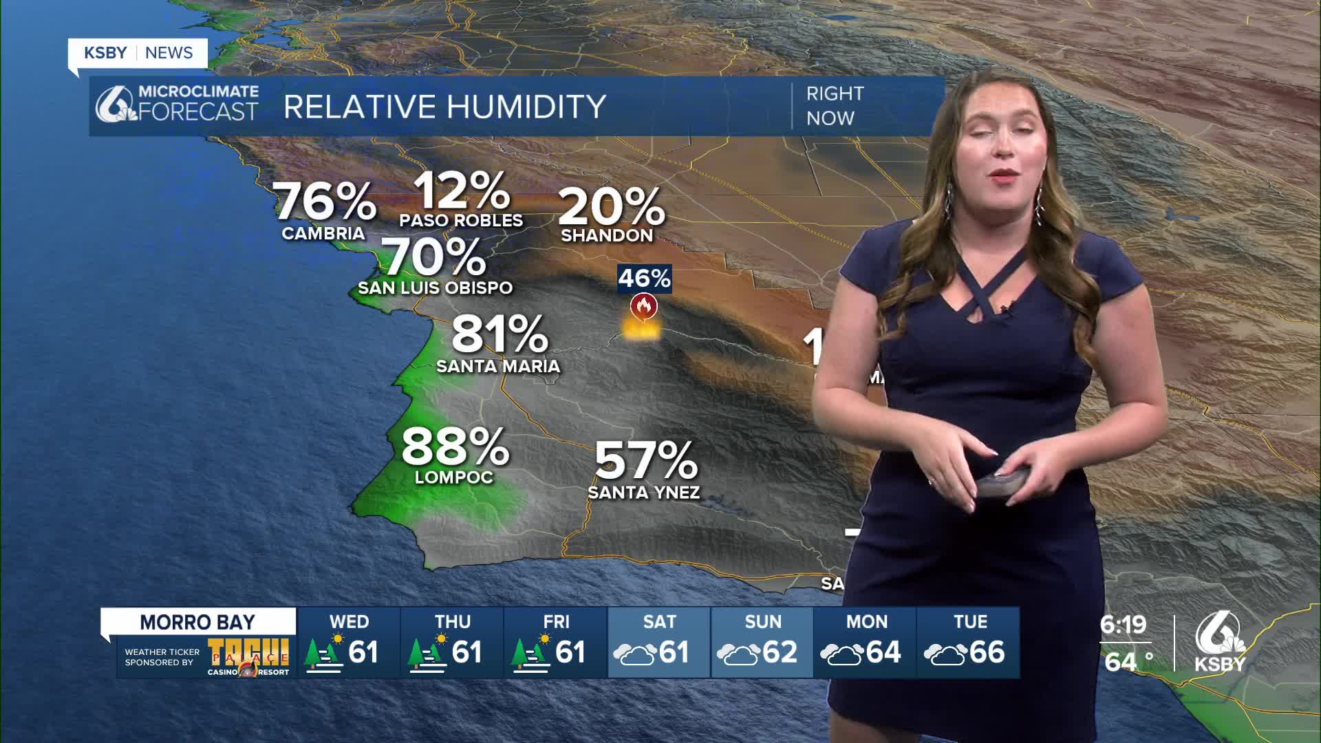
As of Tuesday afternoon, the Gifford Fire has burned 125,648 acres and is sitting at 33% containment. For the latest updates on the Gifford Fire, click here.
Here are a couple of links on Air Quality Information for San Luis Obispo and Santa Barbara counties:
Air Quality Information San Luis Obispo County
Air Quality Information Santa Barbara County
Residents in San Luis Obispo County can check whether their property is included in evacuations by visiting this link. For information on evacuation orders and warnings in Santa Barbara County, click here.
Highway 166 also remains closed between Highway 101 and New Cuyama with no estimated time for reopening.
Let's dive back into the forecast!
This evening, we are still dealing with warm temps (triple digits for interiors), which means we still have a lingering heat advisory for the interiors of Santa Barbara County. That will expire at 9 p.m.

High temps on Wednesday will cool by a couple of degrees; that being said, it is still going to be a warm one. Paso Robles will get into the upper 90s once again. Coastal valleys will be in the 70s while coasts will be in the upper 60s.

Wednesday will also feature continued winds up to 25 mph for most communities, and some gusts up to 40mph along the south coast are expected amid another sundowner wind event.
The low pressure will help to bring more marine air to our communities, but the shift will be slow at first. Thursday will start the day with more cloud cover extending into the interiors and set the stage for temps to be a little cooler as well. The weekend will feature low 90s for the interiors, mid-70s in San Luis Obispo, Santa Maria, and Santa Barbara. Western beaches will be in the upper 60s.
That cooler weather will be a welcome change for firefighters battling the Gifford Fire. That being said, winds will continue, and without any rain on the way, fire danger will continue.


Have a great evening, Central Coast, and be sure to stay aware of the forecast changes surrounding the Gifford Fire!
-Vivian
