


Good morning, Central Coast!
As we kick off our Friday morning, it is more of the same. Morning cloud cover is giving way to afternoon sunshine with temps near normal for this time of the year.
Over the next few days, we will transition to a cooler pattern as a low-pressure system moves in; that isn't here yet, but it is the "next big thing."

Today (temperature wise) is nearly identical to yesterday. Here are the temps.

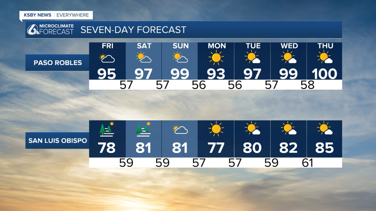
This weekend is more of the same with morning clouds and afternoon sunshine. Temps will warm slightly for the interiors with cooler weather by the beach.
Next week will start off with the coolest day of the forecast; that being said, highs will still be in the low 90s for the interior valleys. Beaches and coasts will be in the 70s.
Late next week, another warm-up will arrive and bring potential triple digits back to the region.
Here is what all of that looks like on a 7-day forecast!

One note before I go: here is a look at local lake levels across the region. The red number is the week-over-week change.

Have a wonderful day and a great weekend ahead!
-Vivian
