

Happy Thursday, Central Coast!
Today was a much sunnier day than Wednesday as a high-pressure system builds in. That ridge will build in and make for a VERY warm week ahead. That warming will get going tomorrow when temps will be in the 70s and 80s.

Before we look into the extended forecast, there are a few other concerns. Starting off with the gusty winds for this evening.
Widespread gusts up to 35 mph are expected tonight and some spots will get up to 45 mph winds. This is enough to prompt a high wind advisory through 11 a.m.

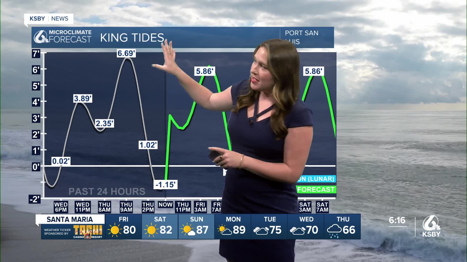
King tides and high surf is also a concern. Here is a look at those tides.

The combination of the high tides and surf up to 16ft in local sets has prompted a high surf advisory for the western beaches through Saturday night. There is also a beach hazard statement and coastal flooding advisory in place through Friday for our beaches.


Back to the temps now. The weekend will bring similar conditions, and mornings will be cloudy with some even making its way into the interior valleys. Still temps are expected to be mild.

Monday is expected to be the warmest day of the forecast, with highs soaring into the 90s for some spots. Those temps are 10-15 degrees above normal for this time of the year.
Later next week, we will reverse that warming and bring in cooler air and the chance for rain. This system is still a long way out, and models are still not agreeing on much, but the potential for a large storm is there. I will keep a close eye on that and bring you the latest information as it gets closer.


Have a great Friday and wonderful weekend, Central Coast!
-Vivian
