



Good morning, Central Coast!
As we kick off our Wednesday morning fog and cloud cover are once again the story is all about localities. If you are by the beach it is all about cloud cover and fog. Interior valleys have much more heat to face.
Starting off the day with the cloud cover and fog. It has a bit less of an extent than over the past few days but still you may face some fog as you head out the door.
Here is a look at temperatures for Wednesday across the region.
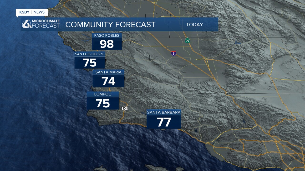
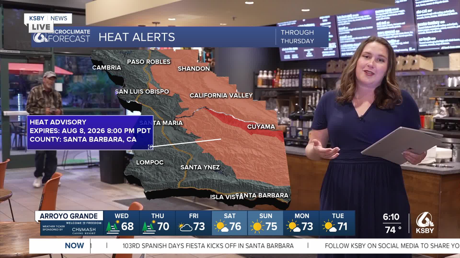
The big concern remains our interior communities. Heat warnings continue for the Cuyama Valley and northern mountains where temperatures will climb 5 to 10 degrees above normal. Paso Robles and Atascadero will see the century mark, while Cuyama, New Cuyama, and the Santa Ynez Valley backcountry could reach 109 degrees.
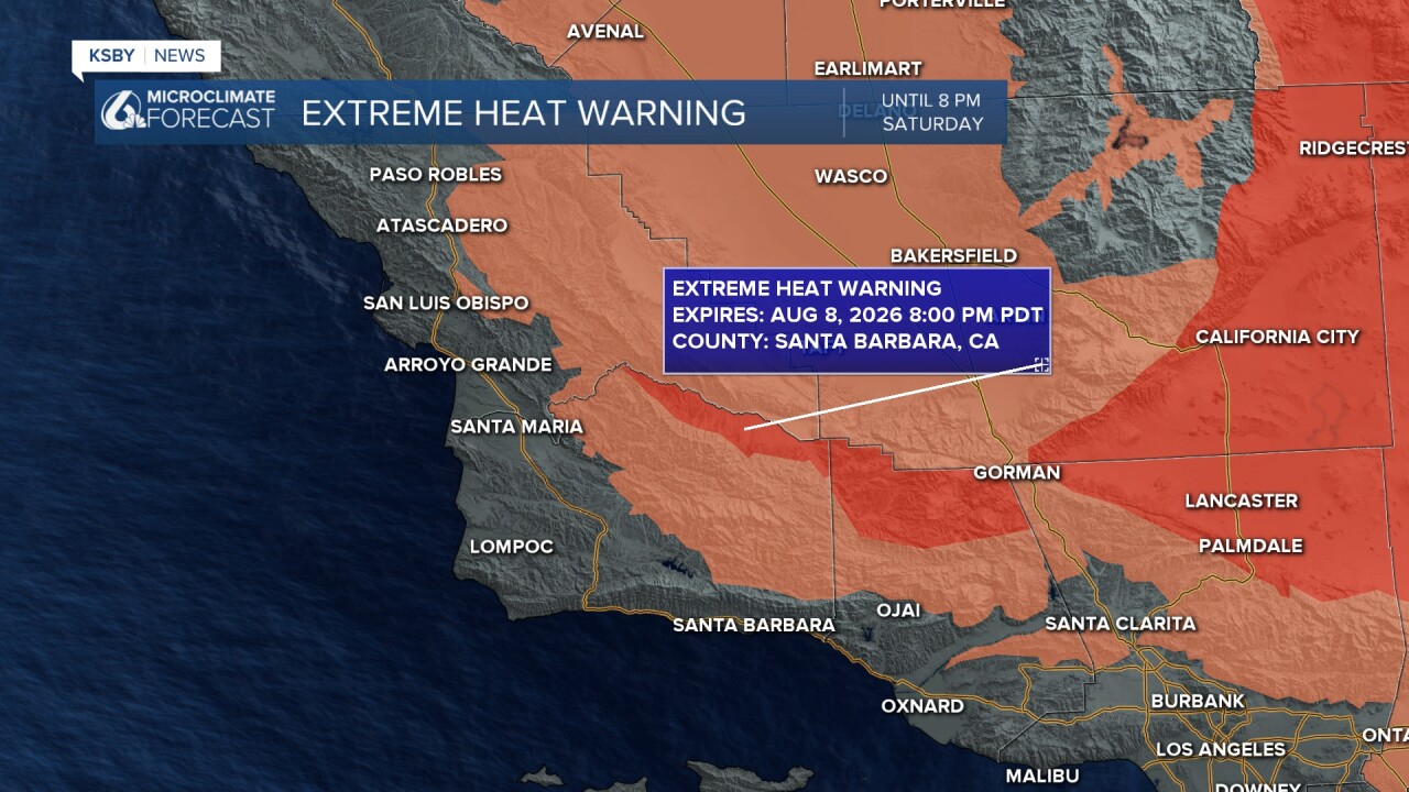
Looking ahead to the weekend, Friday brings a monsoon moisture surge that will make the heat feel even more oppressive. While temperatures may only rise a degree or two, that sticky humidity will keep overnight lows uncomfortably warm in places like Paso Robles, Buellton, and Solvang. Heat warnings have been extended through Saturday evening for our interior areas, and heat advisories will likely be issued for many valley locations.
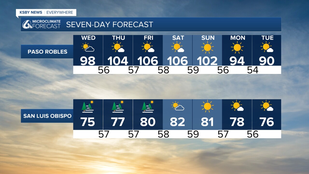
The good news comes Sunday and Monday when the upper-level pattern finally weakens. We're looking at 1-2 degrees of cooling Sunday, followed by another 2-4 degrees of relief on Monday as stronger onshore flow kicks in.
Here is what all of that looks like on the 7 day forecast!
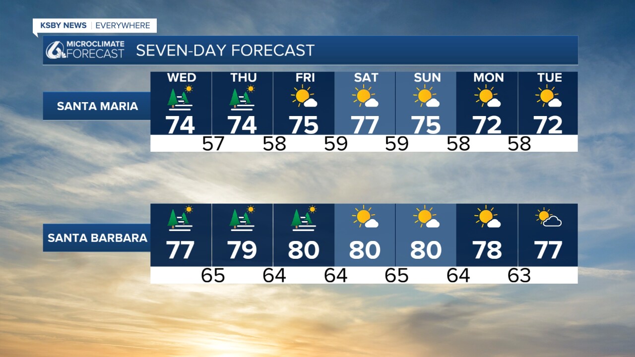
Stay cool and stay safe, Central Coast!
-Vivian
