

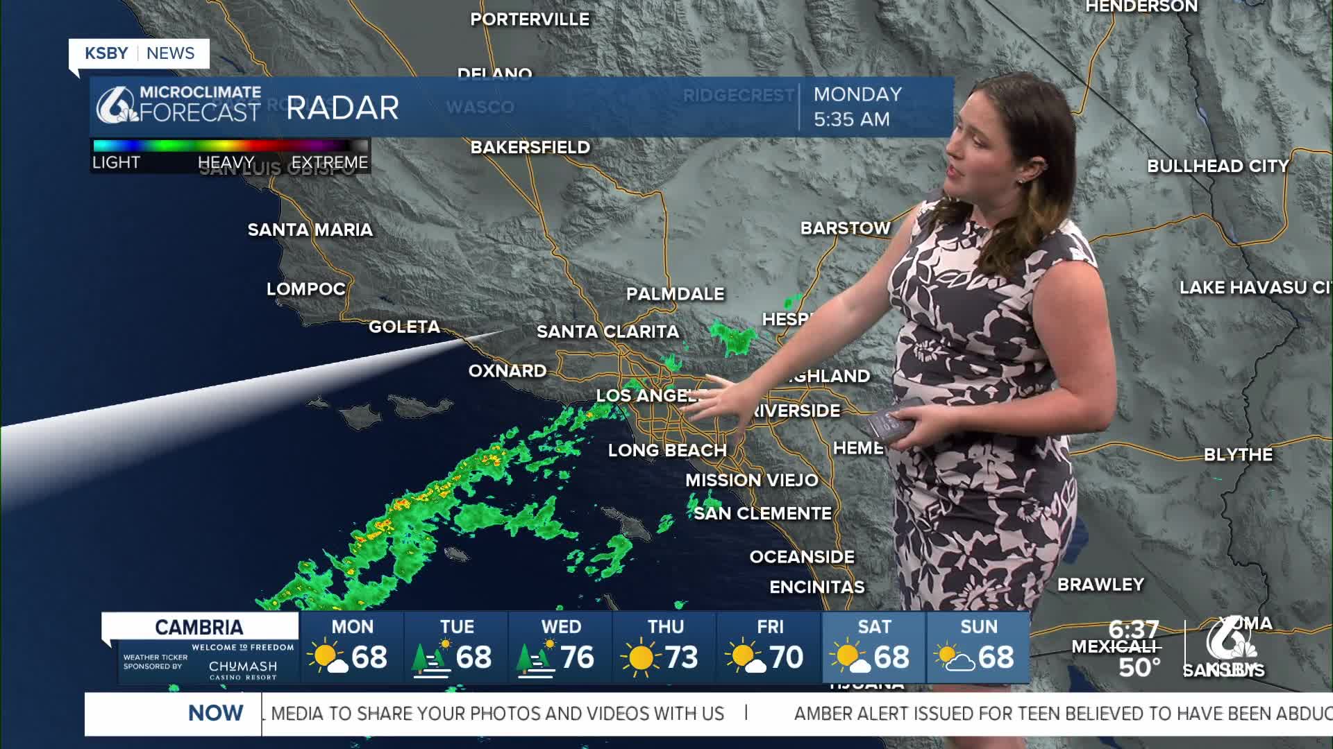


Good morning, Central Coast! As we kick off our Labor Day, sunny skies are in place as the marine layer is banished for a few more days.
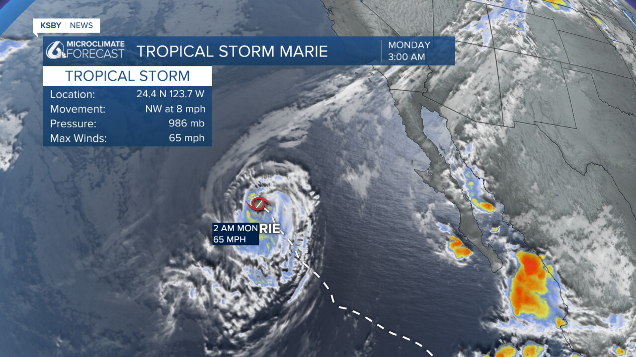
Our South Coast communities have a bit more cloud cover as a far-reaching band of moisture from Tropical Storm Marie pushes north. The core of that system is far from us, about 650 miles to our southeast. While it progresses north (still a long way from us) we can expect some more humidity and the smallest chance for showers. These showers are mainly for Tuesday morning and will amount to just hundredths of an inch of rain. That is a similar scale to the showers that pushed through Santa Barbara Sunday.
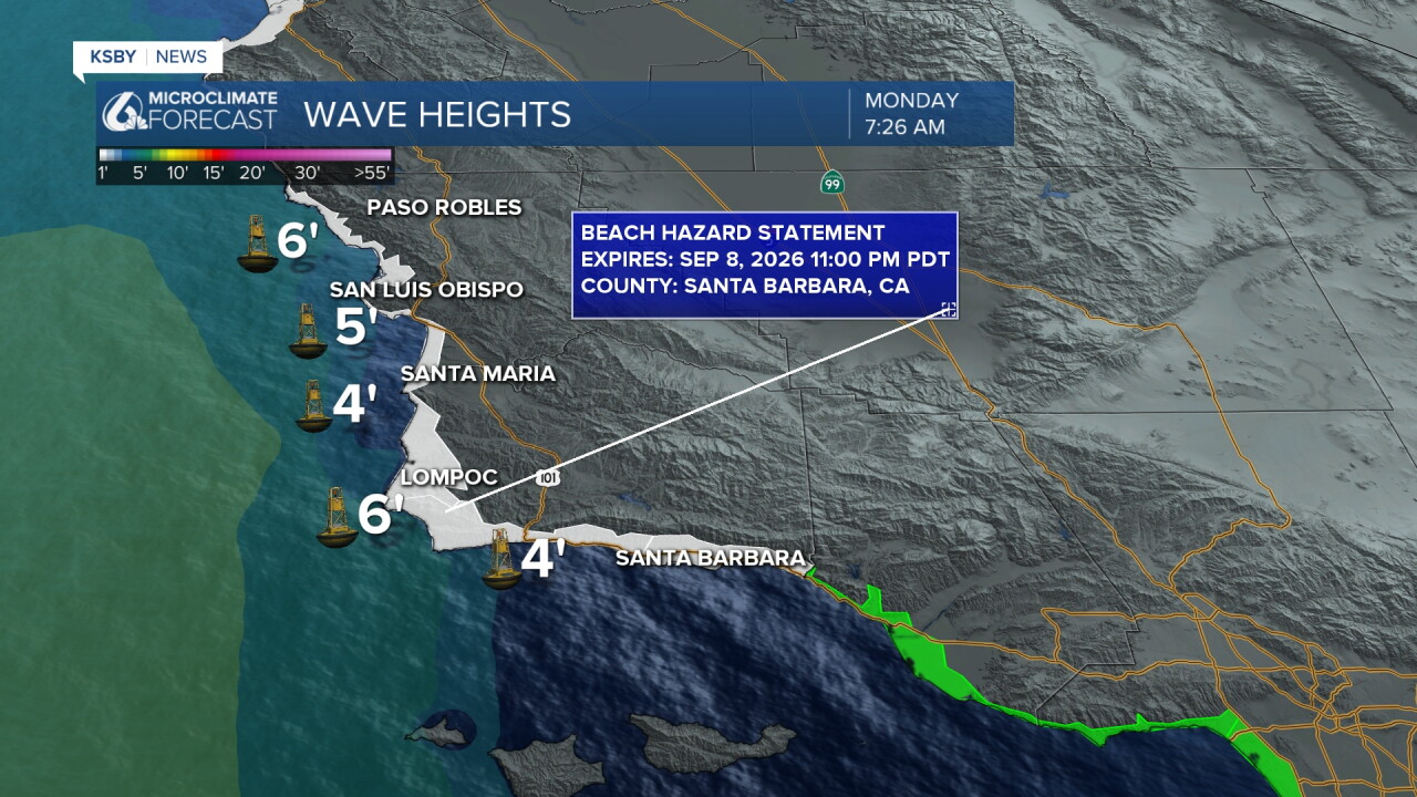
With the storm, there is a beach hazard statement in place through 11 p.m. Thursday evening. We can expect more waves up to 8 ft and rip current risk.
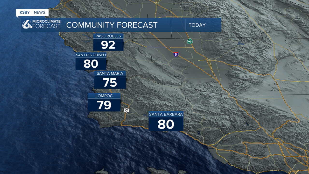
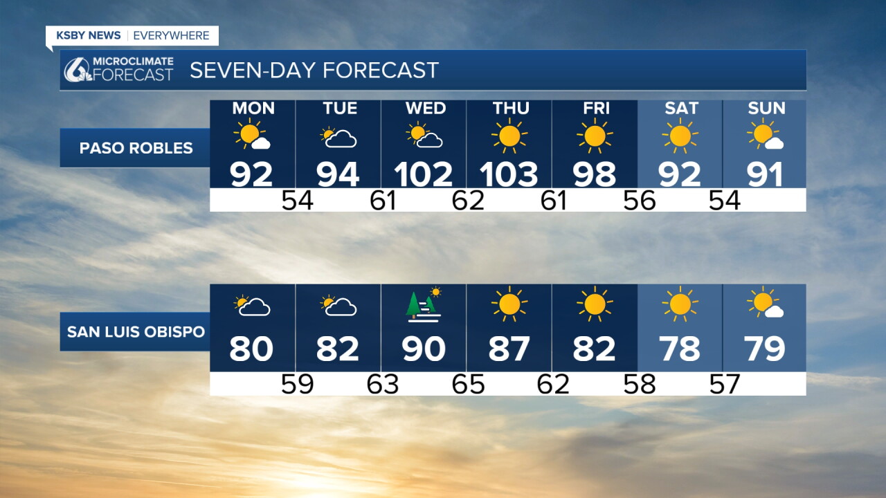
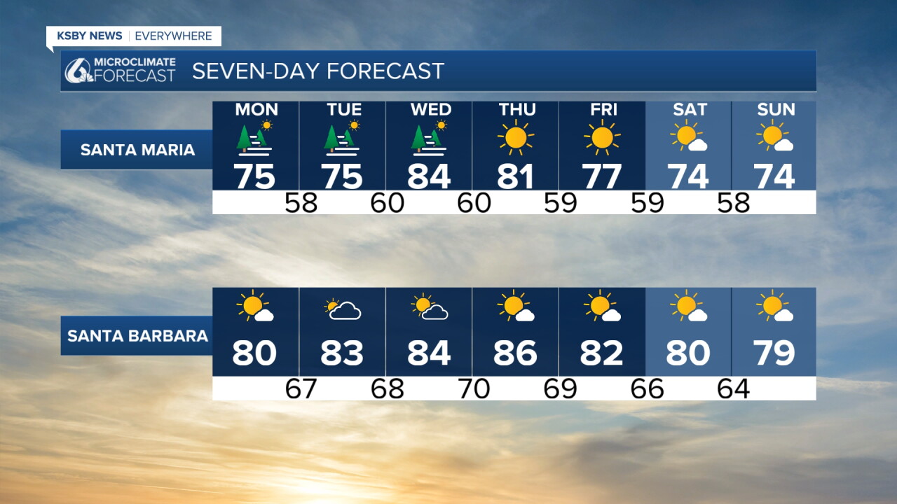
Here is a look at the temps we can expect for our Labor Day.
As the tropical influence pushes north, we will see a return to "normal" conditions Tuesday as a warming trend kicks in. This will bring us well above normal for this time of the year midweek, with triple digits in the interiors on the way.
Stay hydrated and limit outdoor activities during peak afternoon hours Wednesday and Thursday.
Have a wonderful Labor Day, Central Coast!
-Vivian
