



Good morning, Central Coast!
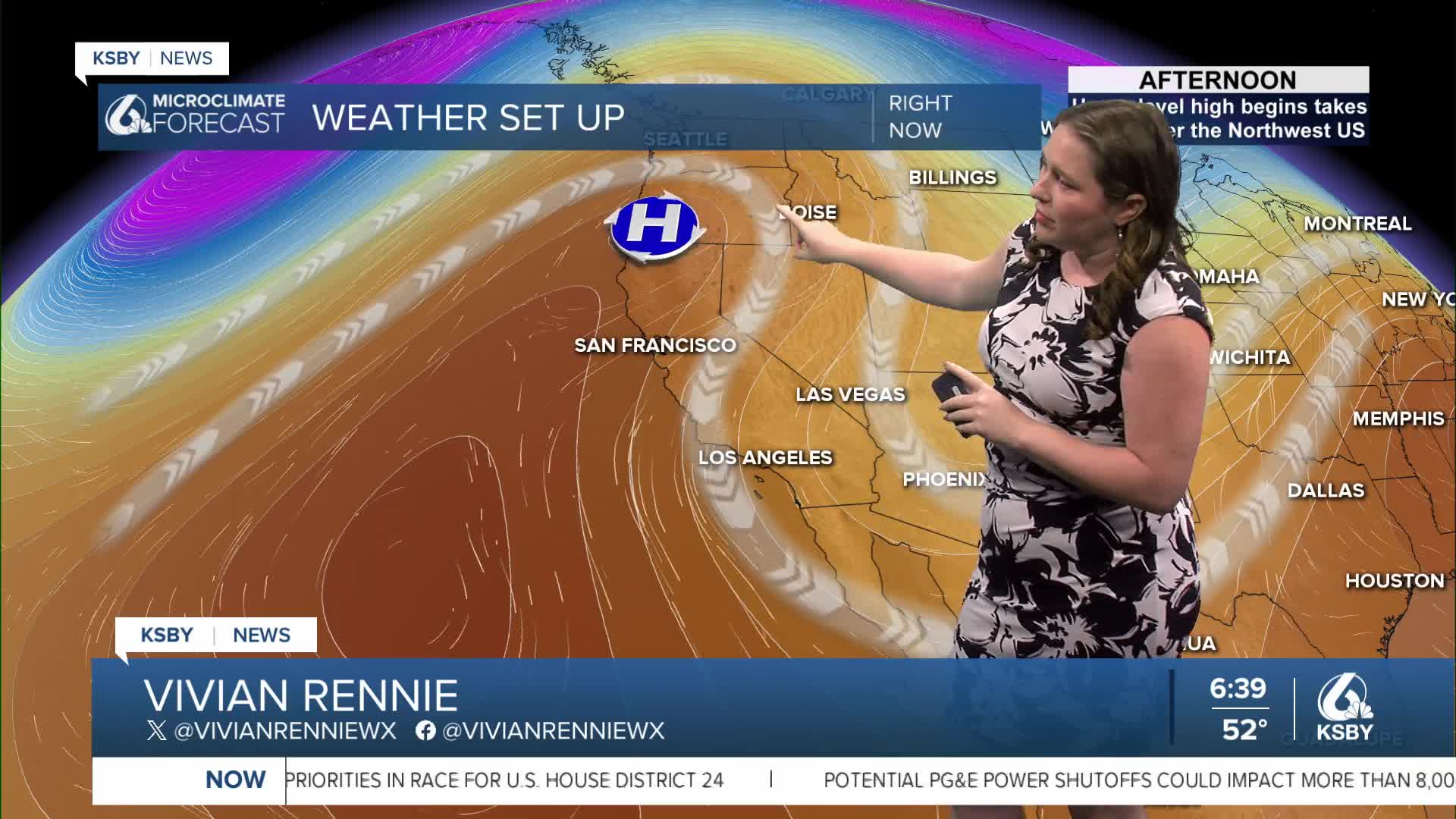
The calendar may say mid-October, but the temperatures are set to soar and feel like summer. This is thanks to the high-pressure system to our west, pushing north and drawing the low pressure over the Rockies back south. That will create a path of strong offshore winds in Southern California.
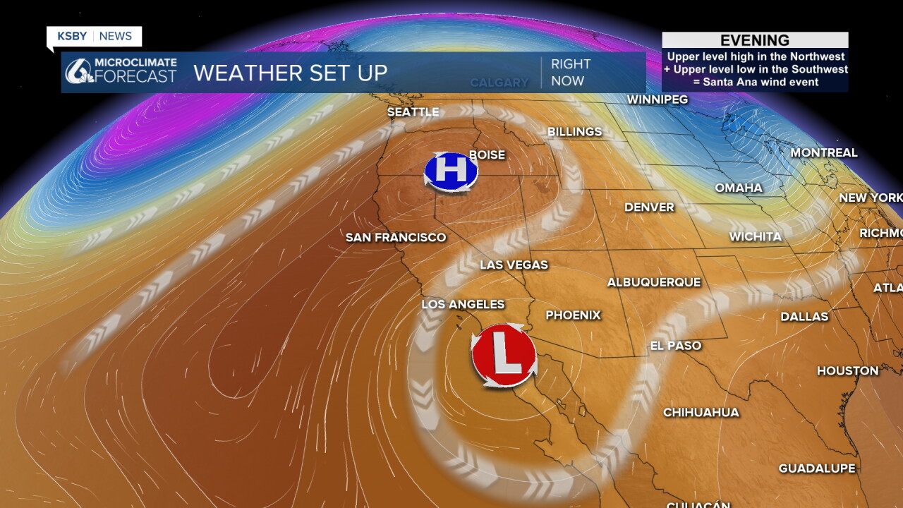
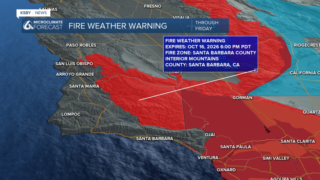
Strong Santa Ana winds and significant fire weather is expected to our south with the warm temperatures. A fire weather warning is in place for the interiors and highest elevations through Friday night.
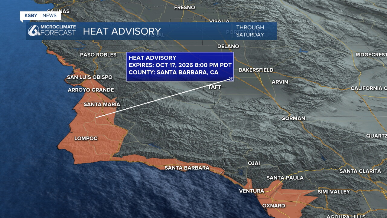
There is also a heat advisory in place for our coastal communities through Saturday night.
Here is what the temperatures will be this afternoon across the region.
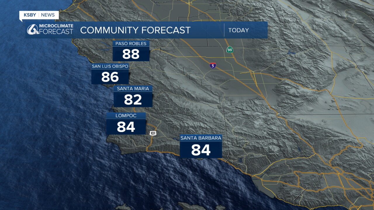
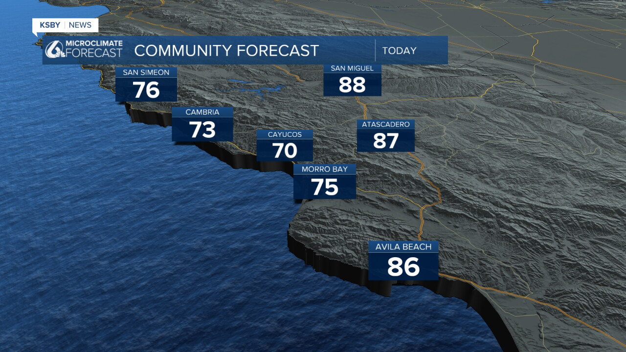
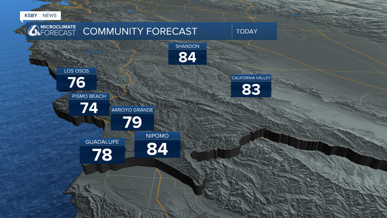
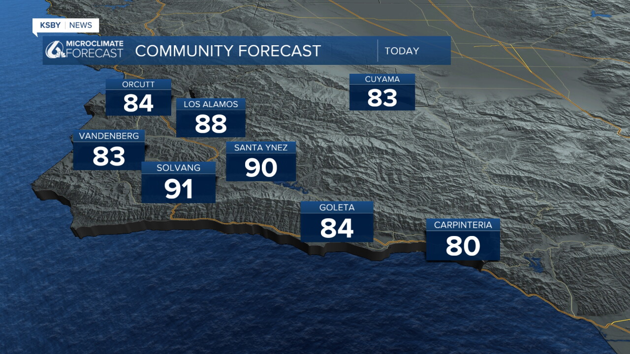
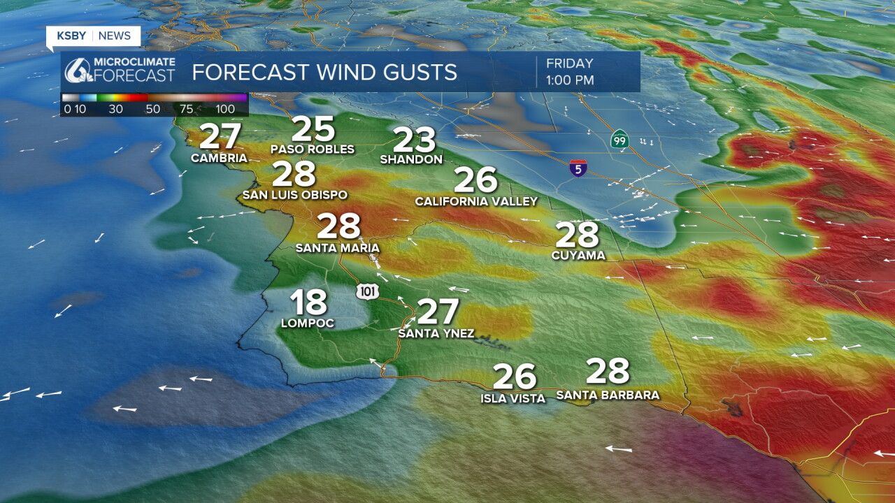
Friday winds will peak and bring with it the highest fire weather concern. Here is a look at the winds we can expect Friday around lunchtime.
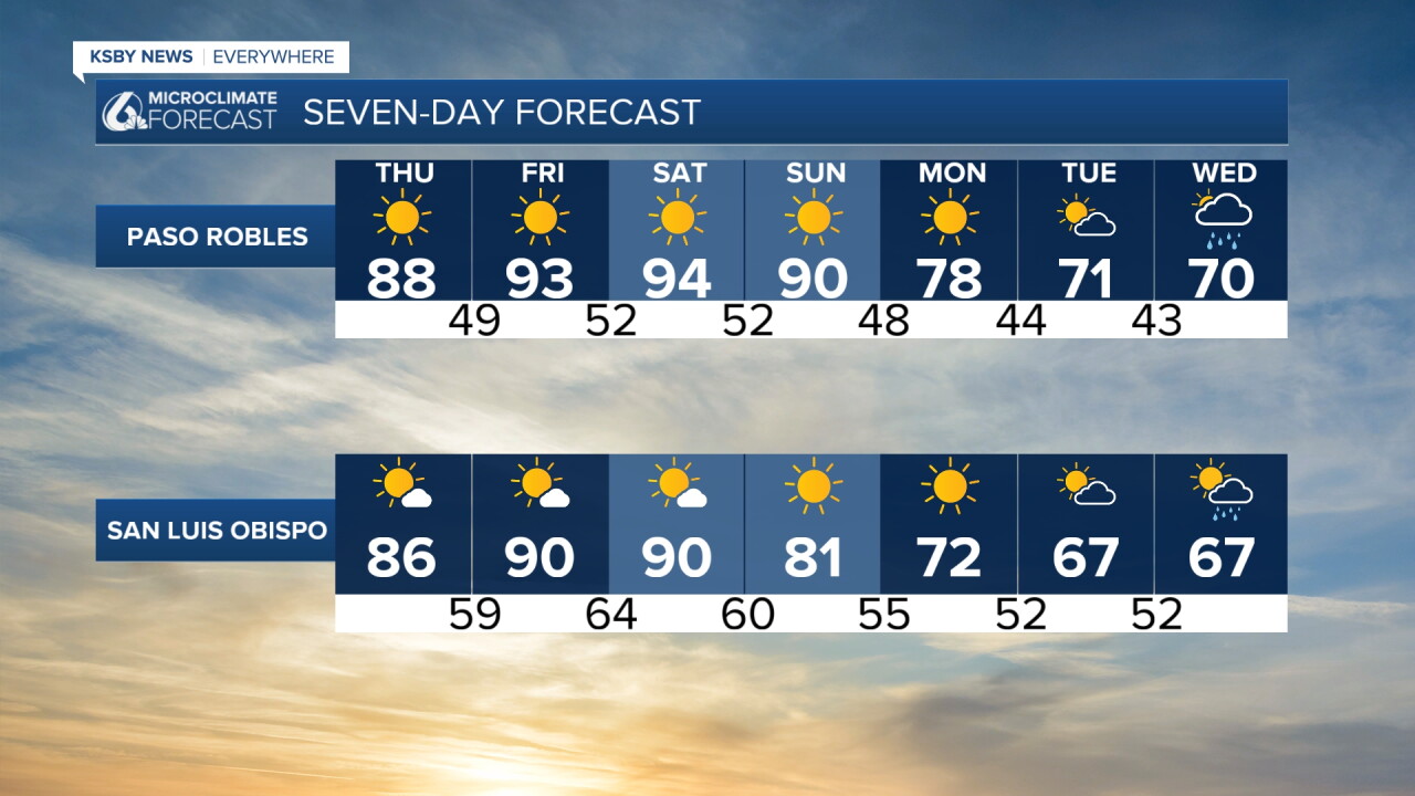
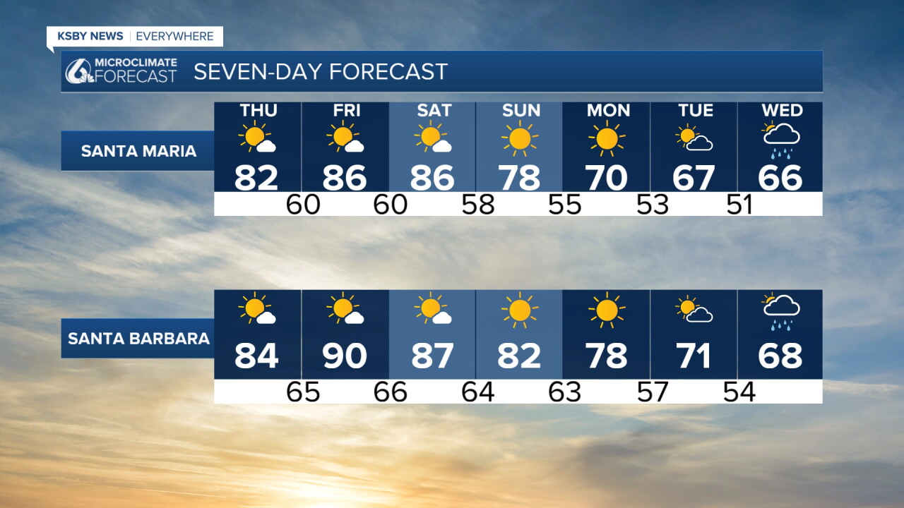
Turning to the extended forecast. The weekend will stay hot, and we will see high temps, strong winds, and low humidity. Sunday, though, the high pressure will move on, and temps will start to fall.
Next week they will plummet, with highs only reaching the 60s next week. That cooldown will be accompanied by the chance for rain. Beginning on Tuesday evening and lasting through Thursday morning, there are shower chances through the region. It is not looking like a huge system, but it may bring some much-needed accumulations to the region. Here is what all of that looks like on your 7-day forecast!
Have a wonderful day, Central Coast!
-Vivian
