

Good morning, Central Coast!
It is a foggy start to the morning for portions of Western Santa Barbara County. Be cautious on the roads as we head through the morning.
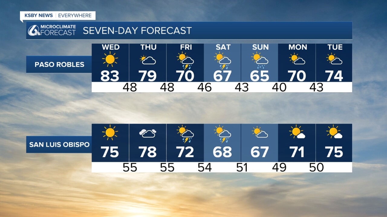
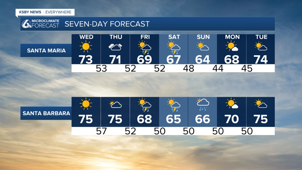
Skies will clear by mid-morning, and we will have beautiful conditions and temps about five degrees above normal.

Thursday will see more cloud cover and cooler conditions as a storm system gets closer to the region.
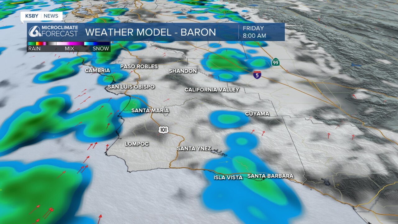
The first few showers will begin late Thursday into early Friday. They will start off mild but become more widespread as Friday goes on. Within these first few storms, there are chances for some localized stronger cells.
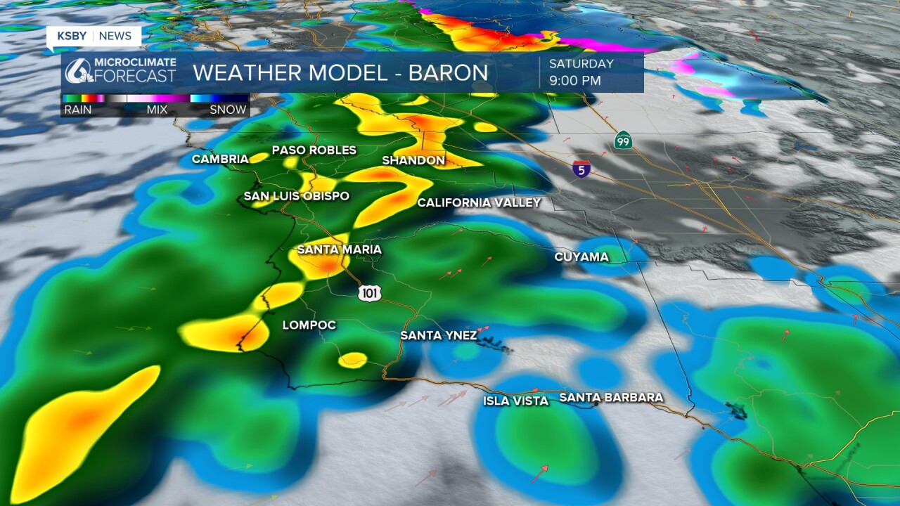
A line of stronger storms will reach us on Saturday. This is where thunder, lightning, and the potential for hail is expected.
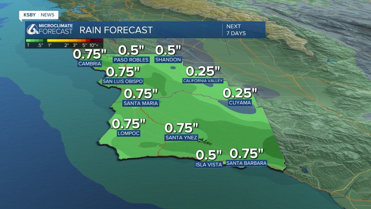
Here is a look at the rain totals we can expect. I don't think they will be this uniform, but it is a good benchmark for what we can expect.
I will be keeping a close eye on the storm as it gets closer. Stay tuned for the latest.
Here is what all of that looks like on the 7-day forecast.
Have a wonderful day, Central Coast!
-Vivian
