
Good morning, Central Coast!
If you are up early Thursday morning, Meteorologist Vivian Rennie is live at Common Grounds Coffee in Paso Robles until 8 a.m., stop by and say hi!
Temps to start off the day are in the 50s for most spots, 40s for the interiors. There is some fog for our coastal valleys. Take it slow on the roads.
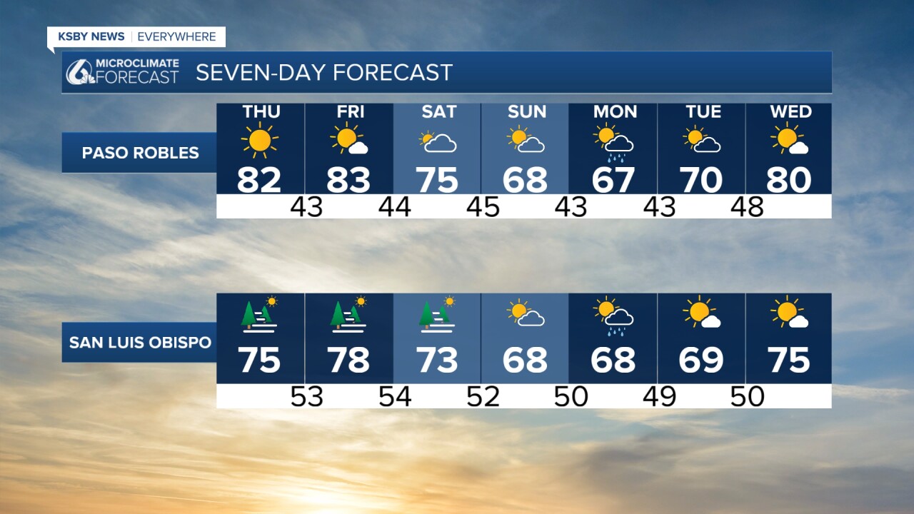
Today's highs will be nearly identical to yesterday. 80s for interiors, 70s by the coasts.

Into the weekend, the winds will start to turn onshore and bring a cooling trend to the region. That will be minimal and will come mainly in the form of more marine influence in the early mornings by the beach. It will still be a wonderful weekend across the region!
By late Sunday evening, a small system will take aim at the region. This will put rain chances into the forecast to kick off the week. Monday and Tuesday will be cloudy, cooler, and potentially soggy. Accumulations won't be too impactful; it will be a dreary day, but there isn't any risk of flooding. I will be keeping a close eye on the system as it gets closer. At least until then, sunshine is the story!
Here is what all that looks like on your 7-day forecast!


Have a wonderful day, Central Coast!
-Viv
