

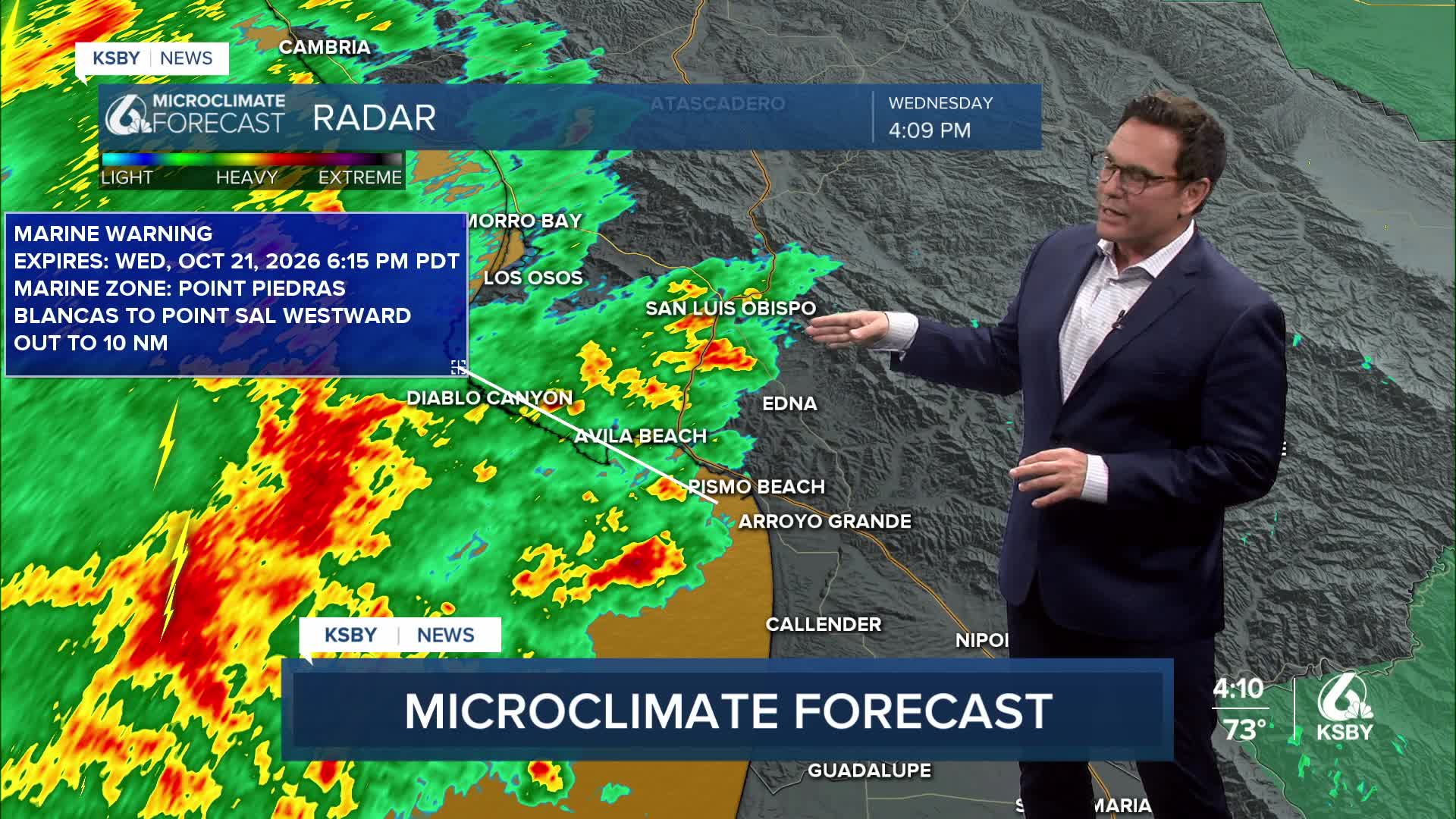


Here's your Central Coast weather update from Meteorologist Jim Castillo for San Luis Obispo & Santa Barbara counties:
Tonight through Thursday
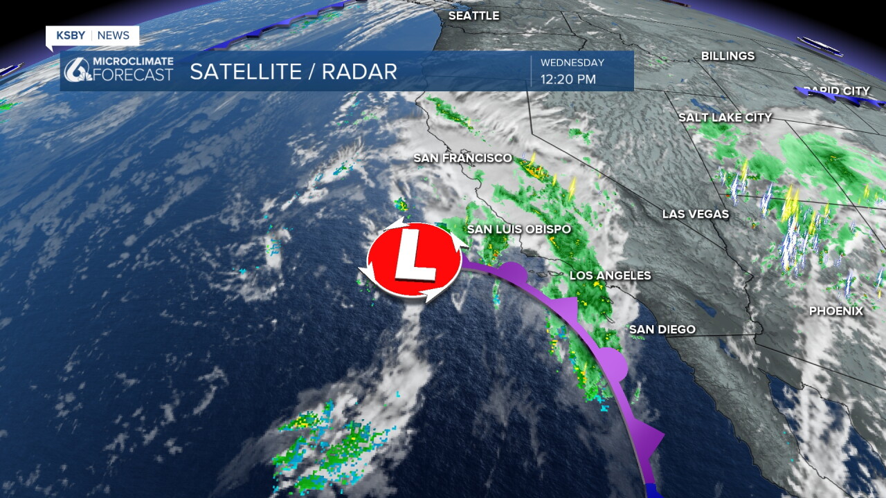
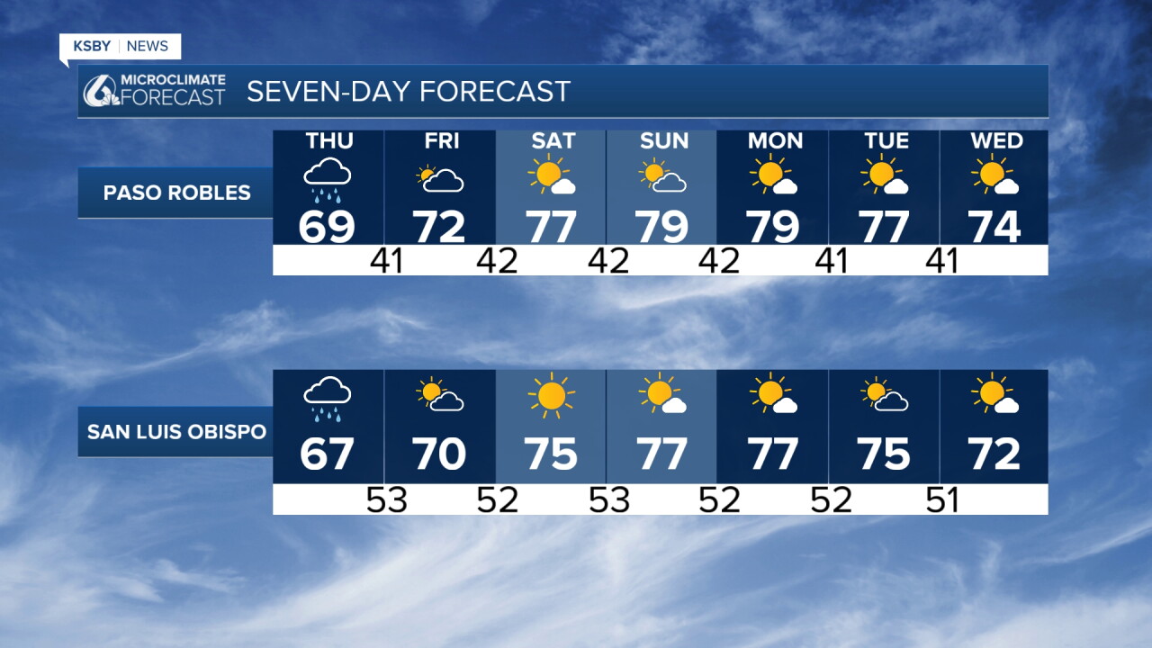
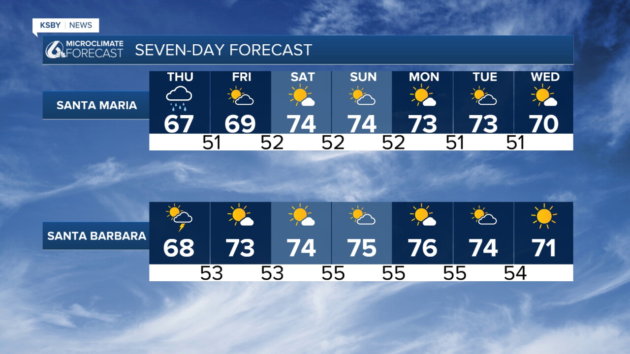
Waves of showers & and the potential for thunderstorms: Expect scattered heavy showers and embedded thunderstorms through tonight, then rain chances end Thursday afternoon.
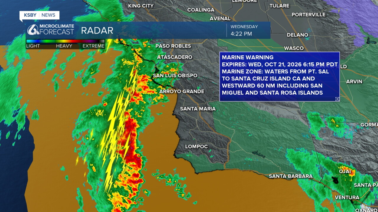
Rainfall Totals: Widespread 1 to 1.5 inches, with 2 to 3 inches in the Santa Ynez south-facing foothills due to mountain upslope flow.
Severe Potential: Chance of severe localized features, including offshore waterspouts moving briefly inland as weak tornadoes through tonight.
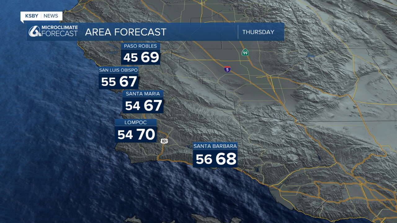
Temperatures: Cool under heavy cloud cover, staying in the low-to-mid 60s.
Friday & The Weekend:
Friday Wind & Warm-Up: High pressure brings an offshore wind event Friday morning with gusts up to 35 mph in mountain passes. Skies clear, warming temps into the low-to-mid 70s.
Weekend & Beyond: Stronger offshore winds (30-35 mph gusts) hit Saturday, with clear skies and a steady warming trend peaking Sunday into Monday.
Stay safe out on the roads!
Stay weather aware, Central Coast!
-Jim
