


Hey, Central Coast!
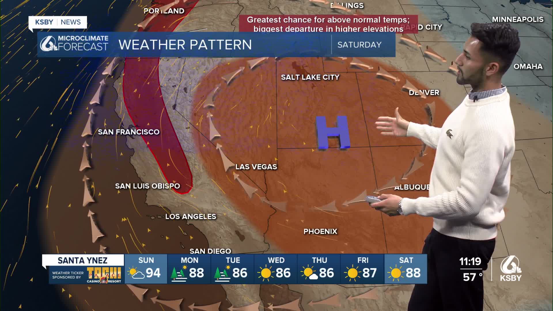
The heatwave continues this weekend due to a high-pressure system that remains positioned over the 4 Corners region through Sunday.


Monsoon moisture moved into California, bringing scattered showers and thunderstorms to Los Angeles and Ventura counties. However, it was able to reach the coastal waters south of Point Conception.
Most of the activity shifted to the mountains and the far interior areas of San Luis Obispo County this afternoon.
With all the monsoon moisture around, temperatures were all over the place. In general, it was cooler today, though when the clouds cleared even briefly, temperatures soared.
Humidities were 15-25% higher on Saturday with the monsoon moisture in place, which added to the heat risk.
With less moisture and clouds expected across the coast and valleys on Sunday, areas that cooled today due to cloud cover are expected to rebound on Sunday.


Cooling temperatures and increasing onshore flow are expected Monday and Tuesday as the upper high-pressure system over the 4 Corners region weakens and shifts back east.


Have a great weekend, Central Coast!
-Eddie
Advisories & warnings:
A Red Flag Warning in effect for the interior valleys of San Luis Obispo and Santa Barbara counties ends Saturday at 9 p.m.

A Heat Advisory for Santa Barbara County's south coast ends Saturday at 9 p.m.

An Extreme Heat Warning for San Luis Obispo and Santa Barbara counties ends Sunday at 9 p.m.

