

Happy Sunday, Central Coast!
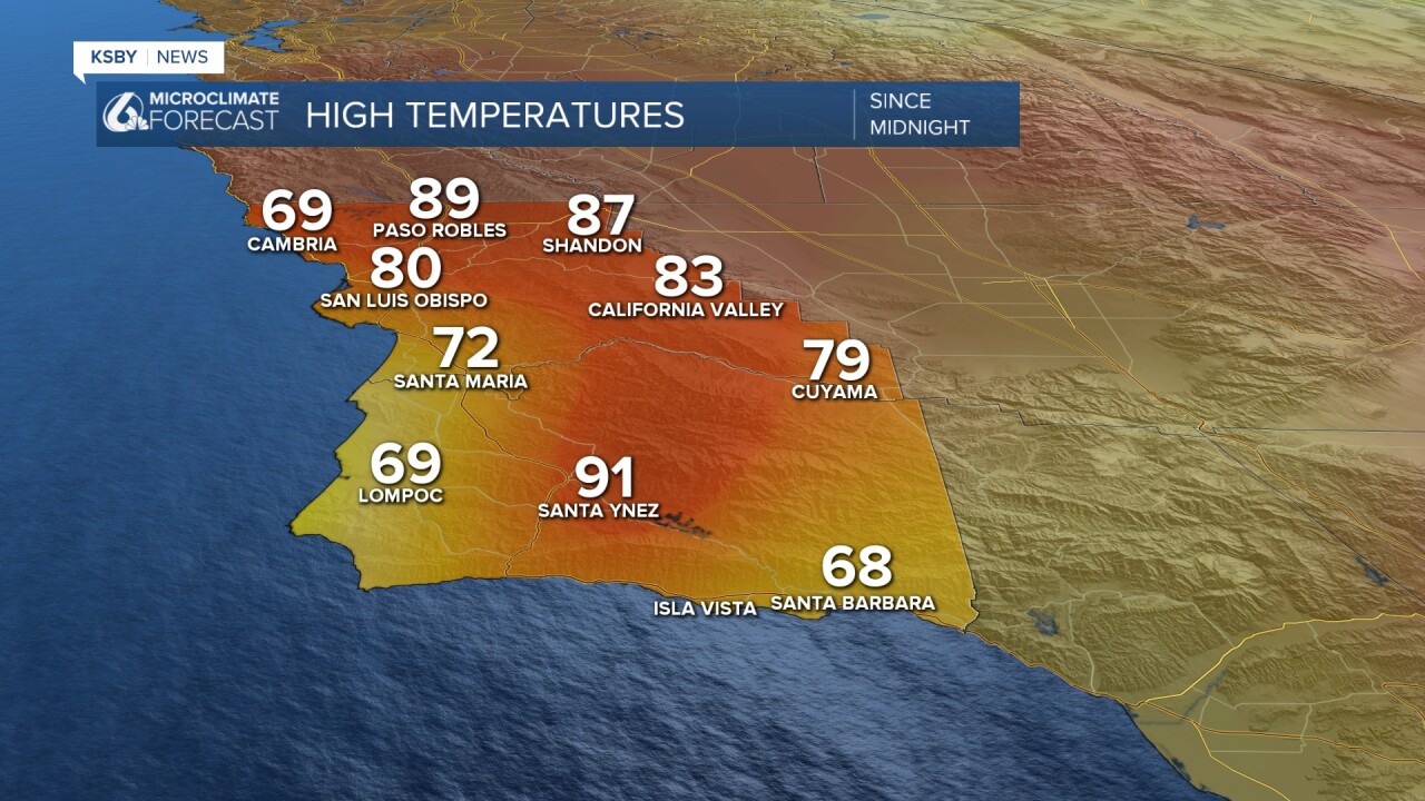
It's a hot day today for many of us here! These are the high temperatures we recorded in the last 24 hours. It feels more like summer, rather than fall. Santa Ynez reached a high temperature of 91 °F this Sunday!
We'll continue to observe higher temperatures on Monday. The reason for this warm-up is a ridge of high pressure that has been sticking to our region since last Friday.

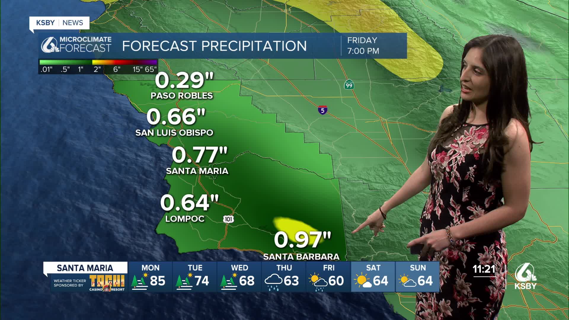
This trend is expected to change on Tuesday, when we will begin to see a cooling trend as a result of this high-pressure system weakening. This weather pattern will then be replaced by a low-pressure system, which will bring a chance of rain to our region on Thursday and Friday. These are some of the rain totals one of our models is projecting.

Models also indicate that the bulk of this rain will likely occur on Thursday, but we will start to observe some light rain on Wednesday evening.
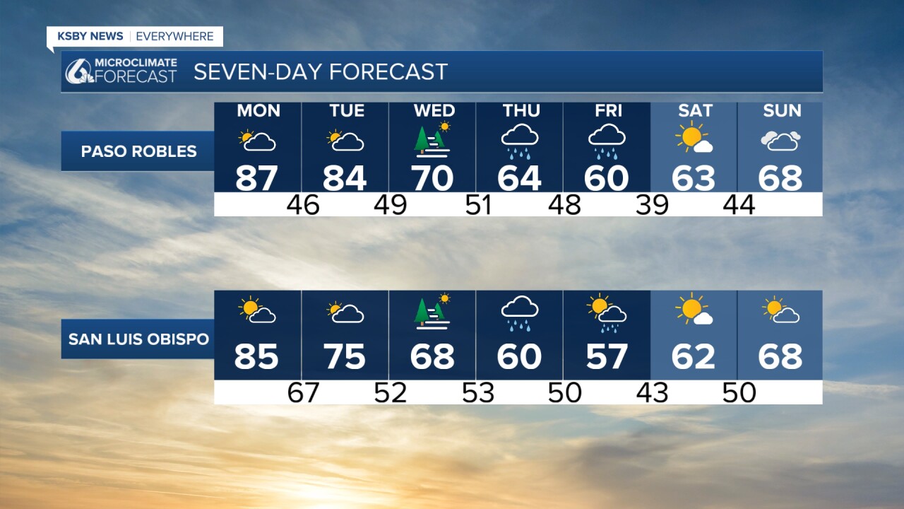
Overall, it's looking like this cool down in the second half of the week will be sticking with us into next weekend.

Enjoy your evening, Central Coast!
—Leslie Molina
