After a very active morning of lightning, thunderstorms, and brief, heavy downpours across the Central Coast, the rain is expected to continue at least until the late morning for Santa Barbara County’s south coast region.
An upper low-pressure system that is part of the driving force behind this storm will move eastward by the afternoon, which is when conditions should start to dry up locally.
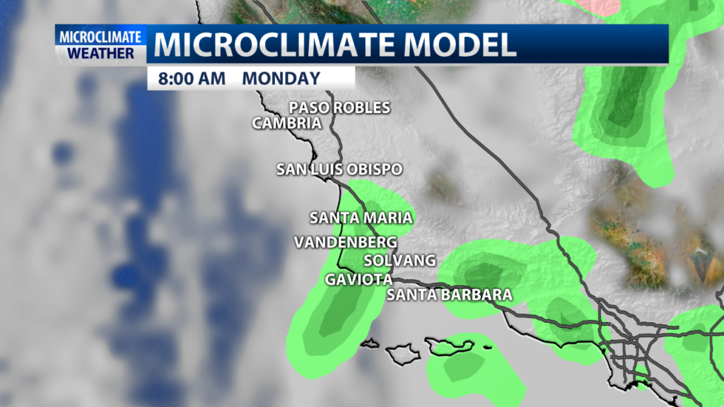
Daytime highs for the area will be below average on Monday, ranging from the low to upper 60s. Winds will start to pick up in the afternoon hours and range from 15-25 miles per hour. Breezy conditions are expected along the north coast and in parts of the interior and coastal valleys San Luis Obispo County.
Rainfall totals:
Cal Poly San Luis Obispo: 0.12”
San Luis Obispo: 0.23”
Pismo Beach: 0.11”
Arroyo Grande: 0.21”
Nipomo: 0.15”
Los Berros: 0.24”
Nipomo East: 0.27”
Nipomo South: 0.32”
Guadalupe: 0.18”
Santa Maria: 0.18”
Santa Maria Flood Shop: 0.27”
Casmalia: 0.20”
Vandenberg AFB: 0.14”
Harris Grade: 0.14”
Burton Mesa: 0.08”
Buellton Fire Station: 0.04”
Las Cruces: 0.14”
Point Conception: 0.11”
Gaviota: .10”
El Capitan: 0.12”
Lake Cachuma: 0.05”
Santa Ynez: 0.07”
Solvang: 0.03”
Dos Pueblos: 0.11”
UCSB: 0.08”
Goleta: 0.12”
San Marcos Pass: 0.15”
San Marcos Pass RWS: 0.25”
San Roque: 0.17”
SBC Flood Control OFfice: 0.16”
Santa Barbara City College: 0.07”
Cold Springs: 0.24”
Montecito RAWS: 0.24”
Summerland: 0.12”
One for the books tonight ♥️#beonksby
Posted by Trisha Butcher on Sunday, April 28, 2019
