

Happy Monday, Central Coast! It's hard to believe we have rain headed our way after such a gorgeous weekend! Here's a look at beautiful Pismo Beach from yesterday.

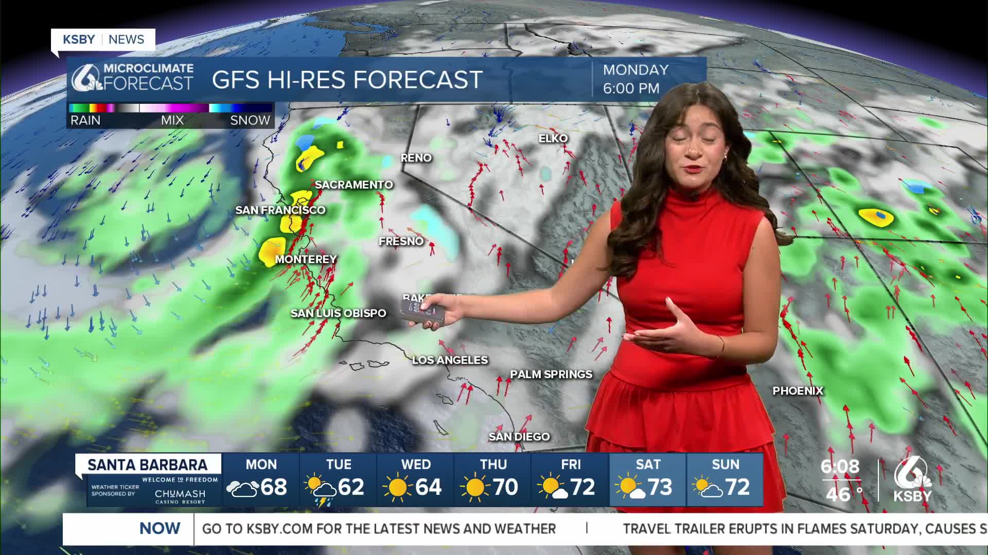
Starting Monday afternoon, a cold front will reach the Central Coast, marking the onset of the storm. This will begin with clouds but turn quickly to rain. This will start in northern San Luis Obispo County in the early afternoon.

At first, the rain will be patchy, but by evening, the core cold front will arrive, bringing a band of heavy rain. That front will pass through from 7 p.m. Monday through 2 a.m. Tuesday.

Once the core front passes through, the storm will shift a little bit and bring patchy showers through Tuesday afternoon.
Expect rain totals to average about an inch. High elevation peaks and ridges in the Santa Lucia mountains and the Los Padres National Forrest are looking at the highest rain totals.

A flood watch has been issued for the areas around recent burn scars in San Luis Obispo and Santa Barbara counties. From this evening through Tuesday afternoon, there is the potential for brief heavy rainfall over local burn scars that may trigger hazardous and damaging flooding and debris flows. Flooding may also occur in poor drainage and urban areas. Low-water crossings may be flooded.

Following the storm, temperatures will be on the cooler side and will take a while to recover fully. Sunshine will return quickly. Here is a look at our 7-day forecast!


Stay safe and have a great week!
