


Good morning, Central Coast! The heatwave begins Wednesday and will continue through the rest of the workweek. The hottest days of the week will be Thursday and Friday.
However, light to moderate onshore flow will be in the forecast.
The combination of weak onshore flow and some high-level clouds has reduced the amount of low clouds over the area.
A gradual increase in morning low clouds is expected to return on Thursday and Friday.

The increasing temperatures and weak onshore flow will allow for 3 to 5 degrees of warming on Wednesday for areas away from the coast.
Highs on Thursday will be in the lower to mid-70s across the beaches and in the lower 90s for the interior communities.


Sundowner winds are expected across the southwestern portion of Santa Barbara County for the next few afternoons and evenings.
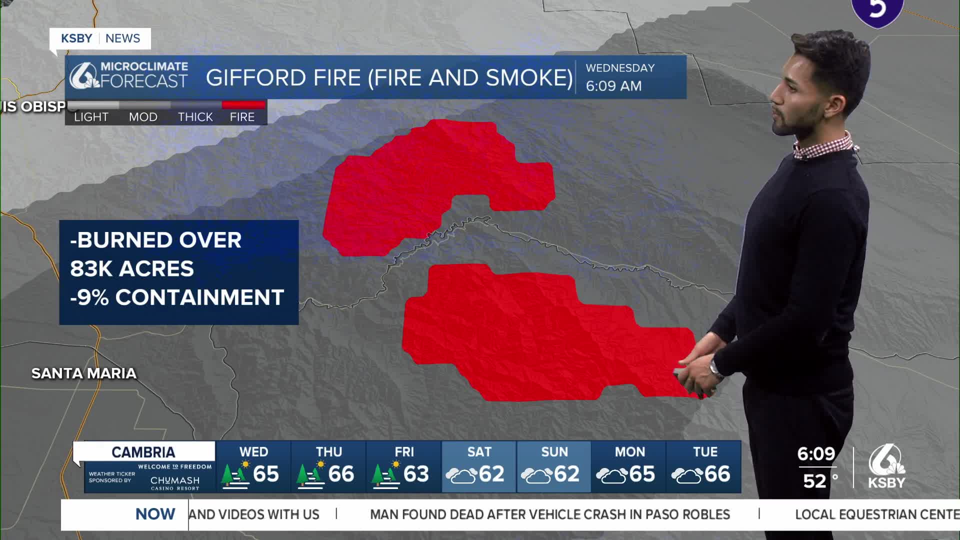
Smoke from Gifford Fire to impact air quality across San Luis Obispo County
Smoke from the Gifford Fire is likely to cause air quality issues in areas of Santa Barbara and San Luis Obispo counties.
For the latest updates on the Gifford Fire from CAL FIRE, click here.
UPDATE: Gifford Fire mapped at 83,933 acres; community meeting planned Wednesday
A slight cooling trend is expected over the weekend, but temperatures will remain above normal for areas away from the immediate coast well into next week.
Have a wonderful Wednesday, Central Coast!
-Eddie
