


———10:15 AM UPDATE———
A tornado warning has been issued for portions of Coastal Santa Barbara County north of Vandenberg SFB. This will stay in effect through 10:30 AM. Latest details on that can be found here.
——— Update 5 AM———
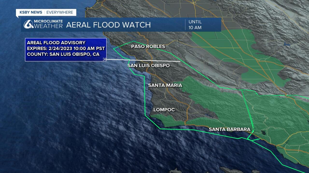
A flood advisory has been issued for most of the Central Coast due to excessive rainfall continuing this morning. This will stay in effect through 10 AM Friday Morning.
Minor flooding in low lying and poor drainage areas is expected and shallow debris flows are possible.
Be aware of your surroundings and do not drive on flooded roads.
———Full Article———
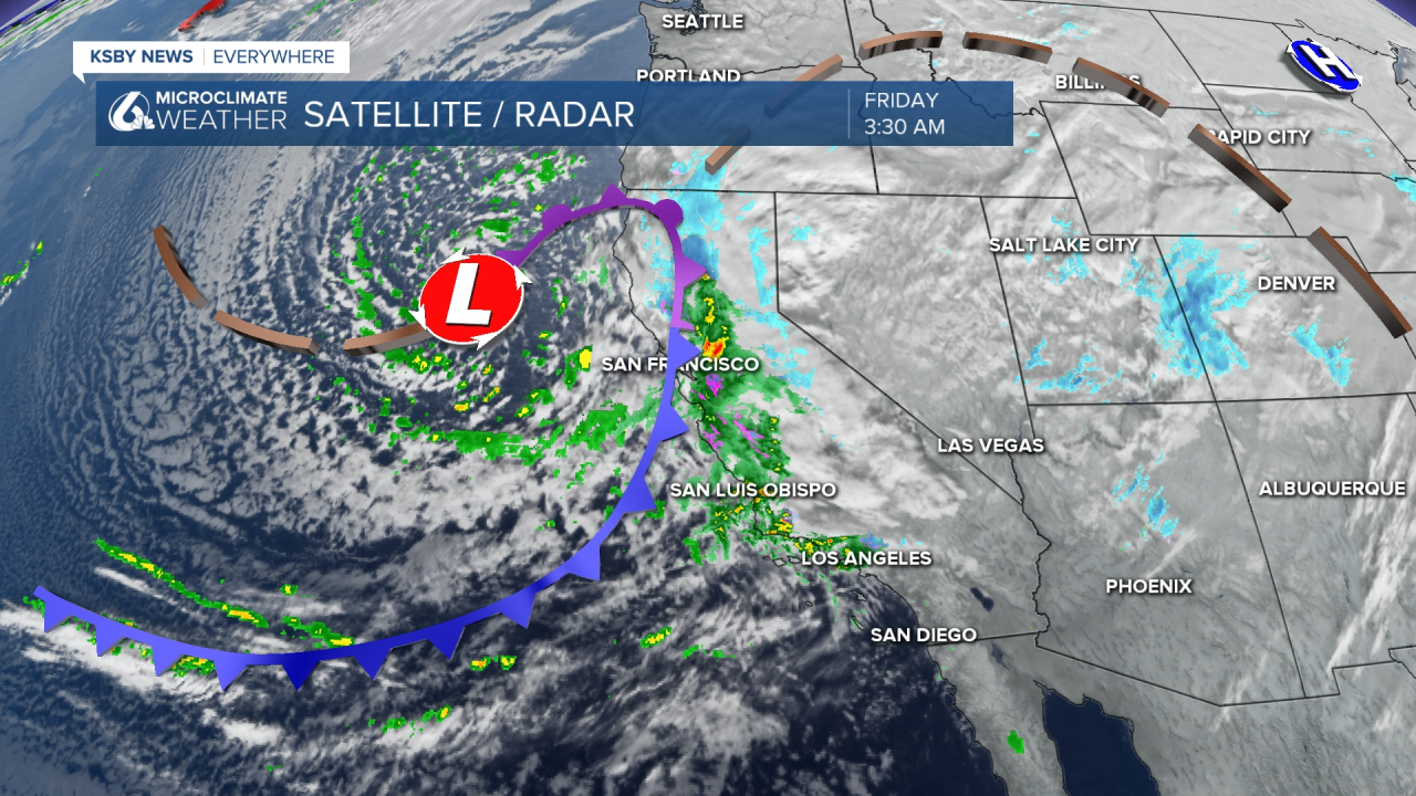
Good Morning Central Coast! The storm we have been talking about and preparing for all week is finally here so let's dive right in!
The "main event" of this storm began to move in Thursday evening right on schedule after the appetizer we saw yesterday that brought snow to the interior valleys. Check out some photos of that snow here!
A large cold front is pushing frigid Canadian air onshore and kicking up instability and strong winds. This is where all of our rain and upper elevation snow is coming from. In terms of scale this system has significant integrated moisture and at least for southern California qualifies as an atmospheric river. Here on the Central Coast we are not included in that official qualification of AR conditions but we are close to it.
Conditions this morning are highly dependent on elevation and temperature as to what you can expect. Coasts and coastal valleys will see significant rain and higher elevations will see ice and snow potential. Thankfully snow levels have risen slightly as compared to Thursday morning (1500ft vs 1000 or lower like we saw this morning). The lower edge of snow and ice possibilities does still include the top of Cuesta grade. I am not sold on that being accumulating but will complicate the commute.
For an interactive map of up to date precipitation totals check out this link!
As the storm continues to bring significant and persistent rain through the day today there is the potential for thunderstorms across the region. The Storm Prediction Center has the risk of thunderstorms possible today and Saturday. (Saturday is interesting, while activity will die down there is a lot of twist in the atmosphere. Thunderstorms, should they form, could form waterspouts or cold air funnels. Just something to watch).
The storm will continue at its current intensity (or more) into the afternoon with consistent heavy rain, localized thunderstorms and high elevation snow. The main front will pass over the region this afternoon and take some of the energy out of the region alongside it. This will calm conditions slightly into the evening hours.
Once things "calm" this evening we will begin to see scattered showers on the tail end of the storm. Those showers will last through Saturday.
Most of the Central Coast will likely see 1-3” of additional rain from Friday morning through Saturday evening. Along the southcoast much more is possible with most locations expecting 2.5-5" of additional rain. The hills and mountains have the highest accumulation potential with 4-6" of total liquid equivalent (melted snow and rain combined) precipitation expected.

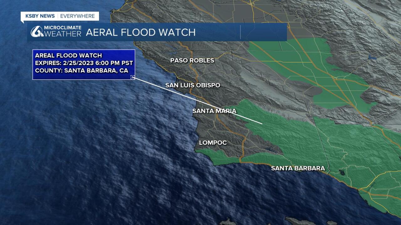
Rain rates are also an issue with .50-1”/hour rain. Some heavy rain is expected in areas that have seen evacuations before this year due to flood potential. There is a flood watch in place for parts of Santa Barbara County.
Heavy snow will develop at high elevations across Southern California and it is expected that this will impact Grapevine travel Friday and potentially Saturday as well. This could divert traffic to the 101 through the Central Coast. Expect grater semi traffic specifically.
Temperatures are an ongoing issue with lows in the 30s and 40s and very weak daytime high recovery into the 40s and 50s. This will mean folks may have to run the heat quite a bit in the forecast for the next week.
There are additional rain systems likely next week, as early as Monday but a more moderate system Tuesday and Wednesday. Not as strong as this system but another .50-1.5” is possible with 1.5-3” additional rain in the mountains.
Have a great day Central Coast and be sure to stay up to date with the latest storm information here as well as on the KSBY Microclimate Weather App.
