


Happy Wednesday, Central Coast! A cooling trend has begun on the first day of school and temperatures will be slightly cooler through Saturday.
Grab those jackets! Temps will be cool this morning, but they will be warming up for areas away from the coast later this afternoon.
The reason we’re experiencing a cooling trend on the Central Coast is due to the ridge of high pressure starting to break down today. As a result, the cooling will help the interior stay out of any heat advisories. The trough of low pressure will replace the high-pressure ridge on Thursday.
However, above normal temperatures are still forecast for the far interior.
The coastal communities are expected to experience cooler daytime highs on Wednesday due to the influence of the marine layer.
Night through morning, low clouds and fog will continue along the coast and in some coastal valleys through the weekend.
The trough and continued onshore flow will bring low clouds to the coasts and some of the valleys.
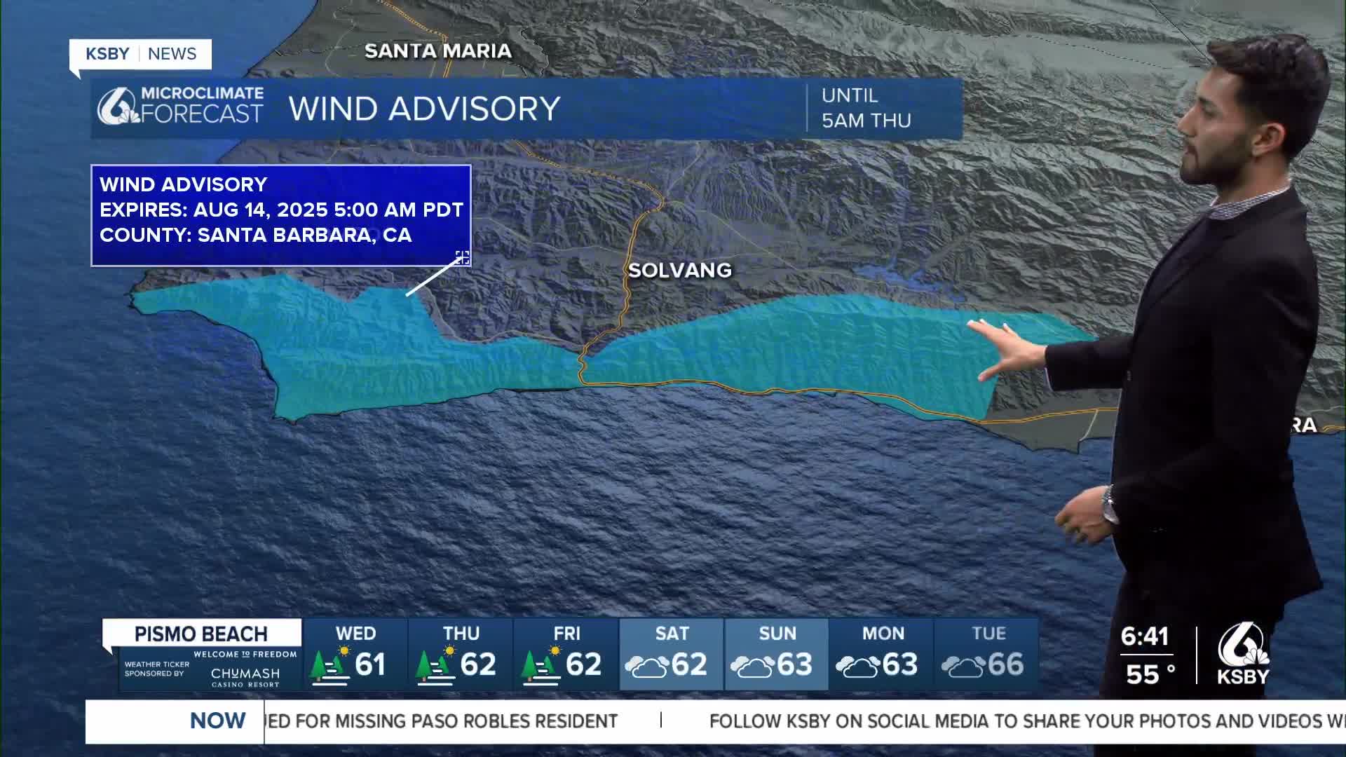
A north wind event will develop tonight with the strongest winds across the southwestern portion of Santa Barbara County, where gusts up to 55 mph will occur. A Wind Advisory has been issued for Santa Barbara County until 5 a.m. Thursday, August 14, 2025.


Have a great day, Central Coast!
-Eddie
Fire forecast:
According to CAL FIRE, as of Wednesday morning, the Gifford Fire has burned over 125,000 acres, and containment is at 37%. For the latest updates on the fire, click here.
We are expecting to see dense smoke in areas near the location of the fire today, but a light presence of smoke will appear in communities throughout Santa Barbara County.


Evacuation orders and warnings remain in effect. Residents in San Luis Obispo County can check whether their property is included in evacuations by visiting this link.
A temporary evacuation point has been established at the Santa Margarita Community Hall, located at 22501 I Street.
An evacuation shelter is also set up at New Life Community Church, located at 990 James Way in Pismo Beach. Pets and trailers/RVs are welcome.
Some evacuation orders and warnings in Santa Barbara County have been downgraded or canceled. For the latest information, click here.
For residents who need to evacuate with large animals, the Elks Rodeo Grounds in Santa Maria is open for large animal evacuations. A large animal shelter has been established in northern San Luis Obispo County. Call (805) 781-1404 for information.
The Horse Emergency Evacuation Team can also assist with large animal evacuation. Contact HEET at (805) 466-7457.
From now through February 8, 2026, the Los Padres National Forest is closed for public safety and the protection of natural resources. This closure includes the entire Santa Lucia Ranger District and a portion of the Mount Pinos Ranger District. Click here to view the closure order.
Highway 166 also remains closed between Highway 101 and New Cuyama with no estimated time of reopening.
