


Good Thursday evening, Central Coast!
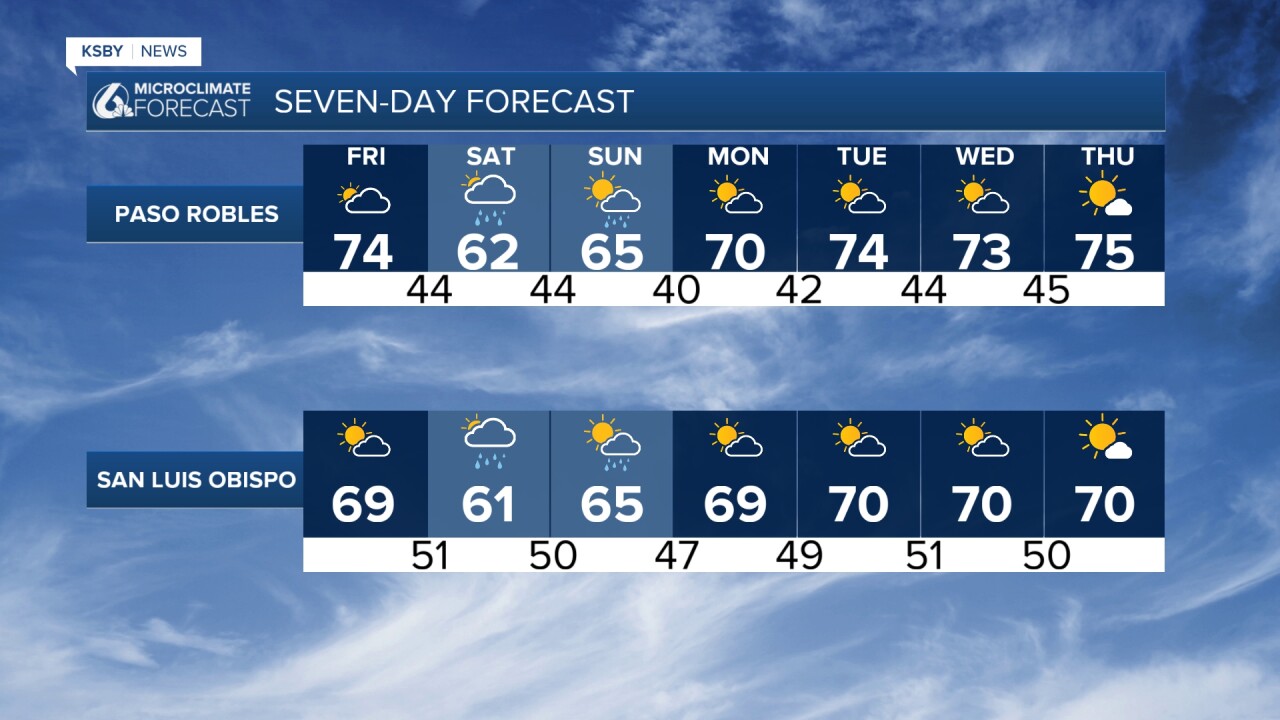
Current temperatures remain near seasonal averages on Friday, then expect a cool weekend. A weak weather system is approaching from the Northwest, bringing the potential for scattered light showers Saturday into early Sunday. Dry conditions return Monday and Tuesday, though temperatures will remain below normal through mid-week.
TONIGHT THROUGH FRIDAY
Partly cloudy tonight across both counties. Lows in the upper 40s to mid 50s on average.
Friday, high clouds continue to increase as the approaching low pressure system draws closer. Expect mostly cloudy morning conditions transitioning to sunnier conditions by afternoon. High temperatures will range from the 60s at some beaches to around 70 in some inland areas. West winds will increase to 15 to 25 mph, particularly noticeable in the Santa Ynez Valley and mountain areas.
WEEKEND OUTLOOK
Saturday marks the arrival of our next weather system. Morning hours start mostly cloudy, with the first chances for light rain developing during the day. The Santa Lucia Mountains and higher elevations of Los Padres National Forest have the best chances for measurable rainfall, with amounts generally under one-tenth of an inch. However, orographic enhancement could produce up to a quarter-inch in the highest peaks.
Temperatures on Saturday will be noticeably cooler, with highs in the 50s to lower 60s in most areas. West winds will increase to 10 to 15 mph, with gusts up to 25 mph possible in exposed areas.
Sunday shows mostly cloudy morning conditions becoming partly cloudy by afternoon. Isolated light showers remain possible, particularly in the Santa Lucia Mountains and eastern portions of both counties. High temperatures in the 60s in most areas.
EXTENDED FORECAST (MONDAY-THURSDAY)
Monday and Tuesday bring dry, sunny conditions with high pressure building over the region. However, temperatures remain near seasonal averages with highs in the upper 60s across both counties. Morning lows will be quite cool, dropping into the 40s.
Another weak system approaches Wednesday, though current model guidance suggests minimal impact. Most areas should remain dry, but a few light showers cannot be ruled out, particularly in the Santa Barbara County mountains and northern portions of Los Padres National Forest. Any rainfall would be light, generally under one-tenth of an inch.
Thursday brings the potential for gusty post-frontal northwest winds, especially in the Santa Ynez Valley and mountain passes. Otherwise, expect dry conditions with a gradual warming trend beginning.
COASTAL WATERS
Small craft advisories continue into early Saturday for weekend boaters as northwest winds increase Saturday. Seas will build to 4 to 6 feet with periods of 4 to 8 seconds. Water temperatures remain cool at 52 to 54 degrees through the weekend.
This forecast reflects conditions specific to San Luis Obispo and Santa Barbara counties, with particular attention to the unique microclimates created by the Santa Lucia Mountains, Santa Ynez Mountains, and the varied terrain of Los Padres National Forest.
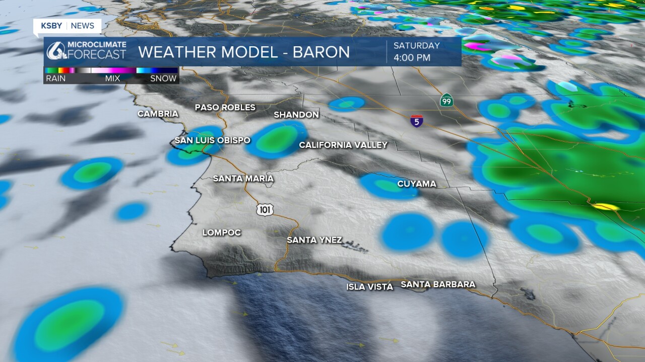

Below: A weak low pressure area moves over us this weekend with less than .10" of rain expected Saturday through Sunday morning.

Below: Local reservoir levels and the change over the last 2 weeks.


Have a great night, Central Coast!
-Jim
