



Good Thursday evening from Meteorologist Jim Castillo
Here is your Central Coast weather forecast for San Luis Obispo & Santa Barbara Counties
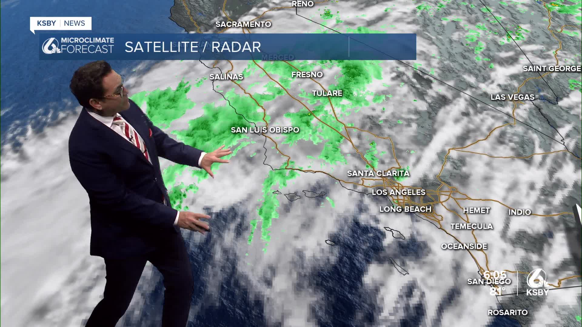
Current Conditions: We cleared in most areas enough to watch the lunar eclipse. Very warm and muggy conditions continue through Friday with high risk for heat-related illness. Remnants of Tropical Storm Iselle are bringing challenging forecast conditions across the region.
Tonight Through Friday
Showers & Thunderstorms: Scattered light showers continue impacting both counties with rainfall amounts staying under 0.10 inches. Eight lightning strikes occurred around Vandenberg this morning. A small chance for lightning continues today, with the highest probability over the Central Coast and Santa Lucia Mountains, Santa Ynez Mountains, and Los Padres National Forest areas.
Tonight brings a northward shift and overall decrease in activity, though isolated showers remain possible with tropical moisture still in place.
Friday's outlook shows a trough northwest of the region interacting with tropical moisture, enhancing shower and thunderstorm chances mainly north of Santa Ynez. San Luis Obispo County faces a 10-30% chance of showers and thunderstorms, with chances decreasing southward into Santa Barbara County.
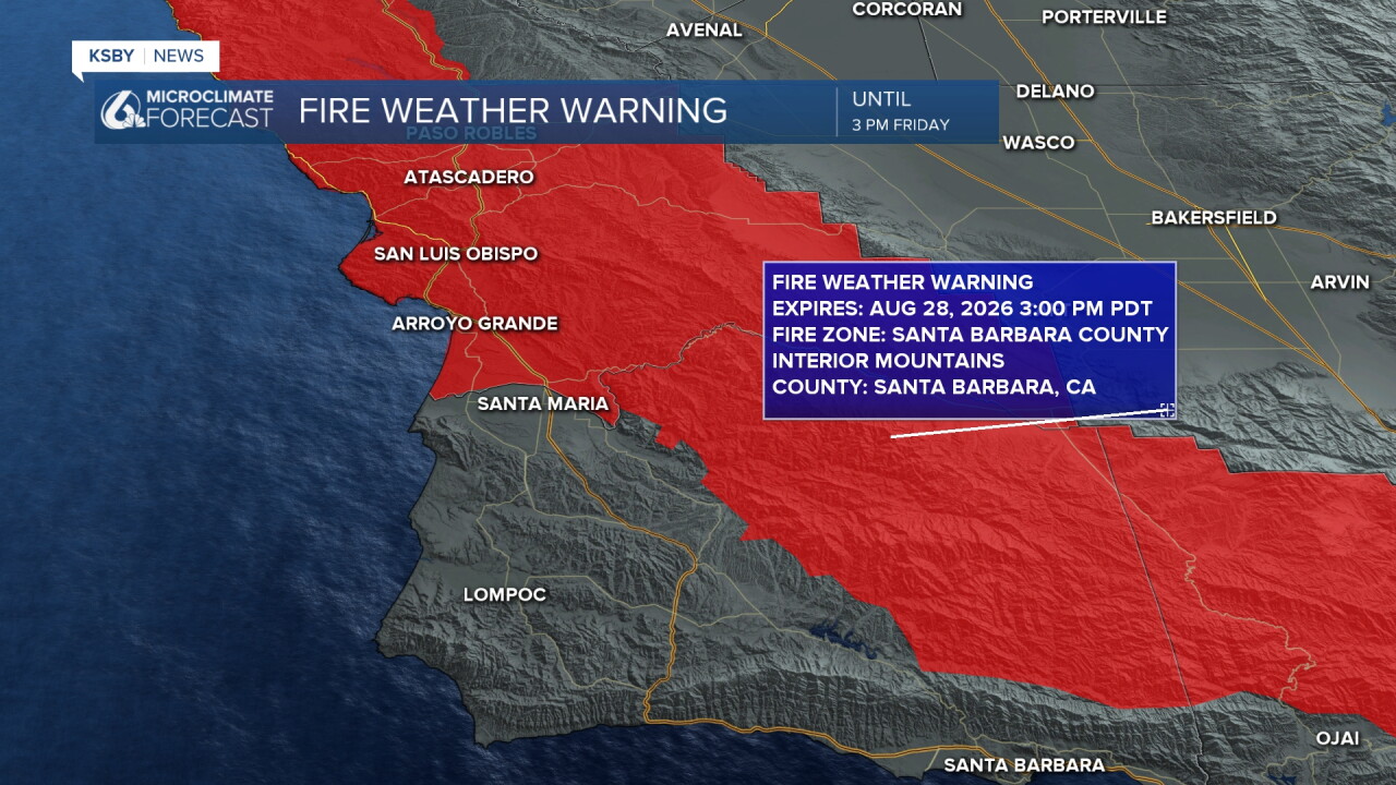
Primary Threats: A Fire Weather Warning has been issued for Friday. Cloud-to-ground lightning and erratic winds pose significant fire start and growth risks. Isolated heavy rain and flooding risk is low but not zero.
Temperature Outlook: Clouds disrupted temperatures today, with most of Santa Barbara and San Luis Obispo Counties running 15-25 degrees cooler, except southwestern Santa Barbara County, which warmed 5-10 degrees. Despite cooler numbers, conditions feel very warm and humid with high dewpoints.
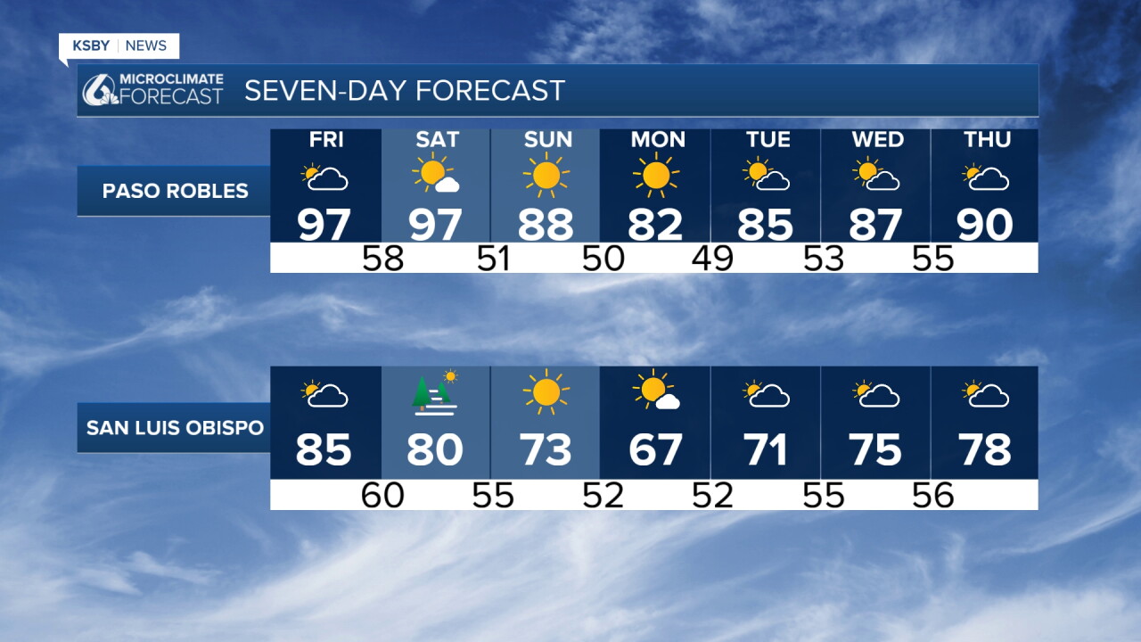
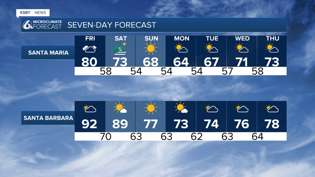
Overnight lows remain in the 60s due to the tropical airmass. Friday's daytime temperatures remain uncertain, potentially varying up or down 10 degrees depending on moisture plume positioning and convection development.
Heat Warnings and Advisories remain until 8 pm on Friday, with possible adjustments Friday.
Weekend & Beyond
Saturday-Sunday: The airmass dries and cools, with temperatures dropping below normal by Sunday. Marine layer clouds likely return with coverage details uncertain. Sundowner winds peak Saturday night with Wind Advisory conditions probable.
Monday: Below-normal temperatures expected with coastal low clouds and typical breezy mountain winds across both counties.
Tuesday-Thursday Outlook: A disturbance forming off the Baja coast will likely become a tropical storm moving west-northwest. Northern trough interaction with tropical moisture creates uncertainty. Approximately half of forecast models show moisture streaming over southwest California, something we are watching.
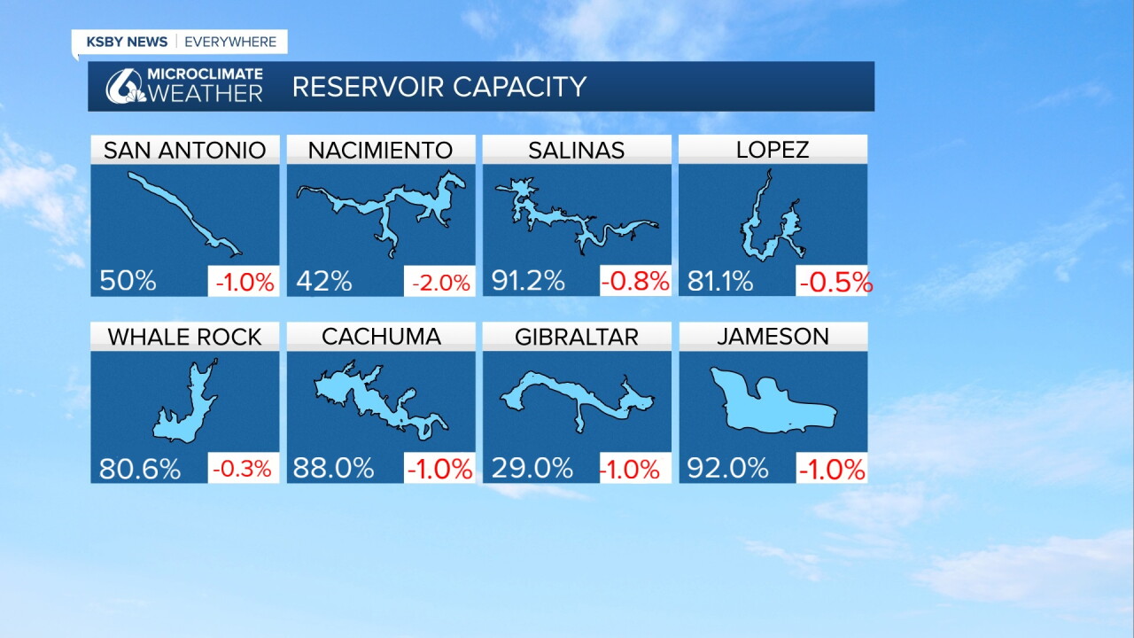
Below: The reservoir levels currently and the change from a week ago.
Have a great night, Central Coast!
-Jim
