


Good Tuesday evening, Central Coast!
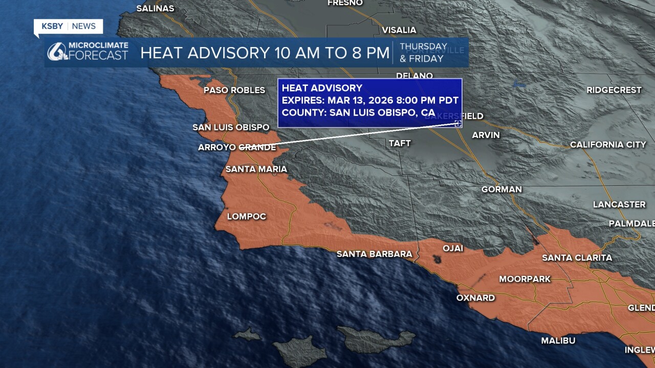
A Heat Advisory begins at 10 am on Thursday and continues until 8 pm Friday; it may be extended as a strong ridge of high pressure builds into the Central Coast this weekend and into next week.
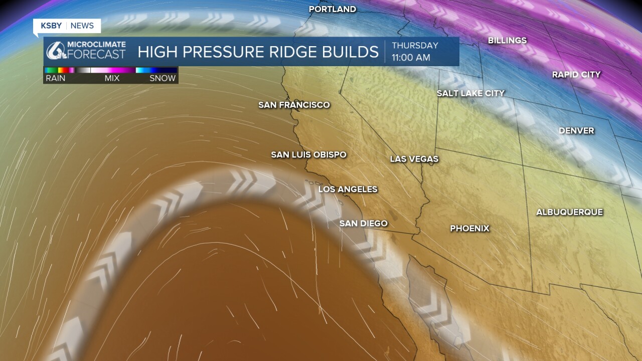
Get ready for a major warm-up starting Wednesday that will stick around well into next week. A rare March heat spell is forecasted, with highs for coastal and inland areas soaring into the 80s and low 90s. Keep in mind our average high is in the mid 60s.
A Heat Advisory is in effect for Thursday and Friday, and additional alerts will likely be issued as the heat continues into the weekend and into next week. Some coastal locations could remain cooler, but still very warm for this time of year.
Expect hot days, mild nights, and almost no chance of rain. This stretch may break March heat records. Stay cool and hydrated!
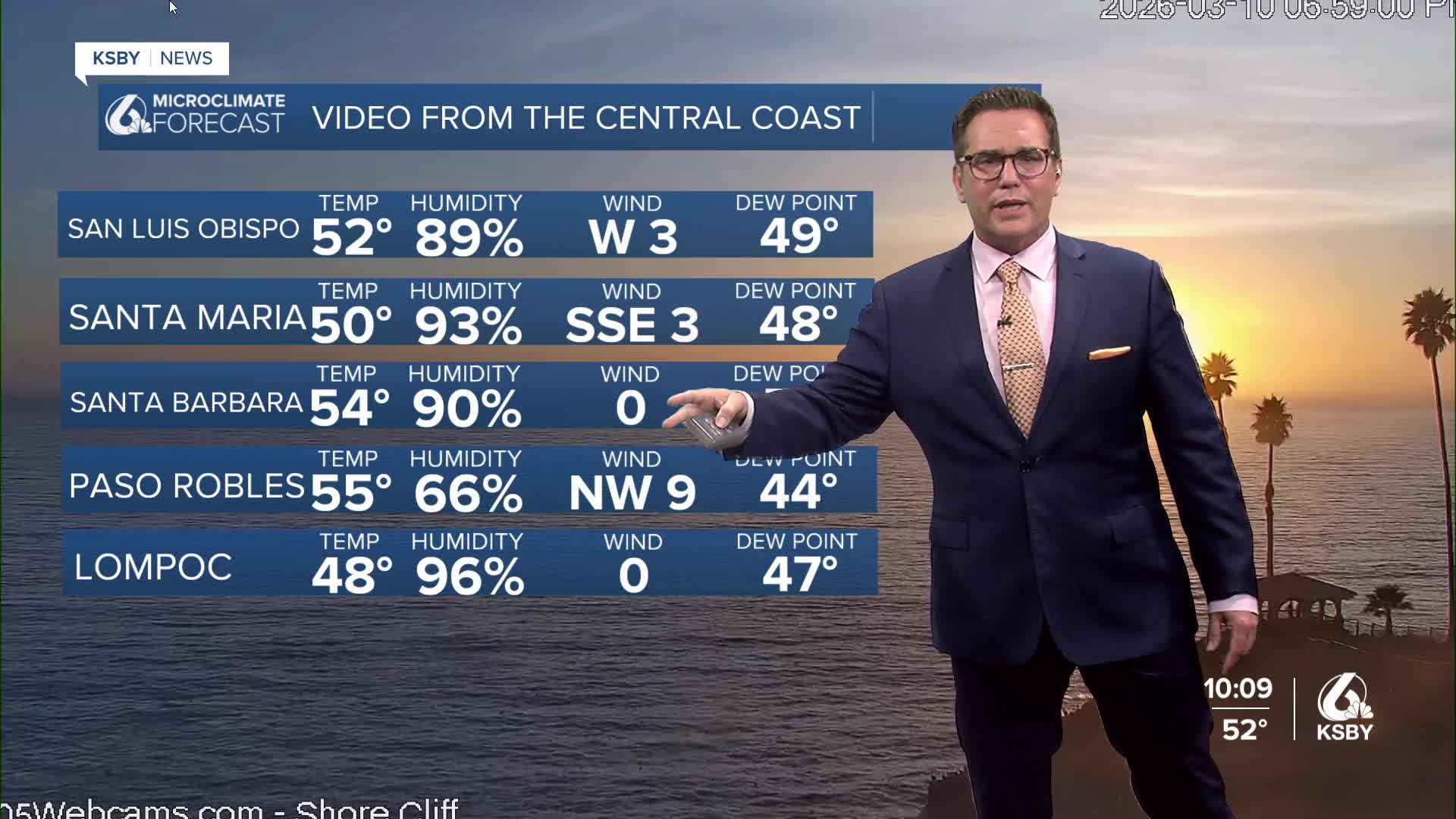
Below are the temperatures for Wednesday. Well above average, but Thursday into the weekend will be hot.


Stay cool and stay hydrated, Central Coast!
-Jim
