

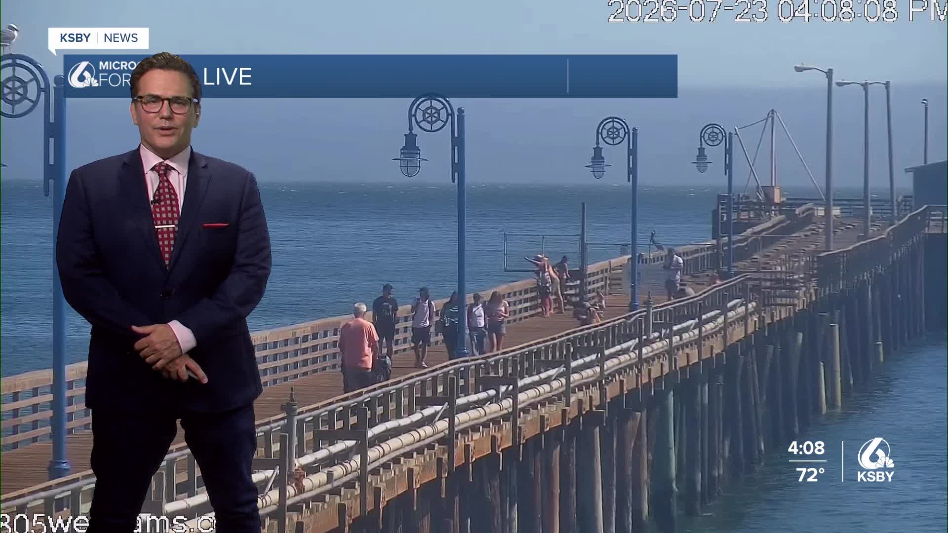


Good Thursday evening, Central Coast!
A dominant high-pressure system anchored over the western United States will maintain a hot air mass across the Central Coast through early next week.
CURRENT PATTERN: The upper-level ridge of high pressure is shifting westward from the Borderland region and will recenter over the Four Corners area by late week. This positioning strengthens the high-pressure influence across Southern California into the Central Coast.
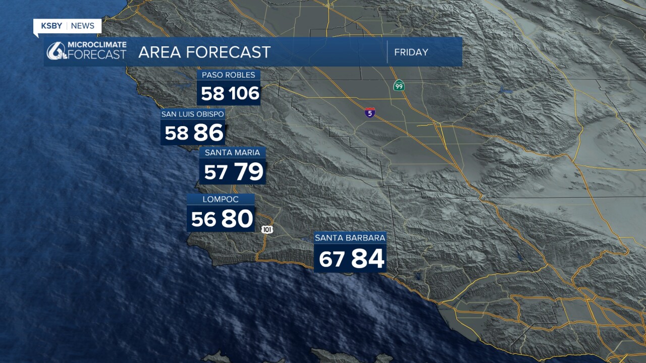
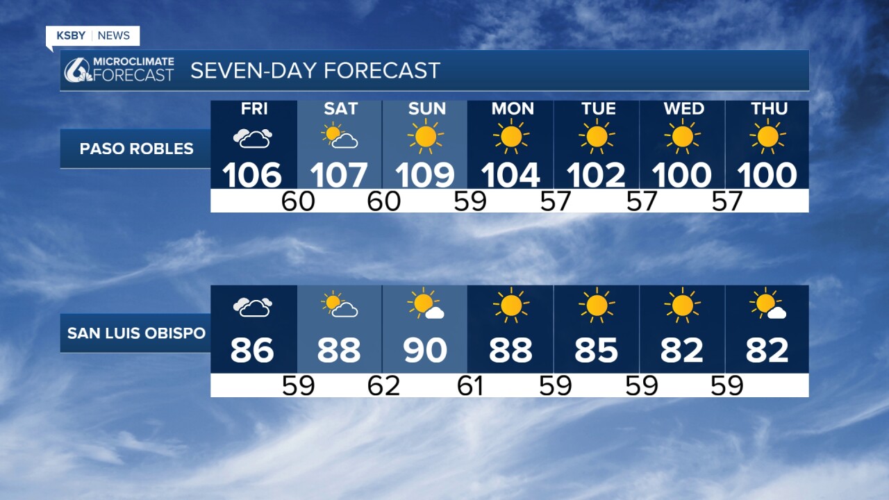
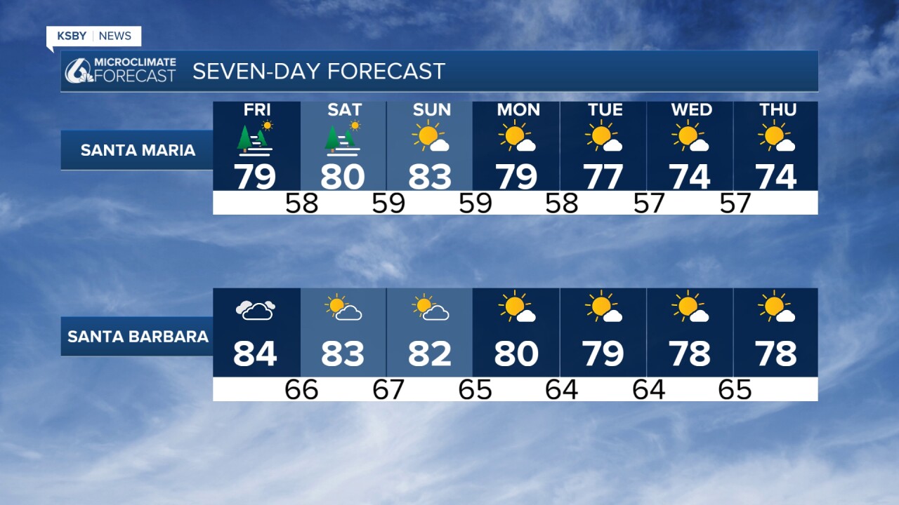
TEMPERATURE FORECAST: Friday will be the hottest day as high atmospheric heights combine with weakening onshore pressure gradients. Near-surface temperatures will climb 1-2 degrees each day through Saturday. The prolonged hot daytime temperatures paired with warm overnight conditions will persist through Monday.
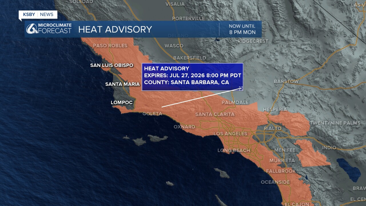
Some of our coastal valleys from San Luis Obispo to Santa Maria are NOT included in the advisory for heat. A Heat Advisory remains in effect for most coastal Santa Barbara County areas, inland valleys, and lower mountain elevations, including portions of the Santa Lucia Mountains, Santa Ynez Mountains, and lower elevations of Los Padres National Forest within our two-county viewing area. There is a moderate to high risk of heat illness over the next several days.
Those most vulnerable include very young children, elderly residents, people without air conditioning, and anyone working or exercising outdoors. These groups face a high risk for heat-related illness during this extended heat event.
A tighter northerly surface pressure difference will trigger another round of Sundowner winds through tonight. Breezy to gusty northwest and north winds will develop across southern Santa Barbara County, with the strongest winds again expected in the southwestern portion of the county. N 20 to 30 with gusts to 50 mph. Gaviota to Goleta and through San Marcos Pass will see the stronger gusts.
Motorists on Highway 101 between Gaviota and Goleta should expect gusty crosswinds that could make driving difficult, particularly for high-profile vehicles.
EARLY NEXT WEEK RELIEF: High pressure aloft will shift eastward early next week, allowing gradual cooling. Stronger onshore flow should return, bringing night and morning low clouds and fog back to coastal areas. There should be enough cooling to likely end heat advisories by Monday.
EXTENDED OUTLOOK: While some relief arrives early next week, high pressure will maintain above-normal temperatures through the week. A potential for more heat could develop by the end of next week.



Have a great night, Central Coast!
-Jim
