

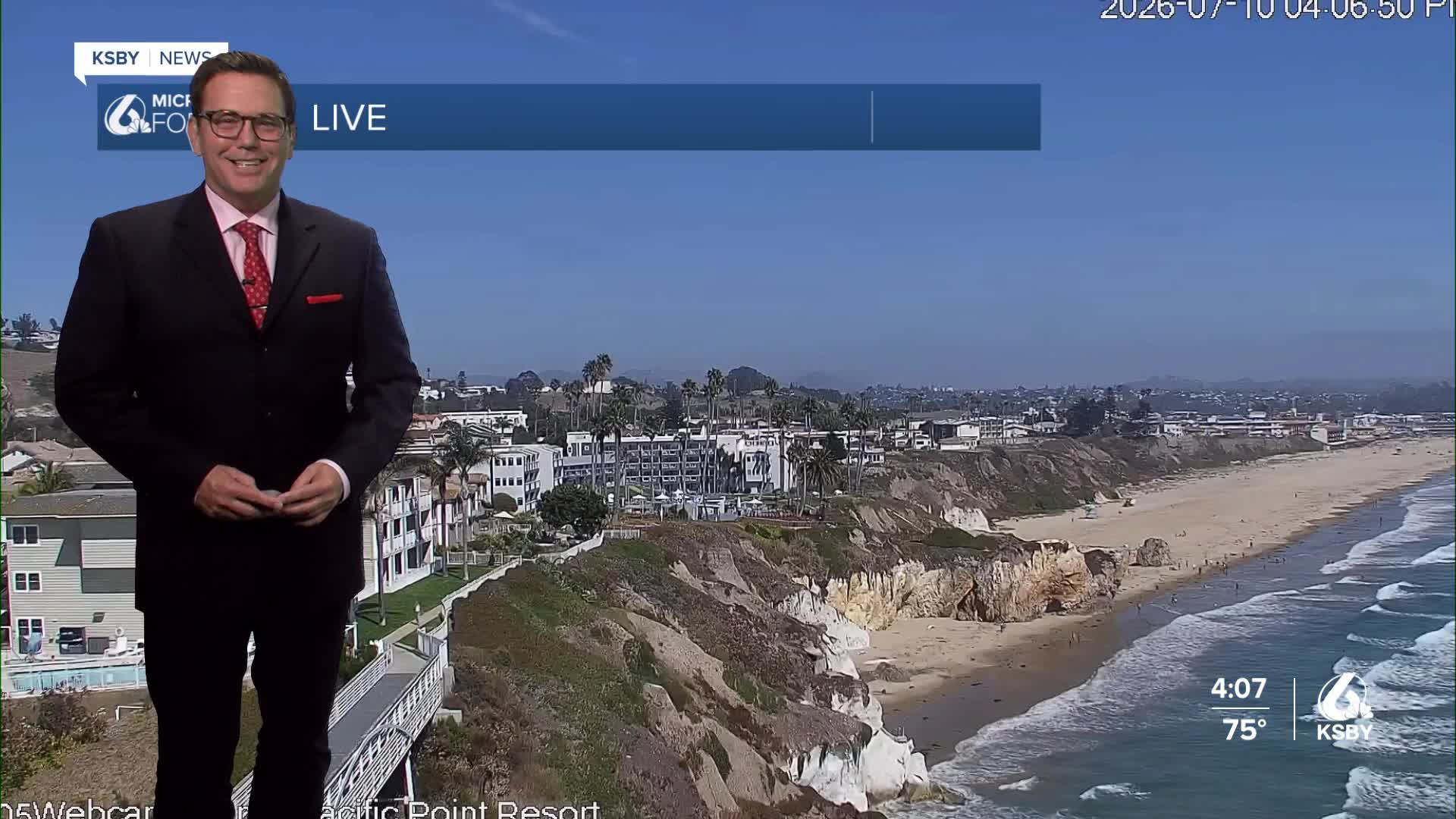


Happy Friday, Central Coast!
Here's your forecast for San Luis Obispo and Santa Barbara Counties:
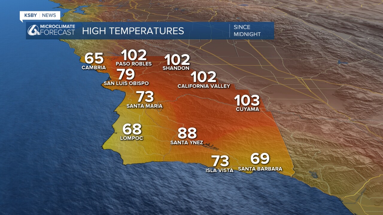
Below: The highs on Friday, where our interior valleys are already hot. The heat moves closer to the coast next week, and it becomes more humid.
Tonight Through the Weekend: Coastal areas are experiencing the most relief, with marine layer depths reaching 1,200 feet - significantly deeper than recent days. Morning low clouds and areas of fog tonight for most coastal areas and extending into some valleys. Lows in the 50s.
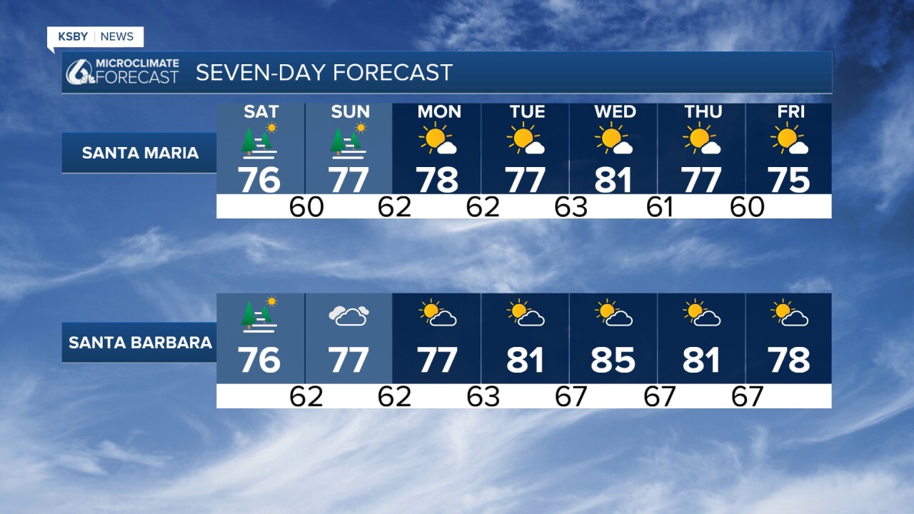
Saturday will see another 1 to 2 degrees of temperature drop, though humidity levels will increase, offsetting the cooling sensation. Strong onshore flow will likely keep nearshore areas under low cloud cover through much of the day. Partly to mostly cloudy conditions are expected due to mid- and high-level clouds moving in from the southeast.
Monsoon Pattern Developing: Sunday marks the beginning of our monsoon potential. A 5 to 10 percent chance of showers and isolated thunderstorms begins Saturday night, increasing to 10 to 20 percent Sunday into Monday. The Santa Lucia Mountains, Santa Ynez Mountains, and Los Padres National Forest areas within our two counties have the highest chances for activity. Even coastal areas of Santa Barbara and San Luis Obispo have smaller chances of seeing some moisture.
Strong offshore flow develops Sunday as the eastern Pacific high pressure weakens, bringing complete clearing to beaches while maintaining cloud cover inland.
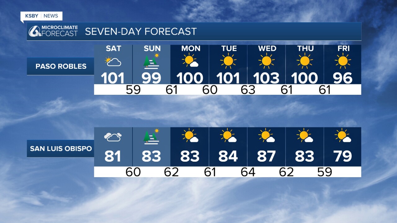
Next Week's Heat Concerns: Tuesday brings renewed heat concerns as an upper-level high-pressure system strengthens over South Dakota and pushes heights higher over California. Valley temperatures will likely climb to 95-105 degrees, with the National Weather Service issuing an Extreme Heat Watch for the potential of higher heat risk levels. The combination of rising temperatures and lingering monsoonal moisture will create uncomfortable conditions.
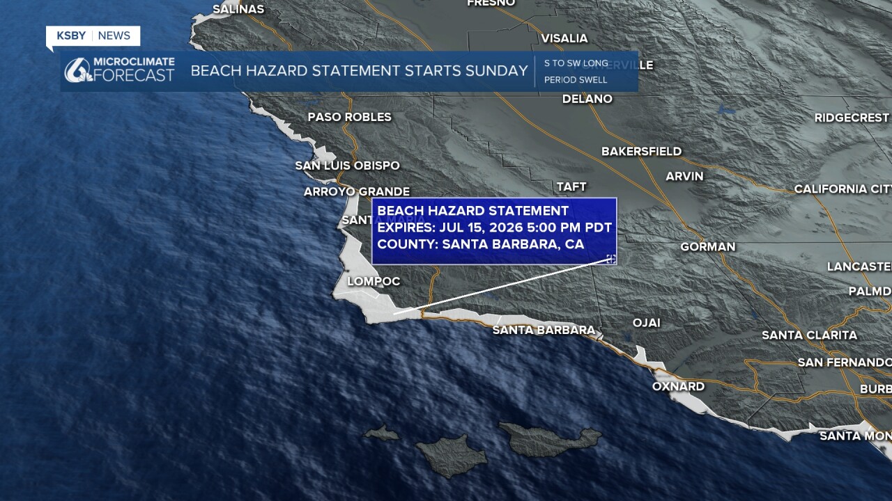
Beach Hazard Statement begins Sunday along the Central Coast. A south to southwest longer period swell will ramp up our rip current risk and sneaker waves.
Extended Outlook: Wednesday shows potential for 3 to 6 degrees of additional warming before onshore flow returns Thursday, bringing substantial marine layer development and 3 to 6 degrees of cooling. There's also a chance the monsoon pattern returns Thursday with another 10 to 20 percent chance of mountain thunderstorms.
The key forecast challenge remains the north-south pressure gradient, which will determine whether we see continued onshore flow or a shift to offshore patterns - critical for next week's temperature trends across the Central Coast.


Have a great weekend, Central Coast!
-Jim
