


Good Evening, Central Coast!
Here's your weather forecast for San Luis Obispo and Santa Barbara Counties:
CURRENT CONDITIONS & OUTLOOK
A significant warming trend is underway on the Central Coast, with temperatures climbing far above early-June normals on Wednesday only. This dramatic temperature spike is being driven by offshore wind patterns and rapidly building high pressure aloft.
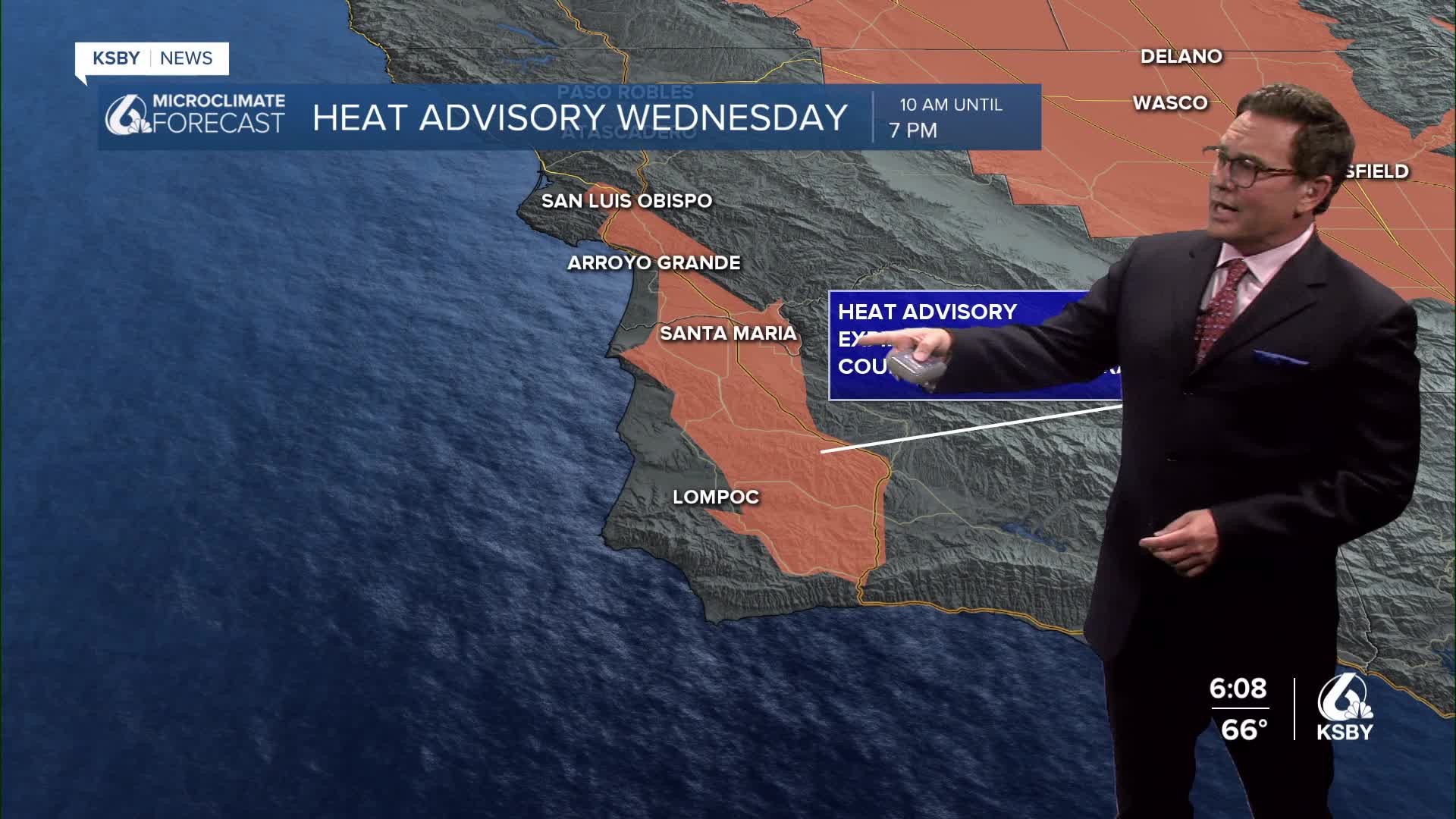
A HEAT ADVISORY has been issued for the interior areas of both Santa Barbara and San Luis Obispo counties for Wednesday only. These inland valleys and foothills could see temperatures reach 15 to 18 degrees above normal, with some locations potentially hitting the lower 90s.

WEDNESDAY - PEAK HEAT The hottest day of this heat is Wednesday as offshore flow dominates. Coastal valley areas will see temperatures in the upper 80s to low 90s, while interior valleys climb into the 95 to 100 degree range. The Santa Lucia Mountains and Santa Ynez Mountains will experience similar warming, with higher elevations in the Los Padres National Forest seeing temperatures 10 to 15 degrees above seasonal averages.

Marine layer development is NOT going to be widespread on Wednesday, allowing for abundant sunshine and rapid daytime heating across both counties.
THURSDAY - DRAMATIC COASTAL COOLING A sharp weather pattern change occurs Thursday as onshore flow returns. While inland areas will remain hot with only minor cooling of 2 to 4 degrees, the immediate coast will see a dramatic temperature drop of 4 to 8 degrees. This cooling will be most pronounced from Morro Bay south through the Santa Barbara coast.
The marine layer returns Thursday night into Friday morning, bringing low clouds and fog back to coastal areas and some coastal valleys.
FRIDAY THROUGH WEEKEND Temperatures stabilize Friday with minimal day-to-day changes of 3 degrees or less. A gradual cooling trend begins this weekend and continues into early next week as persistent onshore flow strengthens.
June gloom returns in full force this weekend, with marine layer clouds becoming widespread across coastal areas and extending inland into the lower valleys during overnight and morning hours.
WIND CONDITIONS Wind advisories remain in effect for Sundowner winds across the western Santa Ynez Range and the southwestern coast of Santa Barbara County on Wednesday morning. Expect northwest to north winds of 20 to 30 mph with gusts reaching 45 mph in these areas. The Santa Lucia Mountains will also experience gusty conditions overnight, though generally below advisory levels.
EXTENDED OUTLOOK The cooling trend continues into next week with high pressure weakening but remaining in place. Daily marine layer development will become the dominant weather feature, with typical early June conditions returning to the Central Coast.


Have a great night, Central Coast!
Stay cool on Wednesday!
-Jim
