

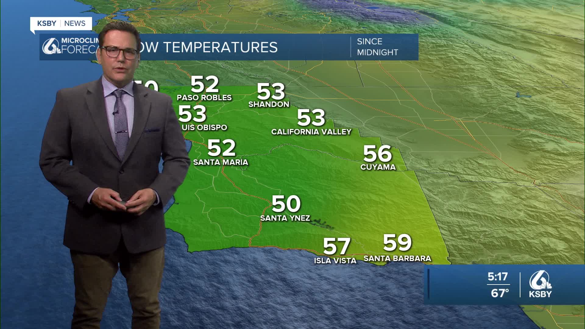


Good Thursday evening, Central Coast!
Here's your forecast for San Luis Obispo & Santa Barbara Counties:
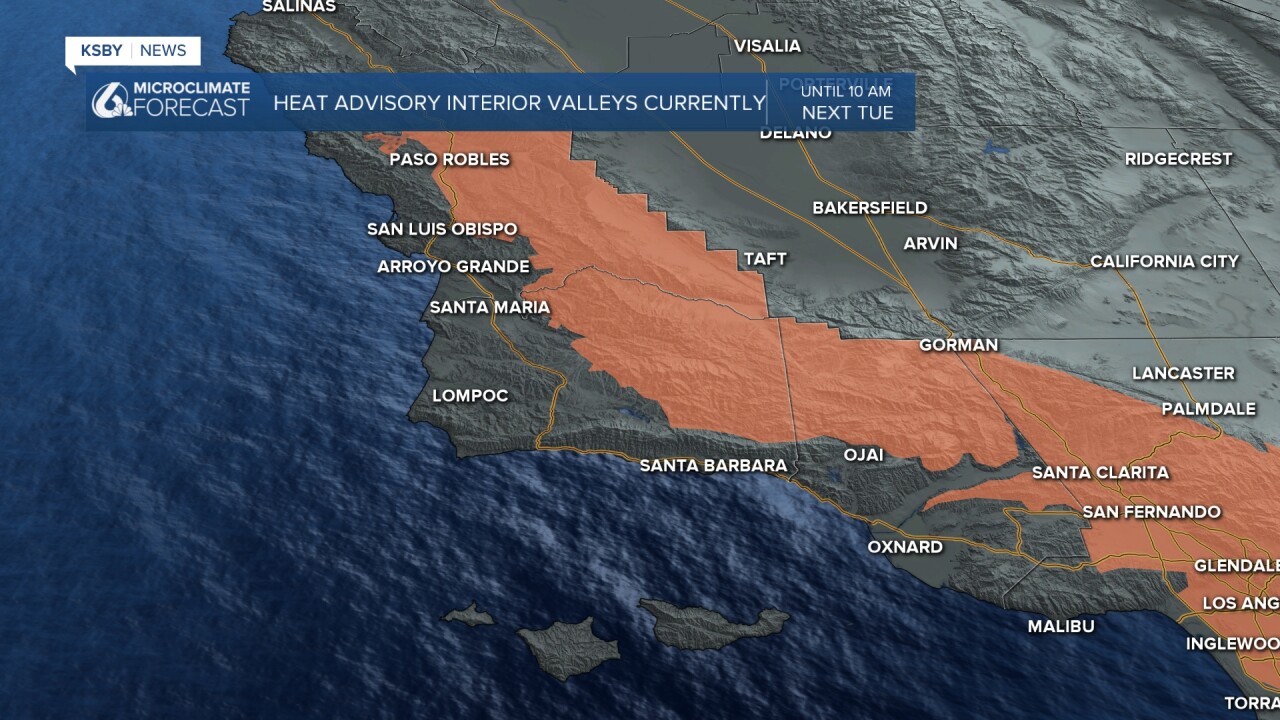
Current Situation: High pressure continues to dominate our region, keeping temperatures 5-10 degrees above normal through the weekend in the interior valleys and closer to the coast. A Heat Advisory remains in effect for interior valleys of both counties, including the Santa Lucia and Santa Ynez Mountains, as well as portions of the Los Padres National Forest.
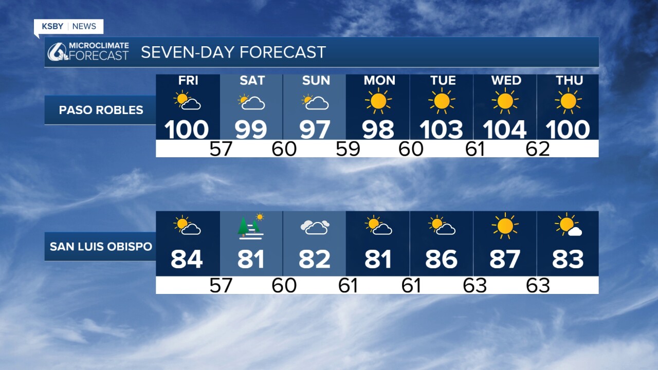
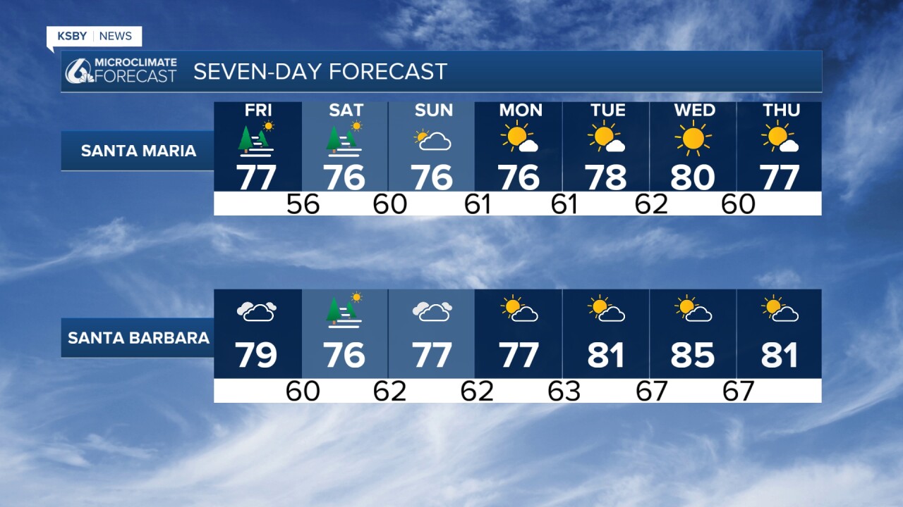
Weekend Outlook (Saturday-Sunday): Interior valleys will see highs between 95-102 degrees, while coastal areas remain more comfortable in the 70s to low 80s. Marine layer development will be more widespread each morning, with areas of dense fog possible, especially along our coastal communities from Cambria to Carpinteria.
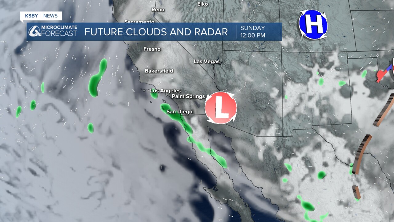
A significant pattern change arrives Sunday as high pressure shifts toward the Four Corners region. This will allow monsoonal moisture to begin streaming in from the southeast, increasing humidity levels.
Thunderstorm Potential (Sunday onward mainly in the Southern California mountains)
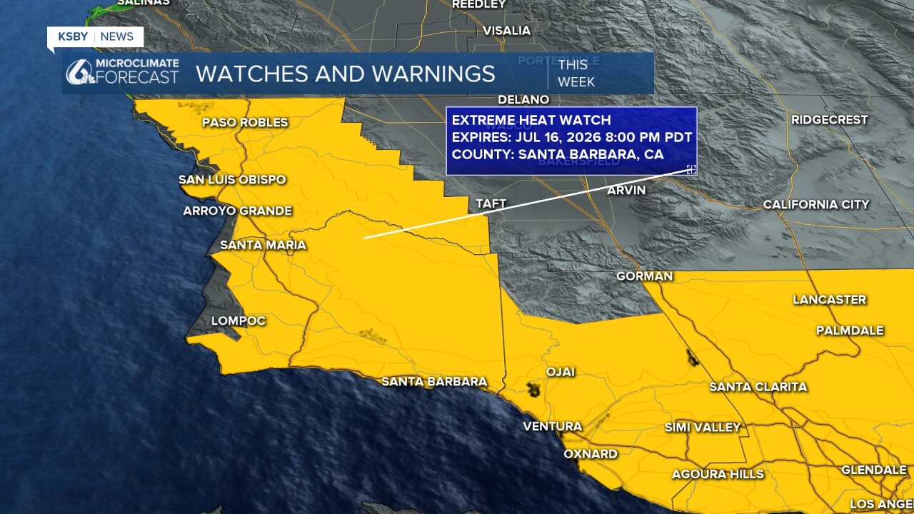
Heat Escalation Next Week: Tuesday marks the beginning of a more significant heat surge as the upper-level ridge expands southwest. This will transition us from the current Heat Advisory to an Extreme Heat Watch beginning Tuesday and continuing through Thursday.
Interior valleys in both counties can expect:
- Tuesday-Thursday: 100-108 degrees
- Increased humidity from monsoonal moisture adding to heat discomfort
- Overnight temperatures remaining elevated due to higher moisture content
Marine Conditions: Expect robust afternoon and evening onshore flow across the region, with particularly gusty conditions in wind-prone areas like the Gaviota Pass and San Marcos Pass. Morning marine layer will provide coastal relief but may struggle to penetrate far inland due to the strong high pressure aloft.
Below is the Heat Advisory for our interior valleys only. This Heat Advisory continues through early Tuesday.
Below is the Extreme Heat Watch that starts Tuesday and lasts until next Thursday evening. This includes most of the area and closer to the coast.
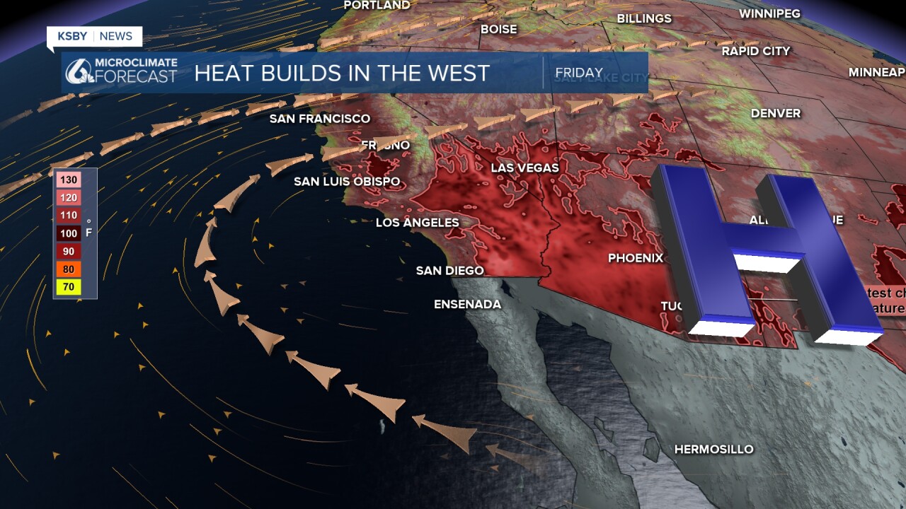
Below: The HEAT DOME in the southwest builds into all of our area next week.
Below: Monsoonal moisture makes it more humid in our area Sunday into next week. Most of the showers and storms, at this point, look to stay in the Southern California mountains.
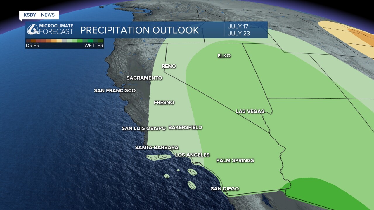
Below: Above-average rainfall in the green shaded areas mainly. Something we will watch next week into the middle of July.
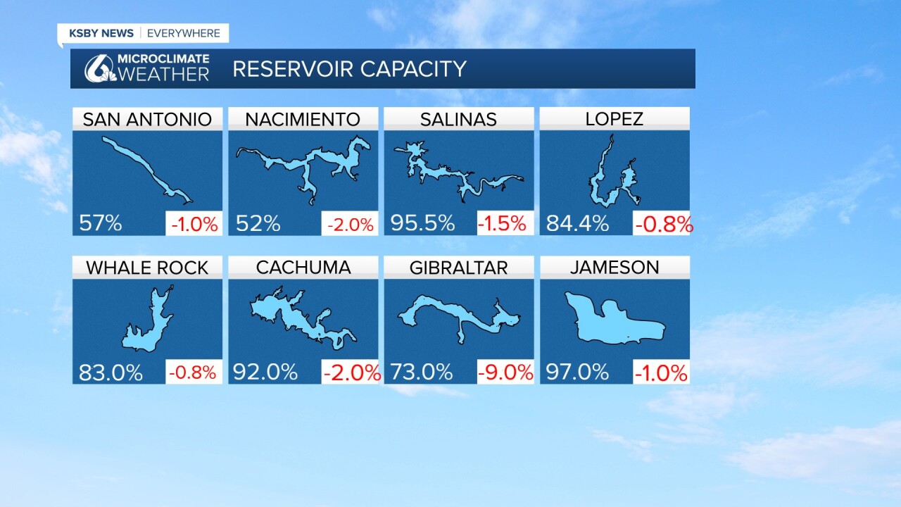
Below: The reservoir levels and the change from a week ago.
Have a great night, Central Coast!
-Jim
