



Good Wednesday evening from Meteorologist Jim Castillo
Here is your Central Coast Weather forecast for San Luis Obispo & Santa Barbara Counties
Dense fog blanketed areas around Nipomo until 10 AM on Wednesday and other coastal valleys and beach areas.
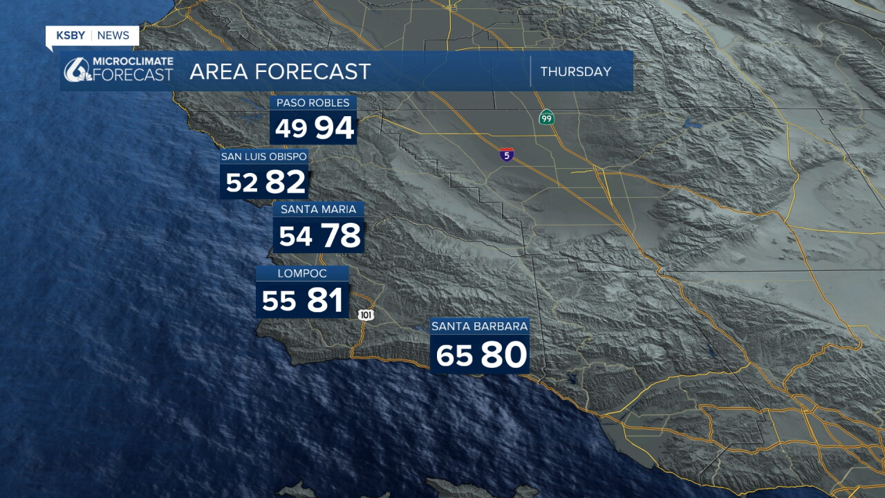
Last night brought gusty Sundowner winds, but these are not expected to return tonight. This means Santa Barbara had cooler highs today compared to the mid to upper 80s experienced over the past couple of days.
Through Thursday
Little change in weather conditions is expected through Thursday, with temperatures running above normal. Morning low clouds and fog remain possible near coastal areas as westerly onshore flow continues to influence the region.
Major Heat Wave Beginning Friday
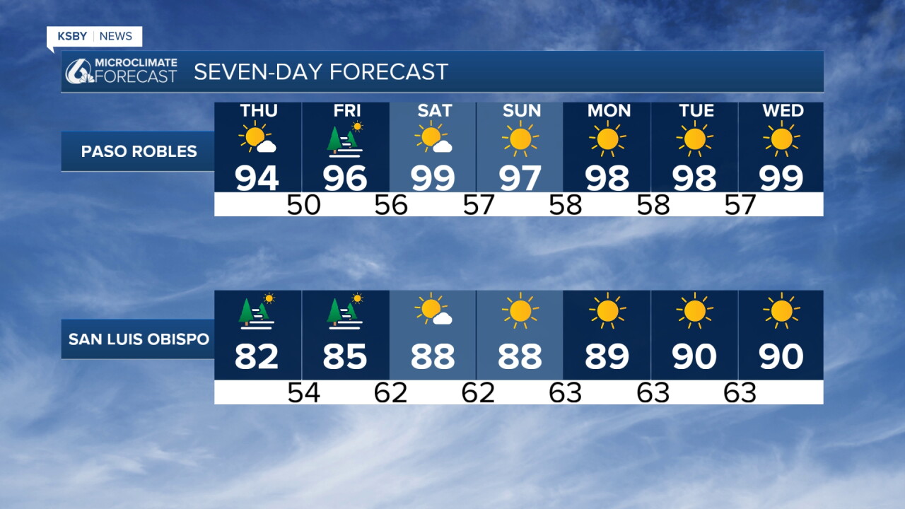
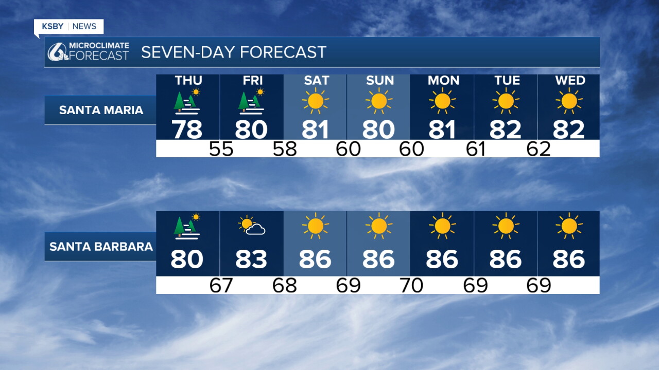
A very dangerous and long-lasting heat wave ramps-up Friday and persists through all of next week at minimum, bringing dangerously hot temperatures to both San Luis Obispo and Santa Barbara counties.
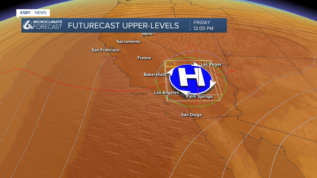
Strong high pressure aloft is moving into the state from the west and will remain positioned overhead through the forecast period and beyond.
Friday marks when the heat wave truly accelerates. Offshore morning flow combined with only weak onshore flow will cause maximum temperatures across coastal areas and valleys to climb several more degrees. This will bring triple-digit heat to the warmest interior valleys, while even beach communities will experience highs in the lower 80s. An Extreme Heat Watch has been issued for Santa Barbara and most of the county from Friday until next Thursday.
Extended Dangerous Heat Event
The long-term forecast centers entirely on extreme heat. Current modeling suggests the heat wave is in store for Southern California and the Central Coast and may last until at least October 13th. High pressure aloft will likely remain entrenched with only minor day-to-day variations. More critically, an extended period of offshore flow appears highly probable.
Watches and Warnings
An Extreme Heat Watch has been issued for most of Santa Barbara County from Friday through next Thursday. Heat Advisories may be necessary for most of the Central Coast, depending on how much offshore flow develops in coastal areas.
The Santa Lucia Mountains, Santa Ynez Mountains, and Los Padres National Forest areas within San Luis Obispo and Santa Barbara counties will be particularly susceptible to the most extreme temperatures during this prolonged heat event.
This represents a significant and potentially life-threatening weather pattern for the Central Coast region. Residents should begin preparing now for an extended period of dangerous heat conditions.
Have a great night, Central Coast!
-Jim
